138.118.104.224 - IP Lookup: Free IP Address Lookup, Postal Code Lookup, IP Location Lookup, IP ASN, Public IP
Country:
Region:
City:
Location:
Time Zone:
Postal Code:
IP information under different IP Channel
ip-api
Country
Region
City
ASN
Time Zone
ISP
Blacklist
Proxy
Latitude
Longitude
Postal
Route
Luminati
Country
Region
01
City
guatemalacity
ASN
Time Zone
America/Guatemala
ISP
ONNO NETWORKS, SOCIEDAD ANONIMA
Latitude
Longitude
Postal
IPinfo
Country
Region
City
ASN
Time Zone
ISP
Blacklist
Proxy
Latitude
Longitude
Postal
Route
IP2Location
138.118.104.224Country
Region
sacatepequez
City
antigua guatemala
Time Zone
America/Guatemala
ISP
Language
User-Agent
Latitude
Longitude
Postal
db-ip
Country
Region
City
ASN
Time Zone
ISP
Blacklist
Proxy
Latitude
Longitude
Postal
Route
ipdata
Country
Region
City
ASN
Time Zone
ISP
Blacklist
Proxy
Latitude
Longitude
Postal
Route
Popular places and events near this IP address

Antigua Guatemala
City in Sacatepéquez, Guatemala
Distance: Approx. 417 meters
Latitude and longitude: 14.5575,-90.73333333
Antigua Guatemala (Spanish pronunciation: [anˈtiɣwa ɣwateˈmala]), commonly known as Antigua or La Antigua, is a city in the central highlands of Guatemala. The city was the capital of the Captaincy General of Guatemala from 1543 through 1773, with much of its Baroque-influenced architecture and layout dating from that period. These characteristics had it designated as a UNESCO World Heritage Site in 1979.

Sacatepéquez Department
Department of Guatemala
Distance: Approx. 497 meters
Latitude and longitude: 14.55666667,-90.73388889
Sacatepéquez (Spanish pronunciation: [sakateˈpekes]) is one of the 22 departments of Guatemala. The name comes from Sacatepéquez, a city from November 21, 1542, until July 29, 1773, when it was destroyed by the 1773 Guatemalan Earthquake (Santa Marta Earthquake). Sacatepéquez means grasshill in the Nahuatl language.

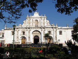
Antigua Guatemala Cathedral
Distance: Approx. 516 meters
Latitude and longitude: 14.5567,-90.7329
Parish of San José (Spanish: Catedral de San José), located in the city of Antigua Guatemala, is part of the Archdiocese of Santiago de Guatemala and is located in a section of the old Primate Cathedral of Antigua Guatemala, which was destroyed by the 1773 Guatemala earthquakes. The first construction of the cathedral began in 1545 with the rubble brought from the destroyed settlement in the Almolonga Valley, which had been a second attempt to found a town in the region. Its complete construction was hampered by frequent earthquakes over the years.
Iglesia de La Merced, Antigua Guatemala
Building in Antigua Guatemala, Guatemala
Distance: Approx. 64 meters
Latitude and longitude: 14.56167111,-90.73434694
The Church and Convent of La Merced is a Catholic church located in the city of Antigua Guatemala in Guatemala. The architect Juan de Dios Estrada was in charge of its construction from 1749. The church was inaugurated in 1767.

Iglesia y Convento de las Capuchinas, Antigua Guatemala
Building in Antigua Guatemala, Guatemala
Distance: Approx. 359 meters
Latitude and longitude: 14.55972222,-90.73138889
The Iglesia y Convento de las Capuchinas is a notable convent and church in Antigua Guatemala, Guatemala. It is one of the finest examples of an 18th-century convent in Guatemala. It was consecrated in 1736 but like the rest of the city suffered damage during the 1751 and 1773 earthquakes respectively, and was abandoned by order of the Captain General at the time.

Arco de Santa Catalina
Monument in Antigua Guatemala
Distance: Approx. 155 meters
Latitude and longitude: 14.55972222,-90.73416667
The Santa Catalina Arch is one of the distinguishable landmarks in Antigua Guatemala, Guatemala, located on 5th Avenue North. Built in the 17th century, it originally connected the Santa Catalina convent to a school, allowing the cloistered nuns to pass from one building to the other without going out on the street. A clock on top was added in the era of the Central American Federation, in the 1830s.
Hotel Museo Uxlabil
Museum and hotel in Guatemala
Distance: Approx. 423 meters
Latitude and longitude: 14.5573,-90.7343
The Hotel Museo Uxlabil was a museum and hotel in Antigua Guatemala, Guatemala. It belonged to the wealthy Pellecer family for five generations. The property was acquired in 2009 and renamed Hotel Casa Antigua.

Santiago de los Caballeros de Guatemala
Capital of the Spanish Captaincy General of Guatemala
Distance: Approx. 630 meters
Latitude and longitude: 14.56666667,-90.73333333
Santiago de los Caballeros de Guatemala ("St. James of the Knights of Guatemala") was the name given to the capital city of the Spanish colonial Captaincy General of Guatemala in Central America. It is located in present-day Antigua Guatemala.

Iglesia y Convento de la Compañía de Jesús, Antigua Guatemala
Building in Antigua Guatemala, Guatemala
Distance: Approx. 420 meters
Latitude and longitude: 14.5575,-90.73555556
The Church and convent of the Society of Jesus in Antigua Guatemala is a religious complex that was built between 1690 and 1698. It was built on a block that is only 325 yards (300 m) away from the Cathedral of Saint James on a lot that once belonged to the family of famous chronicler Bernal Díaz del Castillo and had three monastery wings and a church. There were only a maximum of 13 Jesuit priest at any given time in the building, but they also hosted Jesuit brothers and secular students.

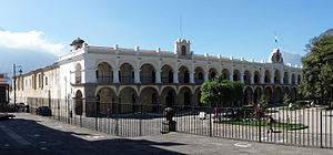
Palacio de los Capitanes Generales, Antigua Guatemala
Building in Antigua Guatemala, Guatemala
Distance: Approx. 589 meters
Latitude and longitude: 14.55583333,-90.73388889
The Captain General Palace, or Palacio de los Capitanes Generales, is a large building localed in the Central Square of Antigua Guatemala. It serves as the headquarters of the Guatemala Institute of Tourism, the Antigua Tourism Association, National Police and the Sacatepquez Department government. It also houses the National Museum of Guatemalan Art.

Museum of the Ancient Book
Printing press museum in Antigua, Guatemala
Distance: Approx. 414 meters
Latitude and longitude: 14.55744,-90.73372
The Museum of the Ancient Book (Spanish: Museo del Libro Antiguo) is a museum in Antigua Guatemala, Sacatepéquez. The museum is dedicated to show the different types of printing used in Guatemala.

National Museum of Guatemalan Art
Art museum in Guatemala
Distance: Approx. 560 meters
Latitude and longitude: 14.55615585,-90.73342852
The National Museum of Guatemalan Art (spanish: Museo Nacional de Arte de Guatemala or MUNAG) is an art museum located in Antigua Guatemala, Sacatepéquez Department.
Weather in this IP's area
scattered clouds
14 Celsius
14 Celsius
13 Celsius
15 Celsius
1016 hPa
92 %
1016 hPa
829 hPa
10000 meters
1.25 m/s
1.3 m/s
326 degree
40 %
