138.117.109.102 - IP Lookup: Free IP Address Lookup, Postal Code Lookup, IP Location Lookup, IP ASN, Public IP
Country:
Region:
City:
Location:
Time Zone:
Postal Code:
IP information under different IP Channel
ip-api
Country
Region
City
ASN
Time Zone
ISP
Blacklist
Proxy
Latitude
Longitude
Postal
Route
Luminati
Country
Region
cal
City
manizales
ASN
Time Zone
America/Bogota
ISP
Media Commerce Partners S.A
Latitude
Longitude
Postal
IPinfo
Country
Region
City
ASN
Time Zone
ISP
Blacklist
Proxy
Latitude
Longitude
Postal
Route
IP2Location
138.117.109.102Country
Region
caldas
City
manizales
Time Zone
America/Bogota
ISP
Language
User-Agent
Latitude
Longitude
Postal
db-ip
Country
Region
City
ASN
Time Zone
ISP
Blacklist
Proxy
Latitude
Longitude
Postal
Route
ipdata
Country
Region
City
ASN
Time Zone
ISP
Blacklist
Proxy
Latitude
Longitude
Postal
Route
Popular places and events near this IP address

Caldas Department
Department of Colombia
Distance: Approx. 4990 meters
Latitude and longitude: 5.1,-75.55
Caldas (Spanish pronunciation: [ˈkaldas]) is a department of Colombia named after Colombian patriotic figure Francisco José de Caldas. It is part of the Paisa Region and its capital is Manizales. The population of Caldas is 998,255, and its area is 7,291 km2.

Manizales
Municipality and city in Andean Region, Colombia
Distance: Approx. 840 meters
Latitude and longitude: 5.0675,-75.51
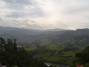
Manizales (Spanish pronunciation: [maniˈzales]) is a city in central Colombia. It is the capital of the Department of Caldas, and lies near the Nevado del Ruiz volcano. Currently, the city is the main center for the production of Colombian coffee and an important hub for higher educational institutions.

Estadio Palogrande
Distance: Approx. 3378 meters
Latitude and longitude: 5.056233,-75.489807
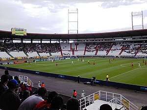
Estadio Palogrande is a multi-purpose stadium in Manizales, Colombia with a capacity of 31,611. It is currently used mostly for football (soccer) matches as home venue of the Once Caldas, winners of the 2004 Copa Libertadores.
La Nubia Airport
Airport in La Nubia
Distance: Approx. 7359 meters
Latitude and longitude: 5.03,-75.46388889
La Nubia Airport (IATA: MZL, ICAO: SKMZ) is an airport serving Manizales, Colombia, 8 kilometres (5 mi) southeast of the city's downtown. Due to its short runway and limited ramp space, the only aircraft that can use the airport are turbopropeller aircraft such as the Fokker 50, ATR 72, and Dash 8. The main problem of La Nubia airport is weather.

Villamaría, Caldas
Municipality and town in Caldas Department, Colombia
Distance: Approx. 7930 meters
Latitude and longitude: 5,-75.5
Villamaría is a town and municipality in the Colombian Department of Caldas. Located in the Colombian coffee growing axis, it was made part of the "Coffee Cultural Landscape" UNESCO World Heritage Site in 2011.
Roman Catholic Archdiocese of Manizales
Catholic archdiocese in Colombia
Distance: Approx. 189 meters
Latitude and longitude: 5.0674,-75.5174
The Roman Catholic Archdiocese of Manizales (Latin: Manizalensis) is an archdiocese located in the city of Manizales in Colombia.

University of Caldas
Distance: Approx. 3089 meters
Latitude and longitude: 5.05611111,-75.49277778
The University of Caldas (Spanish: Universidad de Caldas), is a public, coeducational, research university based in Manizales, Caldas, Colombia. It is the most important higher education institution in the Department of Caldas. It is a public university of national character, subject to inspection and surveillance through Law 1740 of 2014 and Law 30 of 1992 of the Ministry of Education of Colombia; it houses students from all corners of Colombia and abroad; It is considered the best university in the "eje cafetero" and one of the best in Colombia.

Torre de Herveo
Distance: Approx. 3784 meters
Latitude and longitude: 5.05595833,-75.485925
Torre de Herveo (English: Tower of Herveo), also known as Torre del Cable (English: Cable Tower), is a wooden Colombian lattice tower which was the tallest of the support towers of the Manizales - Mariquita Cableway. The Torre de Herveo was in service from 1922 to 1961. It only serves as a monument and as transportation today.
Manizales - Mariquita Cableway
Distance: Approx. 3784 meters
Latitude and longitude: 5.05595833,-75.485925
The Manizales - Mariquita Cableway was a cableway used for transporting coffee, that connected Mariquita (Tolima) with the city of Manizales (Caldas), both in central Colombia. It was one of the most important engineering works carried out in Colombia in response to the difficult topography of the region, that hindered the construction of a railroad.
Plaza de Toros de Manizales
Distance: Approx. 1022 meters
Latitude and longitude: 5.0639,-75.525
Plaza de Toros de Manizales is a bullring located on its homonym city, in the center of Colombia. It's currently used for bullfighting during the Annual Fair of Manizales in January (Feria de Manizales), musical events and sport events to a lesser extent.
St. Aloysius Gonzaga College, Manizales
Jesuit, catholic school in Calle no. , Manizales, Colombia
Distance: Approx. 2451 meters
Latitude and longitude: 5.05876389,-75.49788056
St. Aloysius College (Spanish: Colegio San Luis) is a mixed-gender Catholic school in Manizales, Caldas, Colombia serving two years of kindergarten through grade 11. The school was established by the Society of Jesus in 1954.

Cathedral Basilica of Our Lady of Rosary, Manizales
Church in Manizales, Colombia
Distance: Approx. 178 meters
Latitude and longitude: 5.0675,-75.5174
The Cathedral Basilica of Our Lady of the Rosary (Spanish: Catedral Basílica Metropolitana de Nuestra Señora del Rosario), also called Manizales Cathedral, is a Catholic cathedral, located directly opposite the Plaza de Bolivar (Bolívar Square) in the city of Manizales, Colombia.
Weather in this IP's area
overcast clouds
16 Celsius
16 Celsius
15 Celsius
19 Celsius
1011 hPa
68 %
1011 hPa
795 hPa
5236 meters
2.24 m/s
290 degree
97 %

