137.83.103.41 - IP Lookup: Free IP Address Lookup, Postal Code Lookup, IP Location Lookup, IP ASN, Public IP
Country:
 USA
USARegion:
City:
Location:
Time Zone:
Postal Code:
ISP:
ASN:
language:
User-Agent:
Proxy IP:
Blacklist:
IP information under different IP Channel
ip-api
Country
Region
City
ASN
Time Zone
ISP
Blacklist
Proxy
Latitude
Longitude
Postal
Route
db-ip
Country
Region
City
ASN
Time Zone
ISP
Blacklist
Proxy
Latitude
Longitude
Postal
Route
IPinfo
Country
Region
City
ASN
Time Zone
ISP
Blacklist
Proxy
Latitude
Longitude
Postal
Route
IP2Location
137.83.103.41Country
usRegion
california
City
galt
Time Zone
America/Los_Angeles
ISP
Language
User-Agent
Latitude
Longitude
Postal
ipdata
Country
Region
City
ASN
Time Zone
ISP
Blacklist
Proxy
Latitude
Longitude
Postal
Route
Popular places and events near this IP address

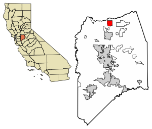
Galt, California
City in California, United States
Distance: Approx. 1884 meters
Latitude and longitude: 38.26083333,-121.30305556
Galt is a city in Sacramento County, California. It is part of the Sacramento metropolitan area. The population was 23,647 at the 2010 census, up from 19,472 at the 2000 census.

Herald, California
Census-designated place in California, United States
Distance: Approx. 5534 meters
Latitude and longitude: 38.28833333,-121.23111111
Herald is a census-designated place in Sacramento County, California. Herald sits at an elevation of 79 feet (24 m). It is located east of the city of Galt along State Route 104.

Jahant AVA
Distance: Approx. 8199 meters
Latitude and longitude: 38.2272,-121.2215
The Jahant AVA is an American Viticultural Area located within the Lodi AVA. Most of the AVA is located within San Joaquin County, California, with a small part in Sacramento County. At 28,000 acres (11,331 ha), Jahant is the smallest of the Lodi sub-appellations. The area is known for its distinctive pink colored Rocklin-Jahant loam soil with the AVA's boundaries being delineated by the extent and reaches of the soil.
Galt High School
Public school in the United States
Distance: Approx. 2210 meters
Latitude and longitude: 38.25638889,-121.29916667
Galt High School is one of three high schools in Galt, California. It is part of the Galt Joint Union High School District and is accredited by Western Association of Schools and Colleges. In addition to serving portions of Galt, it also serves all students in San Joaquin County except for those in the New Hope School District.
Rancho Sanjon de los Moquelumnes
Mexican land grant in California
Distance: Approx. 6473 meters
Latitude and longitude: 38.32,-121.34
Rancho Sanjon de los Moquelumnes was a 35,508-acre (143.70 km2) Mexican land grant in present-day Sacramento County and San Joaquin County, California given in 1844 by Governor Manuel Micheltorena to Anastasio Chaboya. Sanjon is Spanish for ditch or deep slough. The grant stretched from the Cosumnes River on the north to the Mokelumne River on the south, and encompassed present-day Galt.

Brewster Building (Galt, California)
United States historic place
Distance: Approx. 6534 meters
Latitude and longitude: 38.25361111,-121.36166667
The Brewster Building (also known as Galt Mercantile or the Sawyer Building) is a historic commercial building and IOOF Hall located at 201 Fourth Street in Galt, California. It was built in 1882 and was listed on the National Register of Historic Places in 2000. It is a two-story, Italianate style commercial building with a brick veneer exterior.

Brewster House (Galt, California)
Historic house in California, United States
Distance: Approx. 2667 meters
Latitude and longitude: 38.25333333,-121.30388889
The Brewster House is in Galt, California. It is a wooden Victorian Italianate style house built in 1869–70. It was listed on the National Register of Historic Places in 1978.
Collierville, California
Census-designated place in California, United States
Distance: Approx. 7350 meters
Latitude and longitude: 38.21305556,-121.265
Collierville is a census-designated place in San Joaquin County, California. Collierville sits at an elevation of 62 feet (19 m). The 2020 United States census reported Collierville's population was 2,698.
Liberty, San Joaquin County, California
Ghost town in California, USA
Distance: Approx. 3935 meters
Latitude and longitude: 38.2402,-121.29
Liberty is a ghost town in San Joaquin County, in the U.S. state of California.
Liberty Ranch High School
Public school in the United States
Distance: Approx. 1530 meters
Latitude and longitude: 38.286,-121.281
Liberty Ranch High School is a 9-12th grade high school in Galt, California and a part of the Galt Joint Union High School District. It was opened in 2009 to only Freshman and Sophomores. The first graduating class was in 2012.
Weather in this IP's area
few clouds
2 Celsius
-0 Celsius
1 Celsius
4 Celsius
1014 hPa
88 %
1014 hPa
1012 hPa
10000 meters
2.71 m/s
2.59 m/s
14 degree
24 %