137.75.125.46 - IP Lookup: Free IP Address Lookup, Postal Code Lookup, IP Location Lookup, IP ASN, Public IP
Country:
Region:
City:
Location:
Time Zone:
Postal Code:
IP information under different IP Channel
ip-api
Country
Region
City
ASN
Time Zone
ISP
Blacklist
Proxy
Latitude
Longitude
Postal
Route
Luminati
Country
Region
hi
City
honolulu
ASN
Time Zone
Pacific/Honolulu
ISP
NOAA-PACIFIC-REGION-CENTER
Latitude
Longitude
Postal
IPinfo
Country
Region
City
ASN
Time Zone
ISP
Blacklist
Proxy
Latitude
Longitude
Postal
Route
IP2Location
137.75.125.46Country
Region
colorado
City
boulder
Time Zone
America/Denver
ISP
Language
User-Agent
Latitude
Longitude
Postal
db-ip
Country
Region
City
ASN
Time Zone
ISP
Blacklist
Proxy
Latitude
Longitude
Postal
Route
ipdata
Country
Region
City
ASN
Time Zone
ISP
Blacklist
Proxy
Latitude
Longitude
Postal
Route
Popular places and events near this IP address

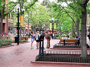
Boulder, Colorado
City in Colorado, United States
Distance: Approx. 47 meters
Latitude and longitude: 40.015,-105.27055556
Boulder is a home rule city in and the county seat of Boulder County, Colorado, United States. With a population of 108,250 at the 2020 census, it is the most populous city in the county and the 12th-most populous city in Colorado. Boulder is the principal city of the Boulder metropolitan statistical area, which had 330,758 residents in 2020, and is part of the Front Range Urban Corridor.
Naropa University
University in Boulder, Colorado, United States
Distance: Approx. 322 meters
Latitude and longitude: 40.01416667,-105.26638889
Naropa University is a private university in Boulder, Colorado, United States. Founded in 1974 by Tibetan Buddhist teacher Chögyam Trungpa, it is named after the 11th-century Indian Buddhist sage Naropa, an abbot of Nalanda. The university describes itself as Buddhist-inspired, ecumenical, and nonsectarian rather than Buddhist.

Folsom Field
Stadium in Colorado, US
Distance: Approx. 715 meters
Latitude and longitude: 40.009,-105.267
Folsom Field is an outdoor college football stadium located on the campus of the University of Colorado in Boulder, Colorado. It is the home field of the Colorado Buffaloes of the Big 12 Conference. Opened in 1924, the horseshoe-shaped stadium has a traditional north–south configuration, opening to the north.
Andrews Arboretum
Distance: Approx. 679 meters
Latitude and longitude: 40.0124,-105.2772
Andrews Arboretum is a small arboretum located on the east side of Broadway between Grandview and Marine Streets in Boulder, Colorado, United States. It is open every day free of charge. The arboretum was established in 1948 by Miss Maud Reed, a former botany teacher at Boulder High School.
List of University of Colorado Boulder alumni
List of some notable people associated with the University of Colorado Boulder
Distance: Approx. 741 meters
Latitude and longitude: 40.0087,-105.2728
The following is a list of some notable people associated with the University of Colorado Boulder.

Colorado MahlerFest
Classical music festival in Boulder, Colorado
Distance: Approx. 605 meters
Latitude and longitude: 40.01,-105.27277778
Colorado MahlerFest is an annual event held in Boulder, Colorado, which each year celebrates one major symphonic work by Austrian composer Gustav Mahler. While "Colorado MahlerFest" is the official name of the event and the organization, the individual annual events are simply referred to as "MahlerFest" (dropping the "Colorado"), followed by a Roman numeral. It is the one of only two North American arts organizations to have received the Gold Medal of the International Gustav Mahler Society, the other being the New York Philharmonic.

Balch Fieldhouse
Distance: Approx. 644 meters
Latitude and longitude: 40.009435,-105.267928
Balch Fieldhouse is a 4,000, at one point seating 7,000, seat multi-purpose arena in Boulder, Colorado. It opened in 1937. It was home to the University of Colorado Buffaloes basketball teams until the CU Events Center opened in 1979.

Boulder High School
Public school in Boulder, Colorado, United States
Distance: Approx. 366 meters
Latitude and longitude: 40.01361111,-105.27388889
Boulder High School is a high school in Boulder, Colorado, United States. It is part of the Boulder Valley School District. Boulder High School was founded in 1875 as a preparatory school to the University of Colorado.
Dushanbe Tea House
Building in Colorado, United States
Distance: Approx. 628 meters
Latitude and longitude: 40.015403,-105.277342
The Boulder Dushanbe Tea House was a gift from Mayor Maksud Ikramov of Dushanbe to the city of Boulder, Colorado.
Downtown Boulder Historic District
Historic district in Colorado, United States
Distance: Approx. 613 meters
Latitude and longitude: 40.01911,-105.27478
The Downtown Boulder Historic District, in Boulder, Colorado, is a 48 acres (19 ha) historic district which was listed on the National Register of Historic Places in 1980. Additional significance for the district was recognized in 2018 for association of the Boulder County Courthouse with events of 1975, when Boulder County clerk Clela Rorex issued marriage licenses to six same-sex couples. It includes a surviving historic commercial area of Boulder, including Pearl Street between 9th and 16th Streets (part or all of what is now the Pearl Street Mall) and parts of Walnut, Spruce, and Pine Streets.

Boulder Post Office
United States historic place
Distance: Approx. 621 meters
Latitude and longitude: 40.017899,-105.2762264
The Officer Eric H. Talley Post Office Building, also known as the Boulder Post Office or Boulder Main Post Office, at 1905 Fifteenth St. in Boulder, Colorado, was built in 1910. It was listed on the National Register of Historic Places as US Post Office—Boulder Main in 1986.
Frasca Food and Wine
Restaurant in Boulder, Colorado, U.S.
Distance: Approx. 519 meters
Latitude and longitude: 40.01925,-105.2725
Frasca Food and Wine is a Michelin-starred restaurant in Boulder, Colorado.
Weather in this IP's area
overcast clouds
3 Celsius
0 Celsius
2 Celsius
4 Celsius
1014 hPa
87 %
1014 hPa
832 hPa
10000 meters
2.57 m/s
110 degree
100 %


