Country:
 Great Britain
Region:
City:
Latitude and Longitude:
Time Zone:
Postal Code:
IP information under different IP Channel
ip-api
Country
Region
City
ASN
Time Zone
ISP
Blacklist
Proxy
Latitude
Longitude
Postal
Route
IPinfo
Country
Region
City
ASN
Time Zone
ISP
Blacklist
Proxy
Latitude
Longitude
Postal
Route
MaxMind
Country
Region
City
ASN
Time Zone
ISP
Blacklist
Proxy
Latitude
Longitude
Postal
Route
Luminati
Country
 NL
NLASN
Time Zone
Europe/Amsterdam
ISP
Equinix (EMEA) Acquisition Enterprises B.V.
Latitude
Longitude
Postal
db-ip
Country
Region
City
ASN
Time Zone
ISP
Blacklist
Proxy
Latitude
Longitude
Postal
Route
ipdata
Country
Region
City
ASN
Time Zone
ISP
Blacklist
Proxy
Latitude
Longitude
Postal
Route
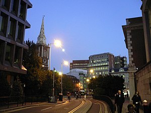
Popular places and events near this IP address

Worshipful Company of Coopers
Livery company of the City of London
Distance: Approx. 90 meters
Latitude and longitude: 51.51679,-0.07925
The Worshipful Company of Coopers is one of the livery companies of the City of London. The organisation of coopers existed in 1422; the Company received its first royal charter of incorporation in 1501. The cooper trade involved the making of wine, beer, and spirit casks (a barrel is specifically a 36-gallon cask, or 32 in some circumstances); the Livery Company also functions as a charitable foundation, and supports two education establishments: the Coopers' Company and Coborn School of Upminster, Essex, and Strode's College of Egham, Surrey.

Baltic Exchange
UK company that operates as a marketplace for shipbrokers, ship owners and charterers
Distance: Approx. 159 meters
Latitude and longitude: 51.5151,-0.0802
The Baltic Exchange (incorporated as The Baltic Exchange Limited) is a membership organisation for the maritime industry, and freight market information provider for the trading and settlement of physical and derivative contracts. Situated since Edwardian times at 24–28 St Mary Axe, London EC3, the building was destroyed by a bomb in 1992. The Baltic Exchange then relocated to 38 St Mary Axe on 15 May 1995, before establishing its headquarters at 77 Leadenhall Street in the City of London as well as further offices in Europe, across Asia, and in the United States.

Houndsditch
Distance: Approx. 90 meters
Latitude and longitude: 51.5153,-0.0787
Houndsditch is a street running through parts of the Portsoken and Bishopsgate Without wards of the City of London; areas which are also a part of the East End of London. The road follows the line of the outside edge of the ditch which once ran outside the London Wall. The road took its name from the section of ditch between Bishopsgate and Aldgate.

Heron Tower
Skyscraper in the City of London, England
Distance: Approx. 157 meters
Latitude and longitude: 51.51611111,-0.08083333
Salesforce Tower, 110 Bishopsgate (formerly, and still commonly known as, Heron Tower) is a commercial skyscraper in London. It stands 230 metres (755 ft) tall including its 28-metre (92 ft) mast making it the second tallest building in the City of London financial district and the fifth tallest in Greater London and the United Kingdom, after the Shard in Southwark and One Canada Square at Canary Wharf. 110 Bishopsgate is located on Bishopsgate and is bordered by Camomile Street, Outwich Street and Houndsditch.
Bevis Marks
London street
Distance: Approx. 130 meters
Latitude and longitude: 51.515,-0.0792
Bevis Marks, classified as part of the A1211, is a short street (about 150 m long) in the ward of Aldgate in the City of London. Traffic runs northwest in a one-way direction into Camomile Street, and parallel to Houndsditch which runs southeast one-way.

100 Bishopsgate
Building in London, England
Distance: Approx. 172 meters
Latitude and longitude: 51.5158,-0.081
100 Bishopsgate consists of two mixed-use buildings in central London. The buildings are situated on the eastern edge of the City of London financial district. Building 1 on the site is a 40-storey tower comprising five floors of 44,000 sq ft (4,100 m2) each and 32 office floors of between 19,000–25,000 sq ft (1,800–2,300 m2).

Camomile Street
Street in the City of London, England
Distance: Approx. 151 meters
Latitude and longitude: 51.51555556,-0.08055556
Camomile Street is a short street in the City of London, the financial and historic centre of London.

St Augustine Papey
Church in London, England
Distance: Approx. 162 meters
Latitude and longitude: 51.5148,-0.0796
St Augustine Papey was a mediaeval church in the City of London situated just south of London Wall opposite the north end of St. Mary Axe Street. First mentioned as "Sci augustini pappey", it originally belonged to the Priory of Holy Trinity.
Fisher's Folly
Former house in Bishopsgate, City of London
Distance: Approx. 154 meters
Latitude and longitude: 51.51691667,-0.08036111
Fisher's Folly was a large mansion on Bishopsgate Street, in Bishopsgate, London, built by Jasper Fisher in the 16th century. In his 1598 Survey of London, Stow reports that the home was "so large and sumptuosly builded" by a man deeply in debt that it became known as Fisher's Folly. Despite his own excessive debt, Edward de Vere, Earl of Oxford bought the mansion in 1580.

St Botolph Building
Office in London, England
Distance: Approx. 174 meters
Latitude and longitude: 51.514822,-0.077116
The St Botolph Building is a commercial office in Houndsditch, central London, opened in 2011 and designed by Grimshaw Architects. It is one of a number of landmark buildings recently delivered or in development to the East of the Gherkin in the City of London ward of Aldgate, which together with the wards of Langbourn, Cornhill and Lime Street forms the centre of the UK insurance industry. Two of the three main tenants, Jardine Lloyd Thompson and Lockton, are businesses with a substantial insurance broking component, which are therefore reliant on close proximity to the Lloyd's building and the globally-significant London market in insurance contracts that focuses on Lloyd's of London.

Middlesex Street Estate
Housing estate in London
Distance: Approx. 138 meters
Latitude and longitude: 51.5159,-0.0766
The Middlesex Street Estate is a housing estate in Aldgate, on the east edge of the City of London in the East End. It was connected to other local buildings by an elevated walkway system called the City of London Pedway Scheme. The estate was built between 1965 and 1970 for the Corporation of London and comprises the 23-storey Petticoat Tower and low-rise buildings around Petticoat Square.

70 St Mary Axe
Office building in the City Of London
Distance: Approx. 110 meters
Latitude and longitude: 51.51527778,-0.07944444
70 St Mary Axe, informally known as the Can of Ham due to its shape, is an office building in the City of London. It was completed in early 2019. With 21 floors above ground, it is 90 metres (295 ft) tall and offers 28,000 square metres (301,400 sq ft) of office space.
Weather in this IP's area
overcast clouds
20 Celsius
20 Celsius
17 Celsius
21 Celsius
1003 hPa
74 %
1003 hPa
999 hPa
10000 meters
3.09 m/s
99 %
06:24:41
19:31:28