137.152.251.149 - IP Lookup: Free IP Address Lookup, Postal Code Lookup, IP Location Lookup, IP ASN, Public IP
Country:
Region:
City:
Location:
Time Zone:
Postal Code:
ISP:
ASN:
language:
User-Agent:
Proxy IP:
Blacklist:
IP information under different IP Channel
ip-api
Country
Region
City
ASN
Time Zone
ISP
Blacklist
Proxy
Latitude
Longitude
Postal
Route
db-ip
Country
Region
City
ASN
Time Zone
ISP
Blacklist
Proxy
Latitude
Longitude
Postal
Route
IPinfo
Country
Region
City
ASN
Time Zone
ISP
Blacklist
Proxy
Latitude
Longitude
Postal
Route
IP2Location
137.152.251.149Country
Region
arizona
City
phoenix
Time Zone
America/Phoenix
ISP
Language
User-Agent
Latitude
Longitude
Postal
ipdata
Country
Region
City
ASN
Time Zone
ISP
Blacklist
Proxy
Latitude
Longitude
Postal
Route
Popular places and events near this IP address
Grand Canyon University
Christian university in Phoenix, Arizona, US
Distance: Approx. 603 meters
Latitude and longitude: 33.5125,-112.13
Grand Canyon University (GCU) is a private for-profit Christian university in Phoenix, Arizona. The university offers degrees in over 200 areas of study and is administratively divided into 9 colleges. As of September 2023, more than 100,000 students were enrolled online and in person, making it one of the largest Christian universities by enrollment.

Cathedral of Saints Simon and Jude (Phoenix, Arizona)
Church in Arizona , United States
Distance: Approx. 2052 meters
Latitude and longitude: 33.5298,-112.1162
The Cathedral of Saints Simon and Jude is the cathedral of the Roman Catholic Diocese of Phoenix in Phoenix, Arizona, in the United States. As of 2025, the rector of the cathedral is Monsignor Matthew Henry.
Bourgade Catholic High School
Private, co-educational school in Phoenix, Arizona, Maricopa, United States
Distance: Approx. 925 meters
Latitude and longitude: 33.50444444,-112.12638889
Bourgade Catholic High School is a diocesan, co-educational Roman Catholic high school in Phoenix, Arizona, United States. It is located in the Roman Catholic Diocese of Phoenix. It is a 27-acre campus located at 4602 N. 31st Avenue, just west of Interstate 17, and several miles from downtown Phoenix.
Alhambra High School (Arizona)
Public secondary school in Phoenix, Arizona, United States
Distance: Approx. 1738 meters
Latitude and longitude: 33.508661,-112.141684
Alhambra High School is a high school that forms part of the Phoenix Union High School District in Phoenix, Arizona. The campus is located at 3839 West Camelback Road, northwest of downtown Phoenix, Arizona, United States. The school predominantly serves students from partner elementary districts Alhambra, Isaac and Phoenix Elementary, although students from across the district come to Alhambra for its Phoenix Union Magnet Program—Medical and Health Studies.

19th Avenue/Camelback station
Valley Metro light rail line stop in Phoenix, Arizona
Distance: Approx. 2304 meters
Latitude and longitude: 33.50972222,-112.09888889
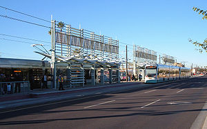
19th Avenue/Camelback is a station on the Metro light rail line in Uptown Phoenix, Arizona, United States. A park and ride lot is adjacent to the station on the south side of Camelback Road.

Montebello/19th Avenue station
Valley Metro Rail station in Phoenix, Arizona
Distance: Approx. 2375 meters
Latitude and longitude: 33.52027778,-112.09972222
Montebello/19th Avenue is a station on the Metro light rail line in Phoenix, Arizona, United States. A large park and ride lot is located on the east side of 19th Avenue. The station is immediately south of Bethany Home Road.

Alhambra, Phoenix
Urban village of Phoenix, Arizona
Distance: Approx. 1826 meters
Latitude and longitude: 33.49833,-112.13361
Alhambra is an urban village of Phoenix, Arizona.

Alhambra Elementary School District
School district in Maricopa County, Arizona
Distance: Approx. 1841 meters
Latitude and longitude: 33.502955,-112.139782
Alhambra Elementary School District provides education for more than 14,000 students in the Phoenix and Glendale areas of Arizona. Alhambra has 15 schools. These schools educate students from kindergarten to eighth grade.

Global Credit Union Arena
Entertainment facility in Arizona, United States
Distance: Approx. 559 meters
Latitude and longitude: 33.510152,-112.128884
Global Credit Union Arena at Grand Canyon University (originally named GCU Arena) is a 7,000-seat, 135,000-square-foot (12,500 m2) multi-purpose entertainment and athletics facility in Phoenix, Arizona, owned and operated by Grand Canyon University. The arena is the home of Grand Canyon University Lopes men's and women's basketball teams, men's and women's volleyball teams and other university events.
Abrazo Central Campus
Teaching hospital in Phoenix, Arizona, US
Distance: Approx. 2463 meters
Latitude and longitude: 33.524984,-112.101668
Abrazo Central Campus is a 216-bed acute care facility and teaching hospital located in Phoenix, Arizona, United States.

Brazell Field at GCU Ballpark
Baseball stadium at Grand Canyon University
Distance: Approx. 856 meters
Latitude and longitude: 33.5119,-112.1327
Brazell Field at GCU Ballpark is a college baseball stadium on the campus of Grand Canyon University in Phoenix, Arizona. It hosts the Grand Canyon Antelopes of the Western Athletic Conference. The field is named for Dr.

GCU Stadium
Collegiate soccer venue in Phoenix, Arizona
Distance: Approx. 708 meters
Latitude and longitude: 33.51194444,-112.13111111
The GCU Stadium (complete name "Grand Canyon University Stadium") is a collegiate soccer soccer-specific stadium located on the campus of Grand Canyon University in Phoenix, Arizona. The venue has a capacity of 6,000 and includes a full-sized (120 x 80 yard) soccer field. The field is located on the west end of the school's campus, sitting directly in front of Antelope Gymnasium, the university's secondary indoor athletic facility, and is in close proximity to Brazell Field at GCU Ballpark, home of the GCU baseball program.
Weather in this IP's area
clear sky
11 Celsius
9 Celsius
11 Celsius
11 Celsius
1021 hPa
33 %
1021 hPa
979 hPa
10000 meters
0.73 m/s
1.1 m/s
186 degree