137.118.193.228 - IP Lookup: Free IP Address Lookup, Postal Code Lookup, IP Location Lookup, IP ASN, Public IP
Country:
Region:
City:
Location:
Time Zone:
Postal Code:
ISP:
ASN:
language:
User-Agent:
Proxy IP:
Blacklist:
IP information under different IP Channel
ip-api
Country
Region
City
ASN
Time Zone
ISP
Blacklist
Proxy
Latitude
Longitude
Postal
Route
db-ip
Country
Region
City
ASN
Time Zone
ISP
Blacklist
Proxy
Latitude
Longitude
Postal
Route
IPinfo
Country
Region
City
ASN
Time Zone
ISP
Blacklist
Proxy
Latitude
Longitude
Postal
Route
IP2Location
137.118.193.228Country
Region
oregon
City
manzanita
Time Zone
America/Los_Angeles
ISP
Language
User-Agent
Latitude
Longitude
Postal
ipdata
Country
Region
City
ASN
Time Zone
ISP
Blacklist
Proxy
Latitude
Longitude
Postal
Route
Popular places and events near this IP address

Manzanita, Oregon
City in Oregon, United States
Distance: Approx. 289 meters
Latitude and longitude: 45.71666667,-123.935
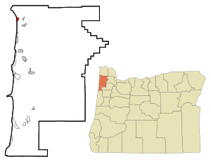
Manzanita is a coastal city in Tillamook County, Oregon, United States. It is located on U.S. Route 101 about 25 miles (40 km) equidistant from Seaside to the north and Tillamook to the south. The population was 603 at the 2020 census.

Nehalem, Oregon
City in Oregon, United States
Distance: Approx. 3257 meters
Latitude and longitude: 45.71944444,-123.89388889
Nehalem is a city in Tillamook County, Oregon, United States. Incorporated in 1889, the city lies along the Nehalem River and Nehalem Bay near the Pacific Ocean. It is bisected by U.S. Route 101.
Neahkahnie Mountain
Mountain in Oregon, United States
Distance: Approx. 3330 meters
Latitude and longitude: 45.74696,-123.951783
Neahkahnie Mountain is a mountain, or headland, on the Oregon Coast, north of Manzanita in Oswald West State Park overlooking U.S. Route 101. The peak is part of the Northern Oregon Coast Range, which is part of the Oregon Coast Range. It is best known for stories of Spanish treasure said to be buried either at the foot of the mountain, or on its slopes.

Nehalem Bay
Distance: Approx. 3196 meters
Latitude and longitude: 45.691792,-123.92355
Nehalem Bay is a bay formed by the confluence of the Nehalem River with the Pacific Ocean in northern Oregon, United States. It is Oregon's fifth-largest estuary. The main tributary of Nehalem Bay is the Nehalem River.

Nehalem Bay State Airport
Airport in Manzanita, Oregon
Distance: Approx. 2387 meters
Latitude and longitude: 45.69816167,-123.92985556
Nehalem Bay State Airport (FAA LID: 3S7) is a public airport located two miles (3.2 km) southeast of Manzanita in Tillamook County, Oregon, United States. The airport is located within the boundaries of Nehalem Bay State Park. It offers several campsites for fly-in camping, a few meters away from the tiedown area.

Nehalem Bay State Park
State park in Oregon, United States
Distance: Approx. 2311 meters
Latitude and longitude: 45.6984395,-123.9359683
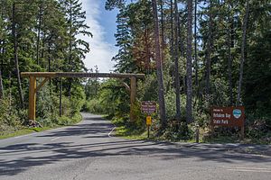
Nehalem Bay State Park is a state park in the United States located on the Oregon Coast, near the communities of Nehalem and Manzanita on the Nehalem Spit, a sand spit west of Nehalem Bay. Tillamook County transferred the land to the State of Oregon for a park in the 1930s. During the 1940s and 1950s, workers planted European beach grass, shore pine, and Scotch broom to stabilize the dunes—a process that took an additional twenty years.

Neahkahnie Beach, Oregon
Unincorporated community in the state of Oregon, United States
Distance: Approx. 1163 meters
Latitude and longitude: 45.729,-123.941
Neahkahnie Beach (or Neahkahnie) is a census-designated place and unincorporated community in Tillamook County, Oregon, United States. It is located west of U.S. Route 101, comprising approximately 370 residences north of the city of Manzanita, at the foot of Neahkahnie Mountain. For statistical purposes, the United States Census Bureau has defined Neahkahnie as a census-designated place (CDP).

Harry F. Wentz Studio
Historic house in Oregon, United States
Distance: Approx. 1721 meters
Latitude and longitude: 45.733318,-123.944819
The Harry F. Wentz Studio, also known as the Harry F. Wentz Studio-Bungalow and Studio Neah-Kah-Nie, is a historic house located in the Neahkahnie community near Manzanita, Oregon, United States. Designed by artist Harry F. Wentz and architect A. E. Doyle and built circa 1916, this bungalow came to be regarded as a prototype of the Northwest Regional style of architecture. Some of the characteristic features of the house include: colors and materials associated with the Northwest, especially timber; low massing with simple wall surfaces; porches with slender wooden supports; and siting to harmonize with the surrounding landscape.

A. E. Doyle Cottage
United States historic place
Distance: Approx. 1203 meters
Latitude and longitude: 45.729217,-123.941605
The A. E. Doyle Cottage is a historic house in Neahkahnie Beach, Oregon, United States. It was designed by American architect A. E. Doyle. The cottage was listed on the National Register of Historic Places in 1991.

Mary Frances Isom Cottage
United States historic place
Distance: Approx. 1171 meters
Latitude and longitude: 45.728541,-123.942738
Mary Frances Isom Cottage ("Spindrift") is a house in Neahkahnie Beach, Oregon, in the United States, included on the National Register of Historic Places. The cottage was designed by American architect A. E. Doyle for the head librarian of the Library Association of Portland, Mary Frances Isom.
Bayside Gardens, Oregon
Unincorporated community in the state of Oregon, United States
Distance: Approx. 1599 meters
Latitude and longitude: 45.71444444,-123.91638889
Bayside Gardens is an unincorporated community in Tillamook County, Oregon, United States. It lies along Route 101 between Manzanita and Nehalem and borders Nehalem Bay. For statistical purposes, the United States Census Bureau has defined Bayside Gardens as a census-designated place (CDP).

Pine Grove Community House
Historic building in Manzanita, Oregon, U.S.
Distance: Approx. 86 meters
Latitude and longitude: 45.718664,-123.936601
The Pine Grove Community House in Manzanita, Oregon, United States, was completed in 1933 and added to the National Register of Historic Places on July 3, 2017.
Weather in this IP's area
clear sky
3 Celsius
1 Celsius
3 Celsius
3 Celsius
1028 hPa
61 %
1028 hPa
1020 hPa
10000 meters
2.65 m/s
2.66 m/s
55 degree
