136.228.174.102 - IP Lookup: Free IP Address Lookup, Postal Code Lookup, IP Location Lookup, IP ASN, Public IP
Country:
Region:
City:
Location:
Time Zone:
Postal Code:
IP information under different IP Channel
ip-api
Country
Region
City
ASN
Time Zone
ISP
Blacklist
Proxy
Latitude
Longitude
Postal
Route
Luminati
Country
Region
06
City
yangon
ASN
Time Zone
Asia/Yangon
ISP
Myanma Posts and Telecommunications
Latitude
Longitude
Postal
IPinfo
Country
Region
City
ASN
Time Zone
ISP
Blacklist
Proxy
Latitude
Longitude
Postal
Route
IP2Location
136.228.174.102Country
Region
shan
City
myothit
Time Zone
Asia/Rangoon
ISP
Language
User-Agent
Latitude
Longitude
Postal
db-ip
Country
Region
City
ASN
Time Zone
ISP
Blacklist
Proxy
Latitude
Longitude
Postal
Route
ipdata
Country
Region
City
ASN
Time Zone
ISP
Blacklist
Proxy
Latitude
Longitude
Postal
Route
Popular places and events near this IP address

Taunggyi
Capital of Shan State, Myanmar
Distance: Approx. 2591 meters
Latitude and longitude: 20.78363333,97.03536111
Taunggyi (Burmese: တောင်ကြီးမြို့; MLCTS: taung kri: mrui. [tàʊɰ̃dʑí mjo̰]; Shan: ဝဵင်းတူၼ်ႈတီး ဝဵင်းလူင်တႆးႁဝ်း Shan pronunciation: [weŋ˥ ton˧˧˨ ti˥]; is the capital and largest city of Shan State, Myanmar (Burma) ဝဵင်းလူင်မိူင်းတႆး and lies on the Thazi-Kyaingtong road at an elevation of 4,712 feet (1,436 m), just north of Shwenyaung and Inle Lake within the Myelat region. Taunggyi is the fifth largest city of Myanmar, although Taunggyi is the capital of Shan State , and has an estimated population of 380,665 as of 2014.

Roman Catholic Archdiocese of Taunggyi
Roman Catholic archdiocese in Myanmar
Distance: Approx. 3022 meters
Latitude and longitude: 20.7802,97.0388
The Archdiocese of Taunggyi (Latin: Archidioecesis Taunggyiensis) is a particular church of the Roman Catholic Church located in the Shan State of Myanmar. The dioceses of Kengtung, Loikaw, Pekhon and Taungngu are suffragans of the archdiocese. The cathedral of the archdiocese is St.

Taunggyi University
Distance: Approx. 6028 meters
Latitude and longitude: 20.75527778,97.05083333
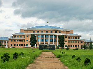
Taunggyi University (Burmese: တောင်ကြီး တက္ကသိုလ် [tàʊɰ̃dʑí tɛʔkəθò]), located in Taunggyi, is the main university in Shan State, Myanmar. The university offers bachelor's and master's degree programs in arts and sciences.

Taunggyi Township
Township in the Shan State of Myanmar
Distance: Approx. 2613 meters
Latitude and longitude: 20.78333333,97.03333333
Taunggyi Township is a township of Taunggyi District in the Shan State of Myanmar. The principal town is Taunggyi.

Ayethaya
Town in Shan State, Myanmar
Distance: Approx. 4842 meters
Latitude and longitude: 20.77722222,96.99888889
Ayethayar (Burmese: အေးသာယာ, also spelt Aye Thar Yar) is a town and resort in the Shan State of eastern Burma. It is located just outside Taunggyi and is a relatively new town. It contains the Technological University of Taunggyi and the Aye Thar Yar Golf Resort.

Taunggyi Stadium
Distance: Approx. 3208 meters
Latitude and longitude: 20.77833333,97.03777778
Taunggyi Stadium is a multi-use stadium in Taunggyi, Myanmar. It is currently used mostly for football matches and is the home ground of Shan United F.C. of the Myanmar National League. The stadium has a capacity of 7,000 spectators.
Chaunggauk, Taunggyi Township
Village in Shan State, Burma
Distance: Approx. 6698 meters
Latitude and longitude: 20.865,97.01666667
Chaunggauk is a village in Taunggyi Township, Taunggyi District, Shan State, of Burma (Myanmar). It lies to the north of the town of Taunggyi.

Panglong University
University in Panglong, Myanmar
Distance: Approx. 6028 meters
Latitude and longitude: 20.75527778,97.05083333
Panglong University (Burmese: ပင်လုံ တက္ကသိုလ်) is a university in Panglong, Southern Shan State, Myanmar. It is a government institution, aimed at improving education in Southern Shan State. It was opened in 2002.
Weather in this IP's area
clear sky
11 Celsius
11 Celsius
11 Celsius
11 Celsius
1014 hPa
87 %
1014 hPa
866 hPa
10000 meters
1.48 m/s
1.46 m/s
176 degree