136.226.75.204 - IP Lookup: Free IP Address Lookup, Postal Code Lookup, IP Location Lookup, IP ASN, Public IP
Country:
Region:
City:
Location:
Time Zone:
Postal Code:
IP information under different IP Channel
ip-api
Country
Region
City
ASN
Time Zone
ISP
Blacklist
Proxy
Latitude
Longitude
Postal
Route
Luminati
Country
Region
ma
City
boston
ASN
Time Zone
America/New_York
ISP
ZSCALER-SJC1
Latitude
Longitude
Postal
IPinfo
Country
Region
City
ASN
Time Zone
ISP
Blacklist
Proxy
Latitude
Longitude
Postal
Route
IP2Location
136.226.75.204Country
Region
massachusetts
City
boston
Time Zone
America/New_York
ISP
Language
User-Agent
Latitude
Longitude
Postal
db-ip
Country
Region
City
ASN
Time Zone
ISP
Blacklist
Proxy
Latitude
Longitude
Postal
Route
ipdata
Country
Region
City
ASN
Time Zone
ISP
Blacklist
Proxy
Latitude
Longitude
Postal
Route
Popular places and events near this IP address
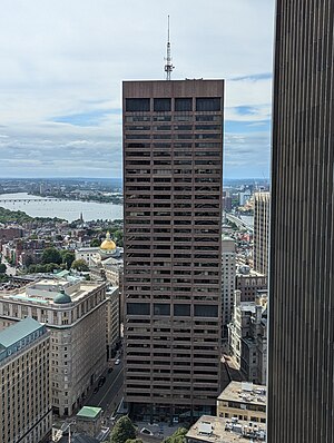
One Beacon Street
Office in Boston, Massachusetts
Distance: Approx. 60 meters
Latitude and longitude: 42.35844,-71.06083
One Beacon Street is a modern skyscraper in the Government Center neighborhood of Boston, Massachusetts. Built in 1972 and refurbished in 1991, it is Boston's 20th-tallest building, standing 505 feet (154 m) tall, and housing 37 floors. Its position near the top of Beacon Hill gives the building a commanding presence, though it is located away from many other Boston skyscrapers.

King's Chapel
United States historic Unitarian chapel in Boston
Distance: Approx. 50 meters
Latitude and longitude: 42.35805556,-71.06
King's Chapel is an American independent Christian unitarian congregation affiliated with the Unitarian Universalist Association that is "unitarian Christian in theology, Anglican in worship, and congregational in governance." It is housed in what was for a time after the Revolution called the "Stone Chapel", an 18th-century structure at the corner of Tremont Street and School Street in Boston, Massachusetts. The chapel building, completed in 1754, is one of the finest designs of the noted colonial architect Peter Harrison, and was designated a National Historic Landmark in 1960 for its architectural significance. The congregation has worshipped according to a Unitarian version of the Book of Common Prayer since 1785, currently in its ninth edition.: 213 Despite its name, the adjacent King's Chapel Burying Ground is not affiliated with the chapel or any other church; it pre-dates the present church by over a century.
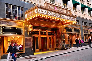
Omni Parker House
Hotel in Boston, Massachusetts, United States
Distance: Approx. 45 meters
Latitude and longitude: 42.35819444,-71.05974167
The Omni Parker House is a historic hotel in Boston, Massachusetts, founded in 1855. The current hotel structure dates to 1927. Located at the corner of School Street and Tremont, not far from the seat of the Massachusetts state government, the hotel has long been a rendezvous for politicians.

King's Chapel Burying Ground
Graveyard in Boston
Distance: Approx. 35 meters
Latitude and longitude: 42.35825,-71.05983333
King's Chapel Burying Ground is a historic graveyard on Tremont Street, near its intersection with School Street, in Boston, Massachusetts. Established in 1630, it is the oldest graveyard in the city and is a site on the Freedom Trail. Despite its name, the graveyard pre-dates the adjacent King's Chapel (whose first structure was built in 1688); it is not affiliated with that or any other church.

Howard Athenaeum
Former theater in Boston, Massachusetts, United States
Distance: Approx. 76 meters
Latitude and longitude: 42.35916667,-71.06027778
The Howard Athenæum (1845–1953), also known as Old Howard Theatre, in Boston, Massachusetts, was one of the most famous theaters in Boston history. Founded in 1845, it remained an institution of culture and learning for most of its years, finally closing in 1953. It was demolished in 1962 after a fire in June 1961.

Boston Museum (theatre)
Distance: Approx. 43 meters
Latitude and longitude: 42.3586,-71.0596
The Boston Museum (1841–1903), also called the Boston Museum and Gallery of Fine Arts, was a theatre, wax museum, natural history museum, zoo, and art museum in 19th-century Boston, Massachusetts. Moses Kimball established the enterprise in 1841.
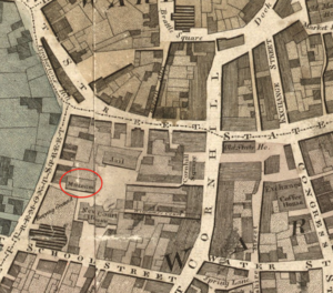
Columbian Museum
Museum and performance space in Massachusetts, US
Distance: Approx. 43 meters
Latitude and longitude: 42.3586,-71.0596
The Columbian Museum was a museum and performance space in Boston, Massachusetts, established by Daniel Bowen, and continued by William M. S. Doyle. The museum operated during 1795–1825 featuring artworks, natural history specimens, wax figures, and other curiosities.
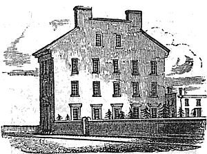
Provident Institution for Savings in the Town of Boston
Distance: Approx. 26 meters
Latitude and longitude: 42.35855278,-71.05978611
The Provident Institution for Savings (est.1816) in Boston, Massachusetts, was the first chartered savings bank in the United States.

1689 Boston revolt
Uprising in New England against Governor Andros
Distance: Approx. 40 meters
Latitude and longitude: 42.3583,-71.0597
The 1689 Boston revolt was a popular uprising on April 18, 1689, against the rule of Sir Edmund Andros, the governor of the Dominion of New England. A well-organized "mob" of provincial militia and citizens formed in the town of Boston, the capital of the dominion, and arrested dominion officials. Members of the Church of England were also taken into custody if they were believed to sympathize with the administration of the dominion.

Beacon Theatre (Boston)
Distance: Approx. 60 meters
Latitude and longitude: 42.35802222,-71.06045
The Beacon Theatre was a cinema on Tremont Street in Boston, Massachusetts built in 1910 and closed in 1948. Jacob Lourie established it. Architect Clarence Blackall designed the building, with its 500-seat auditorium which a contemporary critic described as "showy." It had a staff of 26 in 1910.
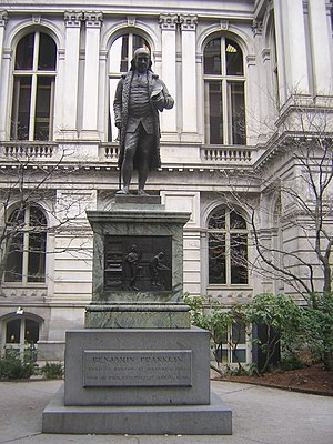
Statue of Benjamin Franklin (Boston)
Statue in Boston, Massachusetts, U.S.
Distance: Approx. 70 meters
Latitude and longitude: 42.35797222,-71.05963889
A statue of Benjamin Franklin by Richard Saltonstall Greenough is installed outside Old City Hall in Boston, Massachusetts, United States. It rests on a base with plaques designed by Greenough and Thomas Ball.

City Carpet
Mosaic in Boston, Massachusetts, U.S.
Distance: Approx. 74 meters
Latitude and longitude: 42.35788,-71.05977
City Carpet is a 1983 sidewalk mosaic by Lilli Ann Killen Rosenberg, installed outside Boston's Old City Hall, in the U.S. state of Massachusetts.
Weather in this IP's area
few clouds
-4 Celsius
-7 Celsius
-6 Celsius
-2 Celsius
1029 hPa
72 %
1029 hPa
1029 hPa
10000 meters
2.17 m/s
4.4 m/s
341 degree
16 %