136.175.23.74 - IP Lookup: Free IP Address Lookup, Postal Code Lookup, IP Location Lookup, IP ASN, Public IP
Country:
Region:
City:
Location:
Time Zone:
Postal Code:
IP information under different IP Channel
ip-api
Country
Region
City
ASN
Time Zone
ISP
Blacklist
Proxy
Latitude
Longitude
Postal
Route
Luminati
Country
Region
ms
City
campogrande
ASN
Time Zone
America/Campo_Grande
ISP
VIA MS DIGITAL LTDA
Latitude
Longitude
Postal
IPinfo
Country
Region
City
ASN
Time Zone
ISP
Blacklist
Proxy
Latitude
Longitude
Postal
Route
IP2Location
136.175.23.74Country
Region
mato grosso do sul
City
campo grande
Time Zone
America/Campo_Grande
ISP
Language
User-Agent
Latitude
Longitude
Postal
db-ip
Country
Region
City
ASN
Time Zone
ISP
Blacklist
Proxy
Latitude
Longitude
Postal
Route
ipdata
Country
Region
City
ASN
Time Zone
ISP
Blacklist
Proxy
Latitude
Longitude
Postal
Route
Popular places and events near this IP address

Mato Grosso do Sul
State of Brazil
Distance: Approx. 205 meters
Latitude and longitude: -20.44277778,-54.64583333
Mato Grosso do Sul (Portuguese pronunciation: [ˈmatu ˈɡɾosu du ˈsuw] lit. 'South Thick Bush') is one of Brazil's 27 federal units, located in the southern part of the Central-West Region, bordering five Brazilian states: Mato Grosso (to the north), Goiás and Minas Gerais (northeast), São Paulo (east) and Paraná (southeast); and two South American countries: Paraguay (south and southwestern) and Bolivia (west). It is divided into 79 municipalities and covers an area of 357,145.532 square kilometers, which is about the same size as Germany. With a population of 2,839,188 inhabitants in 2021, Mato Grosso do Sul is the 21st most populous state in Brazil.

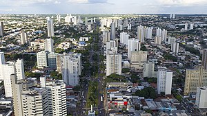
Campo Grande
Capital city of Mato Grosso do Sul, Brazil
Distance: Approx. 5721 meters
Latitude and longitude: -20.48388889,-54.615
Campo Grande (Brazilian Portuguese: [ˈkɐ̃pu ˈɡɾɐ̃dʒi], lit. '"Great Field"') is a city in the central and western region of Brazil, capital of the state of Mato Grosso do Sul. Historically a stronghold of separatists from the North and South, founded by José Antônio Pereira, the city is planned in the middle of a vast green space, with wide streets and tree-lined avenues with several gardens along the way. It is one of the most wooded cities in Brazil, with 96.3% of houses in shade.

Morenão
Distance: Approx. 7645 meters
Latitude and longitude: -20.50138889,-54.60972222
Morenão, also known as Estádio Universitário Pedro Pedrossian, is the home ground of Operário and Esporte Clube Comercial. It is located at Cidade Universitária ("University City", in English), in Campo Grande, Mato Grosso do Sul, Brazil.

Campo Grande International Airport
Airport in Brazil
Distance: Approx. 3789 meters
Latitude and longitude: -20.46944444,-54.67027778
Campo Grande International Airport (IATA: CGR, ICAO: SBCG), sometimes also informally referred to as Antônio João Airport, after the neighborhood where it is located, is the airport serving Campo Grande, Brazil. It is operated by AENA. Some of its facilities are shared with the Campo Grande Air Force Base of the Brazilian Air Force.
Roman Catholic Archdiocese of Campo Grande
Latin Catholic jurisdiction in Brazil
Distance: Approx. 4023 meters
Latitude and longitude: -20.4662,-54.6185
The Roman Catholic Archdiocese of Campo Grande (Latin: Archidioecesis Campi Grandis) is a Latin Church ecclesiastical territory or archdiocese of the Catholic Church located in the city of Campo Grande, Brazil.

Matas do Segredo State Park
Area of environmental protection located in the State of Mato Grosso do Sul, in Brazil
Distance: Approx. 8321 meters
Latitude and longitude: -20.392385,-54.58881
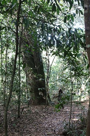
The Matas do Segredo State Park (Portuguese: Parque Estadual Matas do Segredo) is an urban state park in the state of Mato Grosso do Sul, Brazil. It protects an area of cerrado forest.
Metropolitan Cathedral of Our Lady of the Abbey and St. Anthony, Campo Grande
Church in Campo Grande, Brazil
Distance: Approx. 3996 meters
Latitude and longitude: -20.46166667,-54.61527778
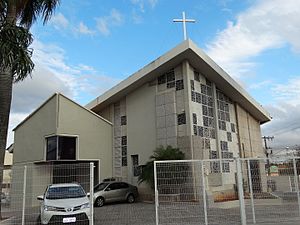
The Metropolitan Cathedral of Our Lady of the Abbey and St. Anthony (Portuguese: Catedral Metropolitana Nossa Senhora da Abadia e Santo Antônio) Also Campo Grande Cathedral It is a Catholic cathedral that functions as the headquarters of the Archdiocese of Campo Grande in the South American country of Brazil. It is also the Parish Church of San Antonio, created on April 7, 1912.

Prosa State Park
State park in Mato Grosso do Sul, Brazil
Distance: Approx. 9153 meters
Latitude and longitude: -20.452608,-54.560684
The Prosa State Park (Portuguese: Parque Estadual do Prosa), formerly the Parque dos Poderes, is an urban state park in the state of Mato Grosso do Sul, Brazil. It protects a remnant of cerrado vegetation, and is home to a wildlife rehabilitation center.
Anhanguera-Uniderp University
Distance: Approx. 6382 meters
Latitude and longitude: -20.4656,-54.5917
The Anhanguera-Uniderp University is a private university in Campo Grande, Mato Grosso do Sul, Brazil established in 1974 and controlled by the private educational group Anhanguera.

Campo Grande Air Force Base
Air base of the Brazilian Air Force
Distance: Approx. 3789 meters
Latitude and longitude: -20.46944444,-54.67027778
Base Aérea de Campo Grande – ALA5 (IATA: CGR, ICAO: SBCG) is a base of the Brazilian Air Force, located in Campo Grande, Brazil. It shares some facilities with Campo Grande International Airport.
TV Morena
Television station in Mato Grosso do Sul, Brazil
Distance: Approx. 6428 meters
Latitude and longitude: -20.47952778,-54.60033333
TV Morena is a Brazilian television station based in Campo Grande, capital of the state of Mato Grosso do Sul. It operates on channel 6 (UHF digital 30) and is affiliated to TV Globo. It belongs to Rede Matogrossense de Comunicação, a television network of the Zahran Group that operates in the states of Mato Grosso do Sul and Mato Grosso, with TV Morena being the network head for the former, as well as the first broadcaster of the network to be founded, in 1965.
Weather in this IP's area
few clouds
23 Celsius
24 Celsius
23 Celsius
23 Celsius
1010 hPa
94 %
1010 hPa
947 hPa
10000 meters
1.54 m/s
280 degree
20 %
