136.143.131.157 - IP Lookup: Free IP Address Lookup, Postal Code Lookup, IP Location Lookup, IP ASN, Public IP
Country:
Region:
City:
Location:
Time Zone:
Postal Code:
ISP:
ASN:
language:
User-Agent:
Proxy IP:
Blacklist:
IP information under different IP Channel
ip-api
Country
Region
City
ASN
Time Zone
ISP
Blacklist
Proxy
Latitude
Longitude
Postal
Route
db-ip
Country
Region
City
ASN
Time Zone
ISP
Blacklist
Proxy
Latitude
Longitude
Postal
Route
IPinfo
Country
Region
City
ASN
Time Zone
ISP
Blacklist
Proxy
Latitude
Longitude
Postal
Route
IP2Location
136.143.131.157Country
Region
oregon
City
arlington
Time Zone
America/Los_Angeles
ISP
Language
User-Agent
Latitude
Longitude
Postal
ipdata
Country
Region
City
ASN
Time Zone
ISP
Blacklist
Proxy
Latitude
Longitude
Postal
Route
Popular places and events near this IP address

Arlington, Oregon
City in Oregon, United States
Distance: Approx. 3316 meters
Latitude and longitude: 45.715,-120.19972222
Arlington is a city in Gilliam County, Oregon, United States. The city's population was 586 at the 2010 census and has a 2019 estimate of 591.

Roosevelt, Washington
Census-designated place in Washington, United States
Distance: Approx. 6943 meters
Latitude and longitude: 45.74472222,-120.21944444
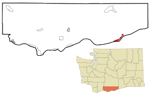
Roosevelt is an unincorporated community and census-designated place (CDP) in Klickitat County, Washington, United States. The population was 152 at the 2020 census. The Roosevelt Regional Landfill, one of the largest landfills in the United States, is located at Roosevelt.

Arlington Municipal Airport (Oregon)
Airport
Distance: Approx. 3683 meters
Latitude and longitude: 45.71638889,-120.16777778
Arlington Municipal Airport (FAA LID: 1S8) is a public airport located one mile (2 km) northeast of the central business district of Arlington, in Gilliam County, Oregon, United States. It is owned by the City of Arlington.

Arlington High School (Oregon)
Public charter high school in Arlington, Oregon, United States
Distance: Approx. 3040 meters
Latitude and longitude: 45.71236,-120.19993
Arlington High School is a public charter high school in Arlington, Oregon. It is part of the Arlington School District #3.

Shepherds Flat Wind Farm
Wind farm in Oregon, USA
Distance: Approx. 6993 meters
Latitude and longitude: 45.7,-120.1
The Shepherds Flat Wind Farm is an 845 megawatt (MW) wind farm in the eastern part of U.S. state of Oregon, near Arlington, in both Gilliam and Morrow counties. Groundbreaking occurred in 2009, and it officially opened in September 2012. The wind farm was built by Caithness Energy using General Electric GE2.5XL 2.5 MW wind turbines, and it supplies electricity to Southern California Edison.
Alkali Canyon Formation
Geologic formation
Distance: Approx. 1787 meters
Latitude and longitude: 45.7,-120.2
The Alkali Canyon Formation is a geologic formation in Oregon. It preserves fossils dating back to the Tortonian to Zanclean stages (Hemphillian) of the Neogene period. It is confined to the Arlington basin, and is named after Alkali Canyon, a canyon 16 km southwest of Arlington, Oregon.
Weather in this IP's area
clear sky
-2 Celsius
-4 Celsius
-2 Celsius
-2 Celsius
1032 hPa
74 %
1032 hPa
998 hPa
10000 meters
1.63 m/s
1.53 m/s
58 degree