Country:
 USA
USARegion:
City:
Latitude and Longitude:
Time Zone:
Postal Code:
IP information under different IP Channel
ip-api
Country
Region
City
ASN
Time Zone
ISP
Blacklist
Proxy
Latitude
Longitude
Postal
Route
IPinfo
Country
Region
City
ASN
Time Zone
ISP
Blacklist
Proxy
Latitude
Longitude
Postal
Route
MaxMind
Country
Region
City
ASN
Time Zone
ISP
Blacklist
Proxy
Latitude
Longitude
Postal
Route
Luminati
Country
USRegion
ca
City
sanfrancisco
ASN
Time Zone
America/Los_Angeles
ISP
AS-SONICTELECOM
Latitude
Longitude
Postal
db-ip
Country
Region
City
ASN
Time Zone
ISP
Blacklist
Proxy
Latitude
Longitude
Postal
Route
ipdata
Country
Region
City
ASN
Time Zone
ISP
Blacklist
Proxy
Latitude
Longitude
Postal
Route
Popular places and events near this IP address

Sunset District, San Francisco
Neighborhood in San Francisco, California, United States
Distance: Approx. 752 meters
Latitude and longitude: 37.75,-122.49
The Sunset District is a neighborhood located in the southwest quadrant of San Francisco, California, United States.

Abraham Lincoln High School (San Francisco, California)
Public school in Sunset District , California, United States
Distance: Approx. 1107 meters
Latitude and longitude: 37.74728,-122.48103
Abraham Lincoln High School (ALHS) is a California Distinguished public high school located in the Sunset District of San Francisco, California. In 2018, ALHS was ranked #499 and earned a gold medal by U.S. News & World Report, placing it in the top 2% of public high schools nationally. ALHS offers honors and college prep programs, and offers students the ability to specialize in one of five academic areas: business, digital media design, teaching, and environmental science.

Holy Name of Jesus Church (San Francisco)
Church in San Francisco, United States
Distance: Approx. 1067 meters
Latitude and longitude: 37.7575,-122.49861111
Holy Name of Jesus Catholic Church in San Francisco is a parish of the Archdiocese of San Francisco in San Francisco, California, United States, one of four Catholic churches in San Francisco's Sunset District. The church is distinctive because of its modern architecture and large size, and can be seen up the hill from nearby Ocean Beach. The parish was established in 1925 with Father Richard J. Ryan as its first pastor.
San Fran Dhammaram Temple
Distance: Approx. 973 meters
Latitude and longitude: 37.764935,-122.486799
The San Fran Dhammaram Temple is the only Thai Buddhist temple in the city of San Francisco.

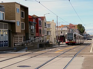
Judah and 19th Avenue station
Distance: Approx. 1041 meters
Latitude and longitude: 37.7617,-122.47703
Judah and 19th Avenue station is a light rail stop on the Muni Metro N Judah line, located in the Sunset District neighborhood of San Francisco, California where Judah Street crosses 19th Avenue (California Route 1). The station opened with the N Judah line on October 21, 1928. The station has two short side platforms in the middle of Judah Street (traffic islands) where passengers board or depart from trains.

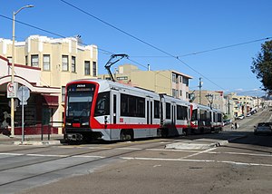
Judah and 22nd Avenue / Judah and 23rd Avenue stations
Distance: Approx. 755 meters
Latitude and longitude: 37.76152,-122.48127
Judah and 22nd Avenue / Judah and 23rd Avenue stations are a pair of light rail stops on the Muni Metro N Judah line, located in the Sunset District neighborhood of San Francisco, California. The eastbound stop is located on Judah Street at 22nd Avenue, while westbound trains stop on Judah Street at 23rd Avenue. The stops opened with the N Judah line on October 21, 1928.

Judah and 25th Avenue station
Light rail stop in San Francisco
Distance: Approx. 645 meters
Latitude and longitude: 37.76142,-122.48342
Judah and 25th Avenue is a light rail stop on the Muni Metro N Judah line, located in the Sunset District neighborhood of San Francisco, California. The station opened with the N Judah line on October 21, 1928. The station has two short side platforms in the middle of Judah Street (traffic islands) where passengers board or depart from trains.
Judah and 28th Avenue station
Distance: Approx. 567 meters
Latitude and longitude: 37.76129,-122.48664
Judah and 28th Avenue is a light rail stop on the Muni Metro N Judah line, located in the Sunset District neighborhood of San Francisco, California. The stop opened with the N Judah line on October 21, 1928. The station has two side platforms in the middle of Judah Street (traffic islands) where passengers board or depart from trains.
Judah and 31st Avenue station
Distance: Approx. 618 meters
Latitude and longitude: 37.76112,-122.48986
Judah and 31st Avenue station is a light rail stop on the Muni Metro N Judah line, located in the Sunset District neighborhood of San Francisco, California. The station opened with the N Judah line on October 21, 1928. The station has two short side platforms in the middle of Judah Street (traffic islands) where passengers board or depart from trains.

Judah and 34th Avenue station
Distance: Approx. 777 meters
Latitude and longitude: 37.76097,-122.49305
Judah and 34th Avenue station is a light rail stop on the Muni Metro N Judah line, located in the Sunset District neighborhood of San Francisco, California. The station opened with the N Judah line on October 21, 1928. The station has two short side platforms in the middle of Judah Street (traffic islands) where passengers board or depart from trains.

Judah and Sunset station
Distance: Approx. 953 meters
Latitude and longitude: 37.76087,-122.49568
Judah and Sunset station is a light rail stop on the Muni Metro N Judah line, located in the Sunset District neighborhood of San Francisco, California. The station opened with the N Judah line on October 21, 1928. The station has two short side platforms in the middle of Judah Street (traffic islands) where passengers board or depart from trains.
Sunset Reservoir
Reservoir in San Francisco, California
Distance: Approx. 790 meters
Latitude and longitude: 37.7496,-122.4833
Sunset Reservoir is one of three terminal reservoirs in the Regional Water System in San Francisco, California. The reservoir, the city's largest, is located in the Sunset District at 24th Avenue and Ortega Street, and is owned and maintained by the San Francisco Public Utilities Commission. Completed in 1960, the subterranean reservoir was constructed as an 11-acre (4.5 ha), 1,000 by 500 feet (300 m × 150 m), concrete basin, now containing 720 floor-to-ceiling columns.
Weather in this IP's area
scattered clouds
18 Celsius
18 Celsius
16 Celsius
23 Celsius
1011 hPa
80 %
1011 hPa
1001 hPa
10000 meters
6.17 m/s
310 degree
40 %
06:55:42
19:11:26