Country:
 USA
USARegion:
City:
Latitude and Longitude:
Time Zone:
Postal Code:
IP information under different IP Channel
ip-api
Country
Region
City
ASN
Time Zone
ISP
Blacklist
Proxy
Latitude
Longitude
Postal
Route
IPinfo
Country
Region
City
ASN
Time Zone
ISP
Blacklist
Proxy
Latitude
Longitude
Postal
Route
MaxMind
Country
Region
City
ASN
Time Zone
ISP
Blacklist
Proxy
Latitude
Longitude
Postal
Route
Luminati
Country
USASN
Time Zone
America/Chicago
ISP
AVAYA
Latitude
Longitude
Postal
db-ip
Country
Region
City
ASN
Time Zone
ISP
Blacklist
Proxy
Latitude
Longitude
Postal
Route
ipdata
Country
Region
City
ASN
Time Zone
ISP
Blacklist
Proxy
Latitude
Longitude
Postal
Route
Popular places and events near this IP address
Bernards Township, New Jersey
Township in Somerset County, New Jersey, US
Distance: Approx. 2197 meters
Latitude and longitude: 40.677455,-74.567277
Bernards Township () is a township in Somerset County, in the U.S. state of New Jersey. As of the 2020 United States census, the township's population was 27,830, an increase of 1,178 (+4.4%) from the 2010 census count of 26,652, reflecting an increase of 2,077 (+8.5%) from the 24,575 counted in the 2000 census. Located on the eastern end of the Somerset Hills region, the township is a bedroom suburb of New York City in the much larger New York metropolitan area, located within the Raritan Valley region.

Basking Ridge, New Jersey
Populated place in Somerset County, New Jersey, US
Distance: Approx. 2739 meters
Latitude and longitude: 40.7062,-74.5493
Basking Ridge is an unincorporated community and census-designated place (CDP) located within Bernards Township in the Somerset Hills region of Somerset County, in the U.S. state of New Jersey. Settled during colonial times, Basking Ridge is in the Raritan Valley and is a commercial hub for northern-central New Jersey and is a commuter town of New York City. It was home to the old AT&T Headquarters, now operated by Verizon.
Bernards Township School District
School district in Somerset County, New Jersey, US
Distance: Approx. 2918 meters
Latitude and longitude: 40.691518,-74.544191
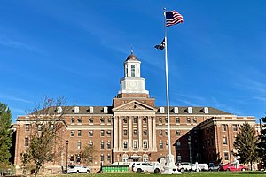
The Bernards Township School District is a comprehensive community public school district, serving students in pre-kindergarten through twelfth grade from Bernards Township in Somerset County, in the U.S. state of New Jersey. As of the 2020–21 school year, the district, comprising six schools, had an enrollment of 4,874 students and 456.1 classroom teachers (on an FTE basis), for a student–teacher ratio of 10.7:1. The district offers its Integrated Preschool Program for children on the autism spectrum, utilizing the principles of applied behavior analysis.
Ridge High School
High school in Somerset County, New Jersey, US
Distance: Approx. 2634 meters
Latitude and longitude: 40.69416667,-74.54722222
Ridge High School is a four-year comprehensive community public high school serving students in ninth through twelfth grades from Bernards Township in Somerset County, in the U.S. state of New Jersey, operating as the lone secondary school of the Bernards Township School District. As of the 2022–23 school year, the school had an enrollment of 1,682 students and 147.9 classroom teachers (on an FTE basis), for a student–teacher ratio of 11.4:1. There were 15 students (0.9% of enrollment) eligible for free lunch and 8 (0.5% of students) eligible for reduced-cost lunch.
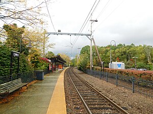
Lyons station
NJ Transit rail station
Distance: Approx. 2704 meters
Latitude and longitude: 40.68477778,-74.54952778
Lyons is a New Jersey Transit station in Basking Ridge, New Jersey along the Gladstone Branch of the Morris & Essex Lines. The station serves south Basking Ridge as well as the Hills and Liberty Corner.

Basking Ridge station
NJ Transit rail station
Distance: Approx. 2649 meters
Latitude and longitude: 40.71138889,-74.55527778
Basking Ridge is an NJ Transit station in Bernards Township, New Jersey along the Gladstone Branch of the Morris and Essex Lines.

Bernardsville station
NJ Transit rail station
Distance: Approx. 2487 meters
Latitude and longitude: 40.71694444,-74.57111111
Bernardsville is a New Jersey Transit station in Bernardsville, Somerset County, New Jersey along the Gladstone Branch of the Morris & Essex Lines, in the United States.
Northern precinct, Somerset County, New Jersey
Distance: Approx. 1709 meters
Latitude and longitude: 40.68,-74.58
The Northern precinct was one of three components of Somerset County, New Jersey, United States, that was created circa 1745 and existed until 1760. The Northern precinct, together with the Eastern precinct and Western precinct, were created as administrative divisions of Somerset County, while still under British colonial rule. Portions of the precinct were taken on April 4, 1749, to form both Bedminster Township and Bridgewater Township.

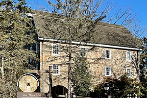
Brick Academy
United States historic place
Distance: Approx. 2710 meters
Latitude and longitude: 40.70666667,-74.55
Brick Academy is the nickname for a Federal-style brick building built in 1809 to meet the growing needs of the Basking Ridge Classical School located in the Basking Ridge section of Bernards Township, Somerset County, New Jersey. That school existed prior to 1799, at least 10 years before the construction of this building in 1809. The brick building was constructed for the elementary school run by local Presbyterian pastor, Rev.
Lyons, New Jersey
Populated place in Somersey County, New Jersey, US
Distance: Approx. 2858 meters
Latitude and longitude: 40.68527778,-74.54722222
Lyons is an unincorporated community and census-designated place (CDP) located within Bernards Township, in Somerset County, in the U.S. state of New Jersey. As of the 2010 United States Census, the population was 228. Lyons is 2.5 miles (4.0 km) south-southeast of Bernardsville.

Basking Ridge white oak
White oak in Basking Ridge, New Jersey
Distance: Approx. 2790 meters
Latitude and longitude: 40.70680556,-74.54902778
The Basking Ridge white oak (also known as the Holy Oak) was a white oak tree that stood in the churchyard of the Presbyterian Church in Basking Ridge, New Jersey. The tree was over 600 years old and died in 2016, before being cut down in 2017. It stood at 97 feet (30 meters) tall, and may have been the oldest white oak in the world.

John Parker Tavern
United States historic place
Distance: Approx. 2730 meters
Latitude and longitude: 40.71861111,-74.56833333
The John Parker Tavern is a historic building located at 2 Morristown Road (U.S. Route 202) in the borough of Bernardsville in Somerset County, New Jersey. Originally known as the Vealtown Tavern, it was frequently used by Continental Army soldiers during the American Revolutionary War. It was added to the National Register of Historic Places on December 14, 1978 for its significance in commerce, military history, and local history.
Weather in this IP's area
clear sky
19 Celsius
19 Celsius
17 Celsius
21 Celsius
1016 hPa
85 %
1016 hPa
1004 hPa
10000 meters
1.54 m/s
350 degree
06:42:23
19:02:19