134.6.33.78 - IP Lookup: Free IP Address Lookup, Postal Code Lookup, IP Location Lookup, IP ASN, Public IP
Country:
Region:
City:
Location:
Time Zone:
Postal Code:
ISP:
ASN:
language:
User-Agent:
Proxy IP:
Blacklist:
IP information under different IP Channel
ip-api
Country
Region
City
ASN
Time Zone
ISP
Blacklist
Proxy
Latitude
Longitude
Postal
Route
db-ip
Country
Region
City
ASN
Time Zone
ISP
Blacklist
Proxy
Latitude
Longitude
Postal
Route
IPinfo
Country
Region
City
ASN
Time Zone
ISP
Blacklist
Proxy
Latitude
Longitude
Postal
Route
IP2Location
134.6.33.78Country
Region
massachusetts
City
quincy
Time Zone
America/New_York
ISP
Language
User-Agent
Latitude
Longitude
Postal
ipdata
Country
Region
City
ASN
Time Zone
ISP
Blacklist
Proxy
Latitude
Longitude
Postal
Route
Popular places and events near this IP address

North Quincy station
Rapid transit station in Quincy, Massachusetts, US
Distance: Approx. 968 meters
Latitude and longitude: 42.2758,-71.0302
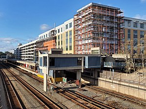
North Quincy station is an MBTA subway Red Line station in Quincy, Massachusetts. It is located in North Quincy, off Hancock Street (Route 3A). A major park-and-ride stop, it has over 1200 parking spaces for commuters.
North Quincy, Massachusetts
Neighborhood of Quincy, Massachusetts
Distance: Approx. 837 meters
Latitude and longitude: 42.27694444,-71.02027778
North Quincy is a neighborhood of Quincy, Massachusetts. It is separated from the city of Boston by the Neponset River, and borders the Quincy neighborhoods of Squantum, Montclair and Wollaston. It contains the smaller neighborhoods of Atlantic (sometimes used as a metonym for North Quincy) and Norfolk Downs, as well as much of Wollaston Beach.
North Quincy High School
Public school in Quincy, MA, United States
Distance: Approx. 771 meters
Latitude and longitude: 42.277142,-71.028371
North Quincy High School (NQHS) is a public secondary school located in the North Quincy neighborhood of Quincy, Massachusetts, United States. The school serves grades 9 through 12, and has an enrollment of over 1,200 students. It is one of two public high schools in the city—the other being Quincy High School.

Charles E. White House
Historic house in Massachusetts, United States
Distance: Approx. 1003 meters
Latitude and longitude: 42.27472222,-71.02291667
The Charles E. White House is a historic house at 101 Billings Road in Quincy, Massachusetts. This 2+1⁄2-story wood-frame house was built c. 1905 by Charles White, a traveling salesman.

Quincy Shore Drive
United States historic place
Distance: Approx. 1161 meters
Latitude and longitude: 42.27805556,-71.01305556
Quincy Shore Drive is a historic parkway in Quincy, Massachusetts. The road is one of a series of parkways built by predecessors of the Massachusetts Department of Conservation and Recreation, to provide access to parks and beaches in the Greater Boston area. Its development was proposed in 1893 by Charles Eliot, who promoted the development of many of the area's parks and parkways.

Quincy School
United States historic place
Distance: Approx. 451 meters
Latitude and longitude: 42.28055556,-71.02861111
Quincy School is a historic school building at 94 Newbury Avenue in Quincy, Massachusetts. The two-story brick building was built in 1906 and enlarged in 1932; its original design was by Hurd & Gore, and the addition was by Hutchins & French. A longtime elementary school, it closed in 1981 following city cutbacks in the wake of Proposition 2 1/2, and was subsequently sold to private developers for conversion to condominiums.

Moswetuset Hummock
United States historic place
Distance: Approx. 706 meters
Latitude and longitude: 42.28944444,-71.02166667
Moswetuset Hummock is a Native American site and the original name of the tribe (Mosetuset) in the region named Massachusetts after them. The wooded hummock in Squantum, Massachusetts, is formally recognized as historic by descendants of the Ponkapoag people. The location was the seat of the ruling Moswetuset Sac'hem (Native American chief) Chickatawbut.

Building at 1–7 Moscow Street
United States historic place
Distance: Approx. 1005 meters
Latitude and longitude: 42.27472222,-71.02722222
The Building at 1–7 Moscow Street in Quincy, Massachusetts, is a rare turn-of-the-20th century wood frame apartment house. It was built in the first decade of the 20th century, and is a long rectangular 2+1⁄2-story wood-frame structure, with two sets of paired entranceways The gambrel projections over the entrances are a hallmark of the Shingle style, but its original wood shingle finish has been replaced by modern siding (see photo). The building was listed on the National Register of Historic Places in 1989.

Building at 51 Hunt Street
Historic house in Massachusetts, United States
Distance: Approx. 662 meters
Latitude and longitude: 42.27805556,-71.02791667
The Building at 51 Hunt Street in Quincy, Massachusetts, is one of a relatively small number of triple decker apartment buildings in the city. Built in 1907 by Charles Stratton as part of his development of North Quincy as a rail-commuter suburb, it is a three-story wood-frame structure, with a flat roof and wooden clapboard siding. The building is notable for its high parapet and its unusual porch balustrades.

John Halloran House
Historic house in Massachusetts, United States
Distance: Approx. 532 meters
Latitude and longitude: 42.27888889,-71.02611111
The John Halloran House is a historic house at 99 E. Squantum Street in Quincy, Massachusetts. This two-family wood-frame house was built in 1910 for John Halloran, a local police officer. It is a well-preserved Colonial Revival example of duplexes that were commonly built in the Atlantic neighborhood of Quincy, with a fine balustraded porch, and an entrance with long sidelight windows and oval window in the door.

Glover House (Quincy, Massachusetts)
Historic house in Massachusetts, United States
Distance: Approx. 59 meters
Latitude and longitude: 42.28347222,-71.02430556
The Glover House is a historic house located at 249 East Squantum Street in Quincy, Massachusetts.

Quincy Shore Reservation
Distance: Approx. 725 meters
Latitude and longitude: 42.28055556,-71.01722222
Quincy Shore Reservation is a public recreation area and protected shoreline on Quincy Bay, Boston Harbor, in Quincy, Massachusetts. Its primary attraction is a 2.3-mile-long (3.7 km) beach, accessible along its entire length by Quincy Shore Drive. The largest beach on Boston Harbor, it is known locally as Wollaston Beach, named for the adjacent Wollaston neighborhood.
Weather in this IP's area
clear sky
3 Celsius
-2 Celsius
1 Celsius
4 Celsius
1006 hPa
46 %
1006 hPa
1002 hPa
10000 meters
4.92 m/s
9.39 m/s
248 degree
2 %