134.6.231.108 - IP Lookup: Free IP Address Lookup, Postal Code Lookup, IP Location Lookup, IP ASN, Public IP
Country:
Region:
City:
Location:
Time Zone:
Postal Code:
ISP:
ASN:
language:
User-Agent:
Proxy IP:
Blacklist:
IP information under different IP Channel
ip-api
Country
Region
City
ASN
Time Zone
ISP
Blacklist
Proxy
Latitude
Longitude
Postal
Route
db-ip
Country
Region
City
ASN
Time Zone
ISP
Blacklist
Proxy
Latitude
Longitude
Postal
Route
IPinfo
Country
Region
City
ASN
Time Zone
ISP
Blacklist
Proxy
Latitude
Longitude
Postal
Route
IP2Location
134.6.231.108Country
Region
alabama
City
montgomery
Time Zone
America/Chicago
ISP
Language
User-Agent
Latitude
Longitude
Postal
ipdata
Country
Region
City
ASN
Time Zone
ISP
Blacklist
Proxy
Latitude
Longitude
Postal
Route
Popular places and events near this IP address
Montgomery Academy (Alabama)
Private school in Montgomery, Alabama, United States
Distance: Approx. 492 meters
Latitude and longitude: 32.352,-86.26
The Montgomery Academy is a non-sectarian independent day school located in Montgomery, Alabama. The Lower School accommodates kindergarten through fourth grade and the Upper School fifth through twelfth. The school's current total enrollment is just under 900, of which approximately 300 are in the Upper School.
Huntingdon College
Methodist college in Montgomery, Alabama, US
Distance: Approx. 1972 meters
Latitude and longitude: 32.35,-86.285
Huntingdon College is a private Methodist college in Montgomery, Alabama. It was founded in 1854 as a women's college.

Montgomery metropolitan area
Metropolitan Statistical Area in Alabama, United States
Distance: Approx. 1608 meters
Latitude and longitude: 32.36166667,-86.27916667
The Montgomery, Alabama Metropolitan Statistical Area (commonly known as the Tri-Counties or the River Region) is a metropolitan area in central Alabama. As of 2020, the MSA had a population of 386,047, ranking it 142nd among United States Metropolitan Statistical Areas. That number is up +3.07% from the 2010 census number of 374,536.
Johnson Abernathy Graetz High School
Public school in Montgomery, Alabama, United States
Distance: Approx. 1220 meters
Latitude and longitude: 32.34361111,-86.26083333
Johnson Abernathy Graetz High School (formerly Jefferson Davis High School) is a public high school with grades 9 through 12 located in Montgomery, Alabama, United States. The principal is Dr. Carlos Hammonds.

Edgewood (Montgomery, Alabama)
Historic house in Alabama, United States
Distance: Approx. 2223 meters
Latitude and longitude: 32.34694444,-86.28666667
Edgewood, also known as the Thomas House, is a historic Federal-style house in Montgomery, Alabama. The two-story frame building was built in 1821 by Zachariah T. Watkins. It is the oldest surviving residence in Montgomery.

Red Lady of Huntingdon College
Distance: Approx. 1972 meters
Latitude and longitude: 32.35,-86.285
The Red Lady of Huntingdon College is a ghost said to haunt the former Pratt Hall dormitory at Huntingdon College in Montgomery, Alabama. Her story is told in Huntingdon alumnus Kathryn Tucker Windham's book 13 Alabama Ghosts and Jeffrey.
Temple Beth Or
Historic Reform synagogue in Montgomery, Alabama, US
Distance: Approx. 1762 meters
Latitude and longitude: 32.354806,-86.283317
Temple Beth Or (transliterated from Hebrew; "House of Light"), founded as Kahl Montgomery, is an historic Reform Jewish congregation and synagogue located at 2246 Narrow Lane Road, in the Cloverdale neighborhood of Montgomery, Alabama, in the United States.
Wheeler–Watkins Baseball Complex
Baseball venue in Montgomery, Alabama
Distance: Approx. 2330 meters
Latitude and longitude: 32.36083333,-86.28805556
Wheeler–Watkins Baseball Complex is a baseball venue in Montgomery, Alabama, United States. It is home to the Alabama State Hornets baseball team of the NCAA Division I Southwestern Athletic Conference. The venue is named for two former Alabama State baseball coaches, Herbert Wheeler and Larry Watkins.

Greenwood Cemetery (Montgomery, Alabama)
Cemetery in Montgomery County, Alabama
Distance: Approx. 2013 meters
Latitude and longitude: 32.37194444,-86.26111111
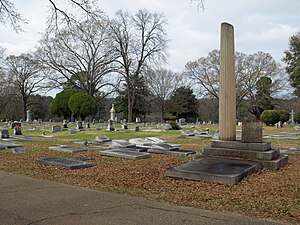
Greenwood Cemetery is a cemetery in Montgomery, Alabama, United States.

ASU Stadium (Alabama)
Distance: Approx. 2673 meters
Latitude and longitude: 32.36388889,-86.29055556
ASU Stadium is an American football stadium in Montgomery, Alabama, on the campus of Alabama State University that serves as the home field for the Alabama State Hornets football team. The stadium opened in 2012 and replaced the Cramton Bowl as the home of ASU football. ASU Stadium's inaugural game was played November 22, 2012, when it hosted the 89th Turkey Day Classic in which the Hornets hosted the Tuskegee Golden Tigers.

W. A. Gayle Planetarium
Planetarium in Montgomery, Alabama
Distance: Approx. 2655 meters
Latitude and longitude: 32.368149,-86.287416
The W.A. Gayle Planetarium is operated by the Montgomery Zoo for the city of Montgomery, Alabama. It provides public presentations and exhibits on astronomy, planetary science, and space exploration.
Lincoln Cemetery (Montgomery, Alabama)
Historic cemetery in Alabama, US
Distance: Approx. 1492 meters
Latitude and longitude: 32.3675,-86.2642
Lincoln Cemetery is a historic cemetery in Montgomery, Alabama, opened in 1908 for the city's Black population.
Weather in this IP's area
overcast clouds
14 Celsius
14 Celsius
13 Celsius
14 Celsius
1019 hPa
94 %
1019 hPa
1011 hPa
10000 meters
3.09 m/s
280 degree
100 %
