Country:
Region:
City:
Latitude and Longitude:
Time Zone:
Postal Code:
IP information under different IP Channel
ip-api
Country
Region
City
ASN
Time Zone
ISP
Blacklist
Proxy
Latitude
Longitude
Postal
Route
Luminati
Country
Region
nl
City
stjohns
ASN
Time Zone
America/St_Johns
ISP
CANET-ASN-4
Latitude
Longitude
Postal
IPinfo
Country
Region
City
ASN
Time Zone
ISP
Blacklist
Proxy
Latitude
Longitude
Postal
Route
db-ip
Country
Region
City
ASN
Time Zone
ISP
Blacklist
Proxy
Latitude
Longitude
Postal
Route
ipdata
Country
Region
City
ASN
Time Zone
ISP
Blacklist
Proxy
Latitude
Longitude
Postal
Route
Popular places and events near this IP address

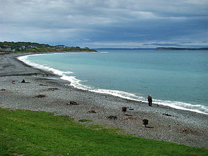
Conception Bay South
Town in Newfoundland and Labrador, Canada
Distance: Approx. 2385 meters
Latitude and longitude: 47.51666667,-52.98333333
Conception Bay South is a town in the Province of Newfoundland and Labrador, Canada. The town is commonly called CBS. The town is located on the Avalon Peninsula which forms part of the southern shore of Conception Bay which is in turn part of the island of Newfoundland. It is approximately 20 kilometres (12 miles) southwest of the provincial capital of St.

Holyrood Thermal Generating Station
Distance: Approx. 8918 meters
Latitude and longitude: 47.45281667,-53.09548056
The Holyrood Thermal Electric Generating Station built by Newfoundland and Labrador Hydro Corporation is located near the community of Holyrood, in Conception Bay, Newfoundland, Canada.
Kellys Island (Newfoundland and Labrador)
Island in Newfoundland and Labrador, Canada
Distance: Approx. 5389 meters
Latitude and longitude: 47.54388889,-53.01638889
Kellys Island is an uninhabited island in Newfoundland and Labrador Canada. With a length of approximately 2 km and a width at its widest point of 1.3 km, it is situated in southeastern Conception Bay. Tradition has it that Kelly's Island took its name from a seventeenth-century Cornish pirate who used the island as a rendezvous point.
St. John's (Paddys Pond) Water Aerodrome
Airport in St. John's, Newfoundland and Labrador
Distance: Approx. 8703 meters
Latitude and longitude: 47.46833333,-52.88944444
St. John's (Paddys Pond) Water Aerodrome (TC LID: CCQ5) is located 5 nautical miles (9.3 km; 5.8 mi) southwest of St. John's, Newfoundland and Labrador, Canada on Paddy's Pond.

Manuels River
River in Newfoundland and Labrador, Canada
Distance: Approx. 4760 meters
Latitude and longitude: 47.52722222,-52.95166667
The Manuels River is located in the eastern portion of the town of Conception Bay South, Newfoundland and Labrador. It forms on the high lands of the central Avalon Plateau, traverses approximately 10 kilometres of terrain and empties into the waters of Conception Bay. The river is accessible via walking trails, which start at the Manuels River Hibernia Interpretation Centre located on the Conception Bay Highway.
Indian Pond
Distance: Approx. 7342 meters
Latitude and longitude: 47.46666667,-53.08333333
Indian Pond was a settlement located northeast of Avondale, Newfoundland and Labrador. It had a population of 87 in 1956.
Murders of Andrew Bagby and Zachary Turner
2001 murder and 2003 child murder
Distance: Approx. 1835 meters
Latitude and longitude: 47.513769,-52.995733
Zachary Andrew Turner (18 July 2002 – 18 August 2003): 78 was a Canadian child from St. John's, Newfoundland and Labrador, who was killed by his mother, Shirley Jane Turner, in a murder–suicide.: 494 At the time, Shirley had been released on bail and awarded custody of the infant, even though she was in the process of being extradited to the United States to stand trial for the murder of Zachary's father, Andrew David Bagby. The case led to a critical overview of Newfoundland's legal and child welfare systems as well as Canada's bail laws.
Weather in this IP's area
overcast clouds
3 Celsius
-1 Celsius
3 Celsius
4 Celsius
997 hPa
89 %
997 hPa
990 hPa
10000 meters
6.93 m/s
10.59 m/s
277 degree
86 %
06:57:00
16:34:36