134.255.227.11 - IP Lookup: Free IP Address Lookup, Postal Code Lookup, IP Location Lookup, IP ASN, Public IP
Country:
Region:
City:
Location:
Time Zone:
Postal Code:
IP information under different IP Channel
ip-api
Country
Region
City
ASN
Time Zone
ISP
Blacklist
Proxy
Latitude
Longitude
Postal
Route
Luminati
Country
ASN
Time Zone
Europe/Berlin
ISP
aurologic GmbH
Latitude
Longitude
Postal
IPinfo
Country
Region
City
ASN
Time Zone
ISP
Blacklist
Proxy
Latitude
Longitude
Postal
Route
IP2Location
134.255.227.11Country
Region
bayern
City
laufach
Time Zone
Europe/Berlin
ISP
Language
User-Agent
Latitude
Longitude
Postal
db-ip
Country
Region
City
ASN
Time Zone
ISP
Blacklist
Proxy
Latitude
Longitude
Postal
Route
ipdata
Country
Region
City
ASN
Time Zone
ISP
Blacklist
Proxy
Latitude
Longitude
Postal
Route
Popular places and events near this IP address

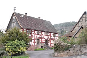
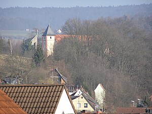
Laufach
Municipality in Bavaria, Germany
Distance: Approx. 4 meters
Latitude and longitude: 50.01666667,9.3
Laufach is a community in the Aschaffenburg district in the Regierungsbezirk of Lower Franconia (Unterfranken) in Bavaria, Germany. As of 2023, the population of Laufach was 5,308.

Sailauf
Municipality in Bavaria, Germany
Distance: Approx. 3577 meters
Latitude and longitude: 50.01666667,9.25
Sailauf is a municipality in the Aschaffenburg district in the Regierungsbezirk of Lower Franconia (Unterfranken) in Bavaria, Germany. It has a population of around 3,600.
Spessart Ramp
Distance: Approx. 3577 meters
Latitude and longitude: 50.01666667,9.35
The Spessart Ramp (German: Spessartrampe) is a 5.4 km long incline on the Main-Spessart Railway in southern Germany between Laufach at one end and the Schwarzkopf tunnel and Heigenbrücken at the other, with an average incline of 20 ‰. The ramp is part of Ludwig's Western Railway and the section from Würzburg via Aschaffenburg to the state border at Kahl am Main was opened on 1 October 1854 by the Royal Bavarian State Railways. The ramp enabled the difference in height between the Laufach valley and the Lohr valley to be overcome as it crossed the Spessart between Kahl am Main and Aschaffenburg on the one side and Würzburg/Bamberg on the other.

Steigkoppe
Distance: Approx. 3039 meters
Latitude and longitude: 50.04388889,9.30388889
Steigkoppe is a wooded hill in the Spessart range of Bavaria, Germany. The 502 metres (1,647 ft) tall hill is located in the district of Aschaffenburg. More specifically, Steigkoppe is in the unincorporated area Sailaufer Forst between Laufach and Jakobsthal, part of Heigenbrücken.
Steinknückl
Distance: Approx. 2953 meters
Latitude and longitude: 49.99282,9.28202
Steinknückl is a low mountain in the Aschaffenburg district of Bavaria, Germany, on the western edge of the Spessart range of wooded low mountains. It is flanked by the communities of Laufach to the north and Waldaschaff to the south. Its parent peak is the 460 m (1,510 ft) Schwarzkopf 7 kilometres (4.3 mi) to the east.
Bessenbach (river)
River in Germany
Distance: Approx. 4695 meters
Latitude and longitude: 49.9857,9.2555
Bessenbach is a river of Bavaria, Germany. It flows into the Aschaff near Waldaschaff. The source of the Bessenbach is in Oberbessenbach, where it rises as the Kirschlingsbach, 317m above sea level.
Beibuschbach
River in Germany
Distance: Approx. 599 meters
Latitude and longitude: 50.0122,9.2954
Beibuschbach is a small river of Bavaria, Germany. It flows into the Laufach in the village Laufach.
Eichenberger Bach
River in Germany
Distance: Approx. 3253 meters
Latitude and longitude: 50.0236,9.2558
Eichenberger Bach is a small river of Bavaria, Germany. It flows into the Sailaufbach in Sailauf.
Erlenbach (Laufach)
River in Bavaria, Germany
Distance: Approx. 638 meters
Latitude and longitude: 50.012,9.2949
Erlenbach is a small river of Bavaria, Germany. It is a left tributary of the Laufach in the village Laufach.
Seebach (Laufach)
River in Bavaria, Germany
Distance: Approx. 1787 meters
Latitude and longitude: 50.0109,9.3233
Seebach is a small river of Bavaria, Germany. It is the left headwater of the Laufach in Hain.
Sailaufbach
River in Germany
Distance: Approx. 2878 meters
Latitude and longitude: 50.04212,9.29264
The Sailaufbach is a stream in Bavaria, Germany. It flows in the low mountain range of the Spessart. It is a right-hand and northwestern tributary of the Laufach in the district of Aschaffenburg in Lower Franconia, flowing into the Laufach near Hösbach.
Laufach station
Railway station in Laufach, Germany
Distance: Approx. 1718 meters
Latitude and longitude: 50.01068,9.27789
Laufach station is a railway station in the municipality of Laufach, located in the Aschaffenburg district in Bavaria, Germany.
Weather in this IP's area
broken clouds
4 Celsius
2 Celsius
1 Celsius
4 Celsius
1037 hPa
66 %
1037 hPa
998 hPa
10000 meters
2.24 m/s
5.59 m/s
334 degree
69 %


