Country:
 USA
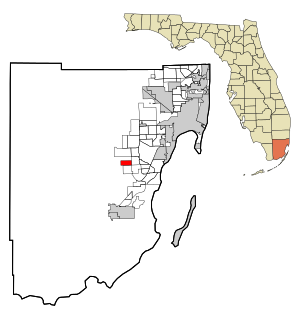
USARegion:
City:
Latitude and Longitude:
Time Zone:
Postal Code:
IP information under different IP Channel
ip-api
Country
Region
City
ASN
Time Zone
ISP
Blacklist
Proxy
Latitude
Longitude
Postal
Route
IPinfo
Country
Region
City
ASN
Time Zone
ISP
Blacklist
Proxy
Latitude
Longitude
Postal
Route
MaxMind
Country
Region
City
ASN
Time Zone
ISP
Blacklist
Proxy
Latitude
Longitude
Postal
Route
Luminati
Country
USRegion
fl
City
miami
ASN
Time Zone
America/New_York
ISP
BECKMAN-COULTER-ASN
Latitude
Longitude
Postal
db-ip
Country
Region
City
ASN
Time Zone
ISP
Blacklist
Proxy
Latitude
Longitude
Postal
Route
ipdata
Country
Region
City
ASN
Time Zone
ISP
Blacklist
Proxy
Latitude
Longitude
Postal
Route
Popular places and events near this IP address
Country Walk, Florida
Census-designated place in Florida
Distance: Approx. 3533 meters
Latitude and longitude: 25.63222222,-80.435
Country Walk is a census-designated place (CDP) in Miami-Dade County, Florida, United States. It is part of the Miami metropolitan area of South Florida. The population was 16,951 at the 2020 census, up from 15,997 at the 2010 census.

Kendall West, Florida
Census-designated place in Florida
Distance: Approx. 4649 meters
Latitude and longitude: 25.70555556,-80.44055556
Kendall West is a census-designated place and unincorporated community in Miami-Dade County, Florida, west of the Florida Turnpike. It is located in the Miami metropolitan area of South Florida. The population was 36,536 at the 2020 census.

The Crossings, Florida
CDP in Florida
Distance: Approx. 3673 meters
Latitude and longitude: 25.66944444,-80.40111111
The Crossings is a census-designated place (CDP) and suburb of Miami in Miami-Dade County, Florida, United States. It is part of the Miami metropolitan area of South Florida. The CDP includes the neighborhoods of The Crossings, Devon Aire, and Calusa.

The Hammocks, Florida
Census-designated place in Florida
Distance: Approx. 749 meters
Latitude and longitude: 25.67055556,-80.43611111
The Hammocks is a planned community and census-designated place in Miami-Dade County, Florida, United States. It is part of the Miami metropolitan area of South Florida. The population was 59,480 at the 2020 census, up from 51,003 in 2010.

Three Lakes, Florida
Census-designated place in Florida
Distance: Approx. 4972 meters
Latitude and longitude: 25.63527778,-80.39916667
Three Lakes is a census-designated place (CDP) and planned community in Miami-Dade County, Florida, United States. It is part of the Miami metropolitan area of South Florida. The population was 16,540 at the 2020 census, up from 15,047 in 2010.

Miami Executive Airport
Airport in Miami-Dade County, Florida
Distance: Approx. 1849 meters
Latitude and longitude: 25.64777778,-80.43277778
Miami Executive Airport, formerly known until 2014 as Kendall-Tamiami Executive Airport, (IATA: TMB, ICAO: KTMB, FAA LID: TMB) is a public airport in unincorporated Miami-Dade County, Florida, 13 miles (21 km) southwest of Downtown Miami. It is operated by the Miami-Dade Aviation Department. The airport opened on November 18, 1967, replacing Tamiami Airport, next to the Tamiami Trail.
Felix Varela Senior High School
Public secondary school in Miami, Florida , United States
Distance: Approx. 1636 meters
Latitude and longitude: 25.6777,-80.4428
Felix Varela Senior High School is a public high school located at 15255 SW 96th St. in The Hammocks, unincorporated Miami-Dade County, Florida, United States. Past principals include Millie Fornell (2000–2005), Connie Navarro (2005–2011), Nery Fins (2011–2023).

Archbishop Coleman F. Carroll High School
Private school in The Hammocks, Florida, United States
Distance: Approx. 3093 meters
Latitude and longitude: 25.671,-80.467
Archbishop Coleman F. Carroll High School is a private high school in The Hammocks, Dade County, Florida, United States, that was opened in 1998. Sponsored by the Roman Catholic Archdiocese of Miami, it is accredited through the Southern Association of Colleges and Schools. Named after the first Archbishop of Miami, Coleman Francis Carroll, the school's mascot is the Bulldog.
Arvida Middle School
Public school in Miami, Florida , United States
Distance: Approx. 3730 meters
Latitude and longitude: 25.666731,-80.400162
Arvida Middle School is a Blue Ribbon middle school in Miami, Florida, United States, founded in 1975, that educates around 1,850 students from grades 6-8. Its principal since August 2019, is Angela Holbrook.

El Rey Jesús
Church in Florida, United States
Distance: Approx. 3317 meters
Latitude and longitude: 25.635276,-80.42803283
Ministerio Internacional El Rey Jesús, anglicized as King Jesus International Ministry, is a non-denominational Christian church located in Miami, Florida. While the church is best known as El Rey Jesús, the anglicized name of King Jesus Ministry has recently seen more usage alongside attempts to reach out to non-Hispanics in the Miami area. Its senior pastor is currently Apostle Guillermo Maldonado.
Wings Over Miami Air Museum
Aviation Museum in Florida, United States
Distance: Approx. 1821 meters
Latitude and longitude: 25.64813,-80.432394
Wings Over Miami is a flying aviation museum of historically significant aircraft, located at Miami Executive Airport in Miami-Dade County, Florida, United States, 13 mi (21 km) southwest of the central business district of Miami.
West End, Florida
Place in Florida, United States
Distance: Approx. 3533 meters
Latitude and longitude: 25.63222222,-80.435
The West End is a wholly unincorporated area in suburban Miami-Dade County, Florida, United States. It is the collection of communities within and adjacent to County Commission District 11. At the time of the 2010 census, there were 213,839 residents.
Weather in this IP's area
overcast clouds
24 Celsius
25 Celsius
23 Celsius
26 Celsius
1019 hPa
92 %
1019 hPa
1019 hPa
10000 meters
1.34 m/s
5.81 m/s
58 degree
99 %
07:22:34
18:50:21