134.169.18.132 - IP Lookup: Free IP Address Lookup, Postal Code Lookup, IP Location Lookup, IP ASN, Public IP
Country:
Region:
City:
Location:
Time Zone:
Postal Code:
IP information under different IP Channel
ip-api
Country
Region
City
ASN
Time Zone
ISP
Blacklist
Proxy
Latitude
Longitude
Postal
Route
Luminati
Country
Region
ni
City
braunschweig
ASN
Time Zone
Europe/Berlin
ISP
Verein zur Foerderung eines Deutschen Forschungsnetzes e.V.
Latitude
Longitude
Postal
IPinfo
Country
Region
City
ASN
Time Zone
ISP
Blacklist
Proxy
Latitude
Longitude
Postal
Route
IP2Location
134.169.18.132Country
Region
niedersachsen
City
braunschweig
Time Zone
Europe/Berlin
ISP
Language
User-Agent
Latitude
Longitude
Postal
db-ip
Country
Region
City
ASN
Time Zone
ISP
Blacklist
Proxy
Latitude
Longitude
Postal
Route
ipdata
Country
Region
City
ASN
Time Zone
ISP
Blacklist
Proxy
Latitude
Longitude
Postal
Route
Popular places and events near this IP address

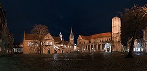
Braunschweig
City and district in Lower Saxony, Germany
Distance: Approx. 686 meters
Latitude and longitude: 52.26666667,10.51666667
Braunschweig (German: [ˈbʁaʊnʃvaɪk] ) or Brunswick (English: BRUN-zwik; from Low German Brunswiek, local dialect: Bronswiek [ˈbrɔˑnsviːk]) is a city in Lower Saxony, Germany, north of the Harz Mountains at the farthest navigable point of the river Oker, which connects it to the North Sea via the rivers Aller and Weser. In 2024, it has a population of 272,417. The urban agglomeration of Braunschweig has an estimate population 476,000 during the year 2024.

Brunswick Cathedral
Church in Lower Saxony, Germany
Distance: Approx. 276 meters
Latitude and longitude: 52.26416667,10.52416667
Brunswick Cathedral (German: Dom St. Blasii (et Johannis), lit. in English: Collegiate Church of Ss.

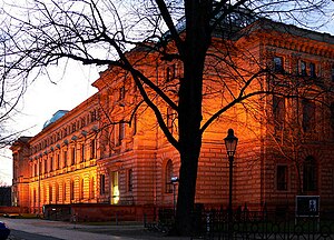
Herzog Anton Ulrich Museum
Art museum in Braunschweig, Germany
Distance: Approx. 531 meters
Latitude and longitude: 52.26333333,10.53305556
The Herzog Anton Ulrich Museum (HAUM) is an art museum in the German city of Braunschweig, Lower Saxony.

Gymnasium Gaussschule
School in Lower Saxony, Germany
Distance: Approx. 614 meters
Latitude and longitude: 52.26111111,10.53055556
Gymnasium Gaussschule is a Gymnasium (high school) in Braunschweig, Lower Saxony, Germany.

Bombing of Braunschweig (15 October 1944)
Most destructive bombing of Braunschweig during Second World War
Distance: Approx. 263 meters
Latitude and longitude: 52.2643,10.5242
In the early hours of 15 October 1944, No. 5 Group of the Royal Air Force (RAF) carried out the most destructive of 42 attacks on Braunschweig (Brunswick) during World War II. The attack was a part of Operation Hurricane, which was designed to demonstrate the capabilities of the Allied bombing campaign. It caused a massive conflagration that developed into a firestorm, and resulted in Braunschweig, the city of Henry the Lion, burning continuously for two and a half days from 15 to 17 October.

Staatstheater Braunschweig
Distance: Approx. 340 meters
Latitude and longitude: 52.26583333,10.53166667
The Staatstheater Braunschweig is a theatre company and opera house in Braunschweig, Germany, presenting and producing music theatre (opera, operetta, musical), Tanztheater, theatre, Theatre for Young Audiences and concerts. The Staatstheater Braunschweig is owned by the State of Lower Saxony.

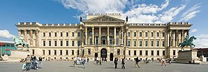
Brunswick Palace
Distance: Approx. 341 meters
Latitude and longitude: 52.26305556,10.52722222
Brunswick Palace (German: Braunschweiger Schloss or Braunschweiger Residenzschloss) on the Bohlweg in the centre of the city of Brunswick (German: Braunschweig), was the residence of the Brunswick dukes from 1753 to 8 November 1918.

Dankwarderode Castle
Medieval Division of the Herzog Anton Ulrich Museum in Brunswick
Distance: Approx. 231 meters
Latitude and longitude: 52.26472,10.52417
Dankwarderode Castle (German: Burg Dankwarderode) on the Burgplatz ("castle square") in Braunschweig (Brunswick) is a Saxon lowland castle. It was the residence of the Brunswick dukes for centuries and, today, is part of the Herzog Anton Ulrich Museum.

Innenstadt (Braunschweig)
Borough of Braunschweig in Lower Saxony, Germany
Distance: Approx. 405 meters
Latitude and longitude: 52.26416667,10.52166667
The Innenstadt ("inner city") is the central Stadtbezirk (borough) of Braunschweig, Germany. The district consists of five formerly independent city municipal areas (Altewiek, Altstadt, Hagen, Neustadt, and Sack), and is surrounded by the river Oker and in area nearly identical to the medieval city of Braunschweig.

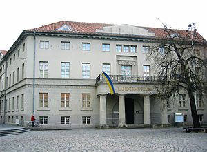
Braunschweigisches Landesmuseum
History museum in Brunswick, Germany
Distance: Approx. 291 meters
Latitude and longitude: 52.2647,10.5231
Braunschweigisches Landesmuseum (BLM) is a history museum in Braunschweig, Germany, operated by the state of Lower Saxony. The museum is scattered on four locations: Vieweghaus, Hinter Ägidien (both in Braunschweig), Kanzlei (Wolfenbüttel) and Bauernhausmuseum (Bortfeld). The collection covers 500,000 years and includes objects from the history of the Braunschweig area, including culture, economy, technology, folk arts, and social history.

Trams in Braunschweig
Distance: Approx. 403 meters
Latitude and longitude: 52.2625,10.52611111
The Braunschweig tramway network (German: Straßenbahnnetz Braunschweig) is a network of tramways forming part of the public transport system in Braunschweig, a city in the federal state of Lower Saxony, Germany. Opened in 1879, the network has been operated since its inception by the company now known as Braunschweiger Verkehrs-AG, and is integrated in the Verkehrsverbund Region Braunschweig (VRB). These lines originally had the letter M before the number, however this was stopped.
Braunschweig (district)
District in Lower Saxony, Germany
Distance: Approx. 630 meters
Latitude and longitude: 52.27,10.52
Braunschweig or Landkreis Braunschweig was a district in Lower Saxony, Germany. The administrative centre of the district was the independent city of Braunschweig, which, however, was not part of the district itself. The district was disbanded on 28 February 1974, as part of a district reform in Lower Saxony.
Weather in this IP's area
overcast clouds
2 Celsius
-2 Celsius
1 Celsius
3 Celsius
1014 hPa
83 %
1014 hPa
1004 hPa
10000 meters
4.47 m/s
7.6 m/s
360 degree
100 %