Country:
Region:
City:
Latitude and Longitude:
Time Zone:
Postal Code:
IP information under different IP Channel
ip-api
Country
Region
City
ASN
Time Zone
ISP
Blacklist
Proxy
Latitude
Longitude
Postal
Route
Luminati
Country
Region
28
City
kobe
ASN
Time Zone
Asia/Tokyo
ISP
Research Organization of Information and Systems, National Institute of Informatics
Latitude
Longitude
Postal
IPinfo
Country
Region
City
ASN
Time Zone
ISP
Blacklist
Proxy
Latitude
Longitude
Postal
Route
db-ip
Country
Region
City
ASN
Time Zone
ISP
Blacklist
Proxy
Latitude
Longitude
Postal
Route
ipdata
Country
Region
City
ASN
Time Zone
ISP
Blacklist
Proxy
Latitude
Longitude
Postal
Route
Popular places and events near this IP address

Hyōgo Prefecture
Prefecture of Japan
Distance: Approx. 206 meters
Latitude and longitude: 34.69081667,135.18307778
Hyōgo Prefecture (兵庫県, Hyōgo-ken) is a prefecture of Japan located in the Kansai region of Honshu. Hyōgo Prefecture has a population of 5,469,762 (as of 1 June 2019) and a geographic area of 8,400 square kilometres (3,200 square miles). Hyōgo Prefecture borders Kyoto Prefecture to the east, Osaka Prefecture to the southeast, and Okayama and Tottori prefectures to the west.

Motomachi Station (Hyōgo)
Railway station in Kobe, Japan
Distance: Approx. 605 meters
Latitude and longitude: 34.6896,135.1874
Motomachi Station (元町駅, Motomachi-eki) is a railway station in Motomachi, Chūō-ku, Kobe, Hyōgo Prefecture, Japan. It is one of the main stations serving the central business district of Kobe. The station is the closest access point to the Motomachi shopping district and to Nanking Town, one of Japan's three largest Chinatown districts.

Kobe Mosque
Mosque in Kobe, Hyōgo, Japan
Distance: Approx. 714 meters
Latitude and longitude: 34.69611111,135.18777778
Kobe Mosque (神戸モスク, Kōbe Mosuku), also known as Kobe Muslim Masjid (神戸ムスリムモスク, Kōbe Musurimu Mosuku), was founded in October 1935 in Kobe and is Japan's first mosque. It is situated in the Hyōgo Prefecture city of Kobe. Established in October 1935, it holds historical significance as a symbol of the early presence of Islam in Japan.

Motomachi, Kobe
District of Kobe, Japan
Distance: Approx. 570 meters
Latitude and longitude: 34.68777778,135.18472222
Motomachi (Japanese: 元町) is a district of Chūō Ward in Kobe, Japan. It is located between Mount Rokkō and the port of Kobe. It is located adjacent to Nankinmachi (南京町: Kobe Chinatown) and Kyū-kyoryūchi (旧居留地: a foreign settlement in the 19th century: there are several buildings from that time, now used as restaurants or coffee shops.).

Nankin-machi
Chinatown of Kobe, Japan
Distance: Approx. 750 meters
Latitude and longitude: 34.68805556,135.18805556
Nankin-machi (南京町, lit. 'Nanjing town') is a neighborhood in Kobe, Japan located south of Motomachi station adjacent to the Daimaru Department Store and is a major tourist attraction. Considered as Kobe's Chinatown, the area has over a hundred Chinese restaurants, shops, and a Chinese temple dedicated to Lord Guan (関帝廟, Kanteibyō).

Kobe Yamate University
Distance: Approx. 352 meters
Latitude and longitude: 34.69388889,135.17833333
Kobe Yamate University (神戸山手大学, Kōbe yamate daigaku) is a private university in Chūō-ku, Kobe, Hyōgo, Japan. The campuses are located in central part of Kobe.

Kenchōmae Station (Hyōgo)
Metro station in Kobe, Japan
Distance: Approx. 260 meters
Latitude and longitude: 34.69083333,135.18388889
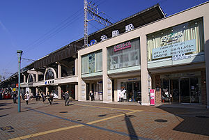
Kenchōmae Station (県庁前駅, Kenchōmae-eki) is a railway station in Chūō-ku, Kobe, Hyōgo Prefecture, Japan.

Minato Motomachi Station
Metro station in Kobe, Japan
Distance: Approx. 773 meters
Latitude and longitude: 34.6856,135.1842
Minato Motomachi Station (みなと元町駅, Minato Motomachi-eki) is a train station in Chūō-ku, Kobe, Hyōgo Prefecture, Japan。

Hanakuma Station
Railway station in Kobe, Japan
Distance: Approx. 677 meters
Latitude and longitude: 34.68611667,135.18152778
Hanakuma Station (花隈駅, Hanakuma-eki, station number: HK-17) is a train station on the Hankyu Railway Kobe Kosoku Line in Chūō-ku, Kobe, Japan.

Sōraku-en
Gardens in Chūō-ku, Kobe, Japan
Distance: Approx. 34 meters
Latitude and longitude: 34.6925,135.18166667
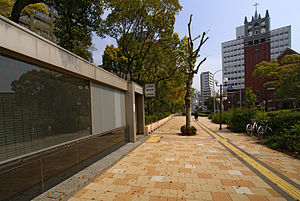
The gardens of Sōraku-en (相楽園) are in Chūō-ku, Kobe, Japan. Formerly attached to the Taishō-era residence of Kodera Yasujirō, ownership passed to the city of Kobe in 1941. Since then they have been open to the public.

Kobe Chinese School
Distance: Approx. 208 meters
Latitude and longitude: 34.6917,135.1794
Kobe Chinese School is a Chinese international school in Chuo-ku, Kobe, Japan. It is one of two Mainland China-oriented schools in Japan, the other being Yokohama Yamate Chinese School. It provides elementary and junior high school education in grades 1-9 and offers first choice in admission to children of alumni.
St. Michael's Cathedral, Kobe
Distance: Approx. 175 meters
Latitude and longitude: 34.69075,135.18233
St. Michael's Cathedral, located in Chūō-ku, Kobe, Japan, is the cathedral church of the Kobe Diocese of the Anglican Church in Japan, covering the Anglican/Episcopal parishes in Hyogo Prefecture of the Kansai Region, the six prefectures of the Chugoku Region, and the four prefectures of the Shikoku Region.
Weather in this IP's area
overcast clouds
17 Celsius
16 Celsius
16 Celsius
18 Celsius
1019 hPa
81 %
1019 hPa
1015 hPa
10000 meters
3.12 m/s
4.25 m/s
36 degree
100 %
06:34:08
16:54:11