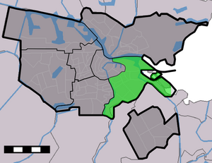
Country:
 Netherlands
Region:
City:
Latitude and Longitude:
Time Zone:
Postal Code:
IP information under different IP Channel
ip-api
Country
Region
City
ASN
Time Zone
ISP
Blacklist
Proxy
Latitude
Longitude
Postal
Route
IPinfo
Country
Region
City
ASN
Time Zone
ISP
Blacklist
Proxy
Latitude
Longitude
Postal
Route
MaxMind
Country
Region
City
ASN
Time Zone
ISP
Blacklist
Proxy
Latitude
Longitude
Postal
Route
Luminati
Country
NLRegion
nh
City
amsterdam
ASN
Time Zone
Europe/Amsterdam
ISP
DIGITALOCEAN-ASN
Latitude
Longitude
Postal
db-ip
Country
Region
City
ASN
Time Zone
ISP
Blacklist
Proxy
Latitude
Longitude
Postal
Route
ipdata
Country
Region
City
ASN
Time Zone
ISP
Blacklist
Proxy
Latitude
Longitude
Postal
Route
Popular places and events near this IP address

Jaap Edenbaan
Sports park
Distance: Approx. 519 meters
Latitude and longitude: 52.34861111,4.94444444
The Jaap Edenbaan (translated: Jaap Eden track) is an ice rink located in the Watergraafsmeer, a neighborhood of eastern Amsterdam. The rink is named after the famous Dutch ice skater Jaap Eden. It contains a 400-meter lane and Jaap Edenhal.

Watergraafsmeer
Neighbourhood of Amsterdam, Netherlands
Distance: Approx. 457 meters
Latitude and longitude: 52.35,4.93333333
The Watergraafsmeer is a polder in the Netherlands, North Holland. It was reclaimed in 1629. In the 17th and 18th centuries, there were many buitenplaatsen in the Watergraafsmeer, though nowadays only one, Frankendael, remains.

Amsterdam Science Park railway station
Railway station in Amsterdam, Netherlands
Distance: Approx. 642 meters
Latitude and longitude: 52.3525,4.94861111
Amsterdam Science Park is a railway station in the borough Amsterdam-Oost in Amsterdam, Netherlands. The station lies on the Amsterdam–Zutphen railway between the railway stations Amsterdam Muiderpoort and Diemen. The station serves the Science Park Amsterdam and the Watergraafsmeer, as well as Amsterdam University College and the Science Park campus of the University of Amsterdam.
Amsterdam-Oost
Borough of Amsterdam in North Holland, Netherlands
Distance: Approx. 594 meters
Latitude and longitude: 52.35277778,4.93055556
Amsterdam-Oost (Dutch pronunciation: [ˌɑmstərdɑmˈoːst]) is a borough of Amsterdam, Netherlands, established in May 2010 after a merger of the former boroughs of Zeeburg and Oost-Watergraafsmeer. In 2013, the borough had almost 123,000 inhabitants.

Oostpoort
Neighborhood of Amsterdam in North Holland, Netherlands
Distance: Approx. 834 meters
Latitude and longitude: 52.35777778,4.93138889
Oostpoort (Dutch pronunciation: [oːstpoːrt]; English: East Gate) is a neighborhood in the borough Amsterdam-Oost in Amsterdam, Netherlands. The neighborhood is situated at 52°21′28″N 4°55′53″E between the Linnaeusstraat, the Ringvaart, the Amsterdam–Arnhem railway, and the Amsterdam–Zutphen railway. Initially, the area was named Polderweggebied after the Polderweg, which is a road running through it.
Jaap Edenhal
Indoor Ice Rink
Distance: Approx. 413 meters
Latitude and longitude: 52.349916,4.944223
Jaap Edenhal (sometimes anglicized as Jaap Eden Hall) is a 4,500-capacity indoor ice rink located adjacent to Jaap Eden baan in Amsterdam, Netherlands. It is named after Dutch speed skater Jaap Eden. The Amsterdam Tigers are its primary tenant.

Het Houten Stadion
Distance: Approx. 236 meters
Latitude and longitude: 52.34989011,4.93956811
Het Houten Stadion (English: The Wooden Stadium) is a former stadium of AFC Ajax which served as the team's home stadium from 1907 to 1934.
Real Sranang
Dutch football club
Distance: Approx. 566 meters
Latitude and longitude: 52.34916667,4.94611111
Real Sranang (English: Royal Suriname) is an amateur association football club from Amsterdam, Netherlands, founded on 1 June 1960, that plays its home games at the Sportpark Middenmeer.
Museum tot zover
Museum in Amsterdam, Netherlands
Distance: Approx. 657 meters
Latitude and longitude: 52.34611111,4.93861111
The Nederlands Uitvaart Museum Tot Zover (Dutch Funeral Museum So Far) is a museum in Amsterdam, Netherlands that displays the various funerary practices of the various cultures present in the Netherlands, with the view that these funerary practices provide a better understanding of these cultures. The museum is located in De Nieuwe Ooster, a memorial park in Amsterdam that includes a cemetery and crematorium. The original building was designed as a caretaker’s residence by Adriaan Willem Weissman (1858–1923), who was a Dutch city architect best known for designing the Stedelijk Museum.

Nikhef
Distance: Approx. 915 meters
Latitude and longitude: 52.35583333,4.95111111
Nikhef is the Dutch National Institute for Subatomic Physics that performs research in particle physics and astroparticle physics. Amongst others, it is a research partner of the CERN institute in Switzerland and a member of the European Gravitational Observatory. Nikhef is a collaboration between the Dutch Research Council (NWO), University of Amsterdam, Vrije Universiteit Amsterdam, Radboud University, University of Groningen, Maastricht University and Utrecht University.
Valreep
Distance: Approx. 667 meters
Latitude and longitude: 52.3576,4.9357
Op de Valreep was a squatted building in Amsterdam, the Netherlands. Occupied in 2011, the former animal shelter was converted into a self-managed social centre. The squatters resisted eviction with creative actions, such as pretending the council had given them ownership and making spoof election materials.

Frankendael
Country estate the Netherlands
Distance: Approx. 411 meters
Latitude and longitude: 52.35111,4.93333
Frankendael is one of two remaining buitenplaats (country estates) in Amsterdam (the other is Amstelrust). It comprises Huis Frankendael and the adjoining Park Frankendael in Watergraafsmeer. The house (Huis Frankendael), located at Middenweg 72, is a historic country residence in Tuindorp Frankendaal (Amsterdam-Oost)., It was probably built largely between the second half or end of the 17th century and around 1733.
Weather in this IP's area
scattered clouds
19 Celsius
19 Celsius
18 Celsius
20 Celsius
1009 hPa
76 %
1009 hPa
1009 hPa
10000 meters
7.2 m/s
210 degree
40 %
07:03:38
20:12:24