Country:
Region:
City:
Latitude and Longitude:
Time Zone:
Postal Code:
IP information under different IP Channel
ip-api
Country
Region
City
ASN
Time Zone
ISP
Blacklist
Proxy
Latitude
Longitude
Postal
Route
Luminati
Country
Region
rn
City
angicos
ASN
Time Zone
America/Fortaleza
ISP
GBATELECOM LTDA
Latitude
Longitude
Postal
IPinfo
Country
Region
City
ASN
Time Zone
ISP
Blacklist
Proxy
Latitude
Longitude
Postal
Route
db-ip
Country
Region
City
ASN
Time Zone
ISP
Blacklist
Proxy
Latitude
Longitude
Postal
Route
ipdata
Country
Region
City
ASN
Time Zone
ISP
Blacklist
Proxy
Latitude
Longitude
Postal
Route
Popular places and events near this IP address

Rio Grande do Norte
State of Brazil
Distance: Approx. 7082 meters
Latitude and longitude: -5.74,-36.55
Rio Grande do Norte (UK: , US: , Portuguese: [ˈʁi.u ˈɡɾɐ̃dʒ(i) du ˈnɔʁtʃi] ) is one of the states of Brazil. It is located in the northeastern region of the country, forming the northeasternmost tip of the South American continent. The name literally translates as "Great Northern River", referring to the mouth of the Potenji River.

Angicos
Municipality in Nordeste, Brazil
Distance: Approx. 5923 meters
Latitude and longitude: -5.66583,-36.6008
Angicos is a municipality in the state of Rio Grande do Norte in the Northeast region of Brazil.

Microregion of Angicos
Microregion in Rio Grande do Norte, Brazil
Distance: Approx. 5926 meters
Latitude and longitude: -5.66583333,-36.60083333
Angicos was a microregion in the Brazilian state of Rio Grande do Norte.

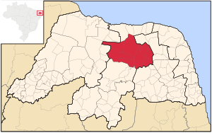
Central Potiguar
Mesoregion in Rio Grande do Norte, Brazil
Distance: Approx. 5926 meters
Latitude and longitude: -5.66583333,-36.60083333
Central Potiguar is the former mesoregion in the Brazilian state of Rio Grande do Norte.
Weather in this IP's area
clear sky
31 Celsius
32 Celsius
31 Celsius
31 Celsius
1013 hPa
42 %
1013 hPa
1001 hPa
10000 meters
6.15 m/s
6.8 m/s
101 degree
9 %
05:00:20
17:23:51