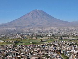
Country:
Region:
City:
Latitude and Longitude:
Time Zone:
Postal Code:
IP information under different IP Channel
ip-api
Country
Region
City
ASN
Time Zone
ISP
Blacklist
Proxy
Latitude
Longitude
Postal
Route
Luminati
Country
ASN
Time Zone
America/Lima
ISP
ENTEL PERU S.A.
Latitude
Longitude
Postal
IPinfo
Country
Region
City
ASN
Time Zone
ISP
Blacklist
Proxy
Latitude
Longitude
Postal
Route
db-ip
Country
Region
City
ASN
Time Zone
ISP
Blacklist
Proxy
Latitude
Longitude
Postal
Route
ipdata
Country
Region
City
ASN
Time Zone
ISP
Blacklist
Proxy
Latitude
Longitude
Postal
Route
Popular places and events near this IP address

Goyeneche Palace, Arequipa
Distance: Approx. 6150 meters
Latitude and longitude: -16.4299,-71.567
Goyeneche Palace or Casa Goyeneche is a 17th-century manorial house in the city of Arequipa, Peru. It attracts tourists interested in observing colonial architecture in Peru. Located on La Merced street, the house looks much the same as other manorial houses of those times.

National University of San Agustín
Distance: Approx. 6329 meters
Latitude and longitude: -16.4137,-71.5342
The National University of San Agustín (UNSA; Spanish: Universidad Nacional de San Agustín) is a public university in Arequipa, Peru. The university has been consistently ranked as one of the top public universities in Peru. It is one of the oldest public universities in Latin America with continuous operation since its founding on November 11, 1828.
Estadio Melgar
Stadium in Peru
Distance: Approx. 6880 meters
Latitude and longitude: -16.4088034,-71.5350241
The Estadio Melgar is a multi-use stadium in Arequipa, Peru. Its primary use is to host football games for Peruvian First Division team FBC Melgar and Peruvian Segunda Division team Sportivo Huracán and Copa Perú teams Senati FBC, FBC Aurora and FBC White Star. The stadium has a seating capacity of 15,000 and includes a running track for track and field events.
Characato District
District of Arequipa, Peru
Distance: Approx. 4522 meters
Latitude and longitude: -16.49333333,-71.49277778
Characato is a district of Arequipa Province, Peru. It is located to the southeast of Arequipa, at an average elevation of 3,505 meters above the sea level. As of the year 2022, it had a population of 17,706.
Socabaya District
District in Arequipa, Peru
Distance: Approx. 1324 meters
Latitude and longitude: -16.47,-71.54
Socabaya District is one of the twenty-nine districts of the Arequipa Province in Peru.
José Luis Bustamante District
District in Arequipa, Peru
Distance: Approx. 4875 meters
Latitude and longitude: -16.42655,-71.52392778
José Luis Bustamante y Rivero District is one of the twenty-nine districts of the Arequipa Province in Peru.

Jacobo Hunter District
District in Arequipa, Peru
Distance: Approx. 3283 meters
Latitude and longitude: -16.45,-71.55
Jacobo Hunter District is one of the 29 districts of the Arequipa Province in Peru. The district is named after Jacob Dixon Hunter (Jacobo Dixon Hunter) who was a Scottish doctor (born in Madison, Indiana (USA) on 8 September 1837. His father was working there as a Presbyterian pastor.

Tiabaya District
District in Arequipa, Peru
Distance: Approx. 6229 meters
Latitude and longitude: -16.42555556,-71.56277778
Tiabaya District is one of the twenty-nine districts of the Arequipa Province in Peru.
Sabandía District
District in Arequipa, Peru
Distance: Approx. 2969 meters
Latitude and longitude: -16.46694444,-71.5
Sabandía District is one of the twenty-nine districts of the Arequipa Province in Peru.

Sachaca District
District in Arequipa, Peru
Distance: Approx. 6498 meters
Latitude and longitude: -16.425,-71.56611111
Sachaca District is one of twenty-nine districts of the province Arequipa in Peru.
Colegio Anglo Americano Prescott
School in Arequipa, Peru
Distance: Approx. 5767 meters
Latitude and longitude: -16.42893,-71.56025
Colegio Anglo Americano Prescott is a school in Arequipa, Peru, named after William H. Prescott an American scientific historian. The school was founded in 1965 by a group of British, American and Peruvian citizens; it retains its bilingual emphasis, maintaining a student exchange program with several English-speaking schools. As of 2018 Colegio Prescott offers an International Baccalaureate program.
Colegio San José, Arequipa, Peru
School in Arequipa, Peru
Distance: Approx. 5874 meters
Latitude and longitude: -16.42444444,-71.555
Colegio San José is a private Catholic pre-school, primary and secondary school, located in Arequipa, Perú. The selective school was founded in 1898 by the Society of Jesus and excels in academics and athletics. As of 2013, Colegio San José was one of 22 (out of 2,439 schools in Perú), that received an "excellent" rating.
Weather in this IP's area
overcast clouds
13 Celsius
12 Celsius
13 Celsius
13 Celsius
1017 hPa
68 %
1017 hPa
775 hPa
10000 meters
0.75 m/s
0.76 m/s
245 degree
99 %
05:04:30
17:56:58
