Country:
Region:
City:
Latitude and Longitude:
Time Zone:
Postal Code:
IP information under different IP Channel
ip-api
Country
Region
City
ASN
Time Zone
ISP
Blacklist
Proxy
Latitude
Longitude
Postal
Route
Luminati
Country
ASN
Time Zone
America/Lima
ISP
ENTEL PERU S.A.
Latitude
Longitude
Postal
IPinfo
Country
Region
City
ASN
Time Zone
ISP
Blacklist
Proxy
Latitude
Longitude
Postal
Route
db-ip
Country
Region
City
ASN
Time Zone
ISP
Blacklist
Proxy
Latitude
Longitude
Postal
Route
ipdata
Country
Region
City
ASN
Time Zone
ISP
Blacklist
Proxy
Latitude
Longitude
Postal
Route
Popular places and events near this IP address

Casma
Town in Ancash, Peru
Distance: Approx. 974 meters
Latitude and longitude: -9.47416667,-78.31055556
Casma is a city in the coastal desert of Peru, located 330 kilometers (210 mi) northwest of Lima. It is the capital of Casma Province and the third most populous city in the Ancash Region with an estimated population of 29,343 (2015)[1]. It is located in the lower Casma Valley, covering an area of 1,205 km2.
Casma Province
Province in Ancash, Peru
Distance: Approx. 1887 meters
Latitude and longitude: -9.467,-78.317
The Casma Province is one of twenty provinces of the Ancash Region of Peru.
Casma River
River in Ancash region, Peru
Distance: Approx. 9295 meters
Latitude and longitude: -9.449444,-78.382375
The Casma River, which upstream is called Río Grande, is a river that crosses northern Casma province in the Ancash Region of Peru. It originates in the Black Mountain Range and drains into the Pacific Ocean. Major tributaries include the Sechín River (right).
Sechín River
Distance: Approx. 1155 meters
Latitude and longitude: -9.485,-78.3003
The Sechín River is a seasonal river about 55 km (34 miles) long in the Ancash department of Peru that remains dry for long seasons, increasing its volume at times of rain in the mountains at its source. It is of irregular regime, due to this is known as Loco River. It rises at an altitude of 4,385 m (14,386 ft) in the Cordillera Negra and it ends by flowing into the Casma River about 10 km (6.2 miles) inland from the Pacific Ocean.

Mojeque
Archaeological site in Peru
Distance: Approx. 9055 meters
Latitude and longitude: -9.507,-78.226
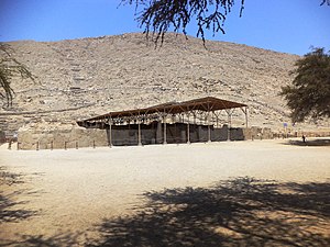
Mojeque, or Pampa de las Llamas-Moxeke, is a large archaeological site located in the Casma Province of Ancash Region in northern Peru. Archaeologists believe it functioned as a temple or religious structure. It contains two large mounds, many smaller mounds, and multiple human figures and heads believes to depict deities or divine rulers.

Cerro Sechín
Archaeological site in Peru
Distance: Approx. 4948 meters
Latitude and longitude: -9.47633333,-78.25666667
Cerro Sechín (also Sechín de las Estelas) is an archaeological site in Casma Province of Ancash Region in northern Peru. Dating to 1600 BC, the site was discovered by Peruvian archaeologists Julio C. Tello and Toribio Mejía Xesspe on July 1, 1937. Tello believed it was the capital of an entire culture, now known as the Casma/Sechin culture or Sechin complex.
Casma District
District in Ancash region of Peru
Distance: Approx. 1884 meters
Latitude and longitude: -9.46694444,-78.31694444
Casma District is one of four districts of the province Casma in Peru.
Sechin Bajo
Archaeological site in Peru
Distance: Approx. 4181 meters
Latitude and longitude: -9.46472222,-78.265
Sechin Bajo is a large archaeological site with ruins dating from 3500 BCE to 1300 BCE, making it not only one of the oldest centers of civilization in the Western Hemisphere, but also one of the oldest civilization centers on earth. Sechin Bajo is located in the valley of the Sechin River, about 12 kilometres (7.5 mi) from the Pacific Ocean and about 330 kilometres (210 mi) northwest of Lima, Peru. Sechin Bajo is one ruin among many located in close proximity to each other in the valleys of the Casma and Sechin Rivers.
Sechin Alto
Archaeological site in Peru
Distance: Approx. 6572 meters
Latitude and longitude: -9.4654,-78.2426
Sechin Alto is a massive architectural complex in Peru belonging to the Early Formative period (2000-1500 BC). It is located in the Casma Province, the Ancash Region, on the left bank of the Sechín River, east of the town of the same name. Other important archaeological sites such as Cerro Sechin and Sechin Bajo are located nearby.

Casma–Sechin culture
Distance: Approx. 4181 meters
Latitude and longitude: -9.46472222,-78.265
The Casma–Sechin culture (alternatively Sechin Complex) (c. 3600 BCE–200 BCE) of Peru refers to the large concentration of pre-historic ruins in the valleys of the Casma River and its tributary the Sechin River and along the nearby coast of the Pacific Ocean. The ruins include major archaeological sites such as Sechin Bajo, Sechin Alto, Cerro Sechin, Mojeque (Pampa de las Llamas-Moxeke), Chankillo, and Taukachi-Konkan, as well as other smaller sites.
Weather in this IP's area
broken clouds
18 Celsius
18 Celsius
18 Celsius
18 Celsius
1014 hPa
87 %
1014 hPa
1008 hPa
10000 meters
1.64 m/s
2.19 m/s
204 degree
68 %
05:41:33
18:14:07
