Country:
Region:
City:
Latitude and Longitude:
Time Zone:
Postal Code:
IP information under different IP Channel
ip-api
Country
Region
City
ASN
Time Zone
ISP
Blacklist
Proxy
Latitude
Longitude
Postal
Route
Luminati
Country
ASN
Time Zone
America/Lima
ISP
ENTEL PERU S.A.
Latitude
Longitude
Postal
IPinfo
Country
Region
City
ASN
Time Zone
ISP
Blacklist
Proxy
Latitude
Longitude
Postal
Route
db-ip
Country
Region
City
ASN
Time Zone
ISP
Blacklist
Proxy
Latitude
Longitude
Postal
Route
ipdata
Country
Region
City
ASN
Time Zone
ISP
Blacklist
Proxy
Latitude
Longitude
Postal
Route
Popular places and events near this IP address

Puerto Maldonado
Place in Madre de Dios, Peru
Distance: Approx. 5016 meters
Latitude and longitude: -12.6,-69.18333333
Puerto Maldonado (Spanish pronunciation: [ˈpweɾto maldoˈnaðo] ) is a city in southeastern Peru in the Amazon rainforest 55 kilometres (34 mi) west of the Bolivian border, located at the confluence of the Tambopata and Madre de Dios rivers. The latter river joins the Madeira River as a tributary of the Amazon. This city is the capital of the Department of Madre de Dios.

Padre Aldamiz International Airport
Small airport in the Peruvian city of Puerto Maldonado
Distance: Approx. 408 meters
Latitude and longitude: -12.61361111,-69.22861111
Padre Aldamiz International Airport (IATA: PEM, ICAO: SPTU), also known as Puerto Maldonado International Airport, is an airport serving the city of Puerto Maldonado in the Madre de Dios Region of Peru. The airport oversees one domestic (national) airline with commercial flights. Padre Aldamiz International Airport is near some of Peru's noted ecological areas, such as the national jungle reserve of Tambopata-Candamo.

Tambopata Province
Province in Madre de Dios, Peru
Distance: Approx. 3397 meters
Latitude and longitude: -12.6,-69.2
Tambopata Province is the largest of three provinces in the Madre de Dios Region of Peru.
Tambopata District
District in Madre de Dios, Peru
Distance: Approx. 6244 meters
Latitude and longitude: -12.5766,-69.1859
Tambopata District is one of four districts of the Tambopata Province in the Madre de Dios Region in Peru. The Tambopata National Reserve and the Bahuaja-Sonene National Park are one of the most biodiverse places on earth. Records include over 700 species of birds, 1200 species of butterfly, 90 species of mammals, 120 species of reptiles and amphibians and innumerable species of insect.
Tambopata River
River in Bolivia, Peru
Distance: Approx. 6559 meters
Latitude and longitude: -12.59666667,-69.16944444
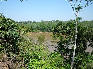
The Tambopata River is a river in southeastern Peru and northwestern Bolivia. Most of the Tambopata is in the Madre de Dios and Puno regions in Peru, but the upper parts of the river forms the border between Peru and Bolivia, and its origin is in La Paz department in Bolivia. The Tambopata is a tributary of the Madre de Dios River, into which it merges at the city of Puerto Maldonado.
Weather in this IP's area
overcast clouds
18 Celsius
18 Celsius
18 Celsius
18 Celsius
1010 hPa
88 %
1010 hPa
984 hPa
10000 meters
0.4 m/s
0.39 m/s
42 degree
91 %
05:00:52
17:42:11
