Country:
Region:
City:
Latitude and Longitude:
Time Zone:
Postal Code:
IP information under different IP Channel
ip-api
Country
Region
City
ASN
Time Zone
ISP
Blacklist
Proxy
Latitude
Longitude
Postal
Route
Luminati
Country
ASN
Time Zone
America/Lima
ISP
ENTEL PERU S.A.
Latitude
Longitude
Postal
IPinfo
Country
Region
City
ASN
Time Zone
ISP
Blacklist
Proxy
Latitude
Longitude
Postal
Route
db-ip
Country
Region
City
ASN
Time Zone
ISP
Blacklist
Proxy
Latitude
Longitude
Postal
Route
ipdata
Country
Region
City
ASN
Time Zone
ISP
Blacklist
Proxy
Latitude
Longitude
Postal
Route
Popular places and events near this IP address
Tnte. FAP Jaime Montreuil Morales Airport
Airport in Peru
Distance: Approx. 4062 meters
Latitude and longitude: -9.15,-78.52361111
Teniente FAP Jaime Montreuil Morales Airport (IATA: CHM, ICAO: SPEO) is an airport serving Chimbote, in the Ancash Region of Peru. It is operated by the civil government and handles many government planes.
Estadio Manuel Rivera Sánchez
Distance: Approx. 7399 meters
Latitude and longitude: -9.10001,-78.560207
Estadio Municipal Centenario Manuel Rivera Sánchez is a multi-purpose stadium in Chimbote, Peru. It was inaugurated on June 30, 2007 with a friendly game between the Peru U-17 national football team and the Colombia U-17 national football team. Peru lost 4–2.
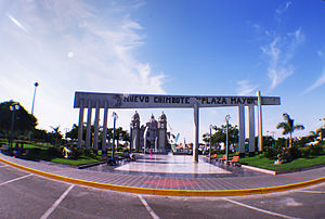
Nuevo Chimbote District
District in Ancash, Peru
Distance: Approx. 3677 meters
Latitude and longitude: -9.12138889,-78.53083333
The district of Nuevo Chimbote is one of the nine that make up the province of Santa, located in the department of Ancash in Peru.
Weather in this IP's area
overcast clouds
17 Celsius
17 Celsius
17 Celsius
17 Celsius
1014 hPa
88 %
1014 hPa
1003 hPa
10000 meters
1.87 m/s
2.29 m/s
191 degree
87 %
05:42:49
18:14:25
