Country:
Region:
City:
Latitude and Longitude:
Time Zone:
Postal Code:
IP information under different IP Channel
ip-api
Country
Region
City
ASN
Time Zone
ISP
Blacklist
Proxy
Latitude
Longitude
Postal
Route
Luminati
Country
ASN
Time Zone
America/Lima
ISP
ENTEL PERU S.A.
Latitude
Longitude
Postal
IPinfo
Country
Region
City
ASN
Time Zone
ISP
Blacklist
Proxy
Latitude
Longitude
Postal
Route
db-ip
Country
Region
City
ASN
Time Zone
ISP
Blacklist
Proxy
Latitude
Longitude
Postal
Route
ipdata
Country
Region
City
ASN
Time Zone
ISP
Blacklist
Proxy
Latitude
Longitude
Postal
Route
Popular places and events near this IP address

Jauja
Town and municipality in Junín, Peru
Distance: Approx. 3007 meters
Latitude and longitude: -11.775,-75.5
Jauja (Shawsha Wanka Quechua: Sausa, Shawsha or Shausha, formerly in Spanish Xauxa, with pronunciation of "x" as "sh") is a city and capital of Jauja Province in Peru. It is situated in the fertile Mantaro Valley, 45 kilometres (28 mi) to the northwest of Huancayo (the capital of Junín Region), at an altitude of 3,400 metres (11,200 ft). Its population in 2015 was 15,432 .

Francisco Carle Airport
Airport in Peru
Distance: Approx. 4014 meters
Latitude and longitude: -11.78333333,-75.47361111
Francisco Carle Airport (IATA: JAU, ICAO: SPJJ) is a high-elevation regional airport serving Jauja, in the Junin Region of Peru, and surrounding cities such as Huancayo and Tarma. It is served by two scheduled airlines. The airport terminal and runways have undergone expansion to accommodate larger aircraft.
Estadio Monumental de Jauja
Distance: Approx. 3953 meters
Latitude and longitude: -11.7858,-75.4858
Estadio Monumental de Jauja is a multi-use stadium in Jauja, Peru. It was used by football team Deportivo Wanka. The stadium holds 10,000 people.

Jauja Province
Province in Junín, Peru
Distance: Approx. 3007 meters
Latitude and longitude: -11.775,-75.5
Jauja Province is a Peruvian province. It is one of the nine provinces of the Junín Region. To the north it borders with the Yauli, Tarma and Chanchamayo Provinces.

Huertas District
District in Junín, Peru
Distance: Approx. 1800 meters
Latitude and longitude: -11.7646,-75.4807
Huertas District is one of thirty-four districts of the province Jauja in Peru.

Jauja District
District in Junín, Peru
Distance: Approx. 3858 meters
Latitude and longitude: -11.7803,-75.5065
Jauja District is one of thirty-four districts of the province Jauja in Peru.
Molinos District
District in Junín, Peru
Distance: Approx. 4440 meters
Latitude and longitude: -11.7368,-75.4503
Molinos District is one of thirty-four districts of the province Jauja in Peru.

Pancán District
District in Junín, Peru
Distance: Approx. 786 meters
Latitude and longitude: -11.7468,-75.4948
Pancán District is one of thirty-four districts of the province Jauja in Peru.

San Pedro de Chunan District
District in Junín, Peru
Distance: Approx. 2882 meters
Latitude and longitude: -11.7247,-75.4918
San Pedro de Chunan District is one of thirty-four districts of the province Jauja in Peru.
Sausa District
District in Junín, Peru
Distance: Approx. 4814 meters
Latitude and longitude: -11.7936,-75.4865
Sausa District is one of thirty-four districts of the province of Jauja (Quechua: Shawsha or Sausa) in Peru.
Yauli District, Jauja
District in Junín, Peru
Distance: Approx. 4133 meters
Latitude and longitude: -11.7149,-75.4775
Yauli District is one of thirty-four districts of the province Jauja in Peru.

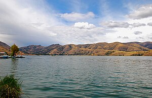
Lake Paca
Lake in Peru
Distance: Approx. 3029 meters
Latitude and longitude: -11.72972222,-75.50666667
Lake Paca (Spanish: Laguna de Paca) is a lake in Peru. It is located 4 kilometres (2.5 mi) north of the historic town of Jauja, which was once the first capital of Peru. The lake is habitat for a variety of flora and fauna.
Weather in this IP's area
overcast clouds
8 Celsius
8 Celsius
8 Celsius
8 Celsius
1018 hPa
90 %
1018 hPa
687 hPa
6116 meters
0.82 m/s
1.08 m/s
261 degree
100 %
05:27:08
18:06:02