132.180.10.175 - IP Lookup: Free IP Address Lookup, Postal Code Lookup, IP Location Lookup, IP ASN, Public IP
Country:
Region:
City:
Location:
Time Zone:
Postal Code:
IP information under different IP Channel
ip-api
Country
Region
City
ASN
Time Zone
ISP
Blacklist
Proxy
Latitude
Longitude
Postal
Route
Luminati
Country
Region
by
City
bayreuth
ASN
Time Zone
Europe/Berlin
ISP
Verein zur Foerderung eines Deutschen Forschungsnetzes e.V.
Latitude
Longitude
Postal
IPinfo
Country
Region
City
ASN
Time Zone
ISP
Blacklist
Proxy
Latitude
Longitude
Postal
Route
IP2Location
132.180.10.175Country
Region
bayern
City
bayreuth
Time Zone
Europe/Berlin
ISP
Language
User-Agent
Latitude
Longitude
Postal
db-ip
Country
Region
City
ASN
Time Zone
ISP
Blacklist
Proxy
Latitude
Longitude
Postal
Route
ipdata
Country
Region
City
ASN
Time Zone
ISP
Blacklist
Proxy
Latitude
Longitude
Postal
Route
Popular places and events near this IP address
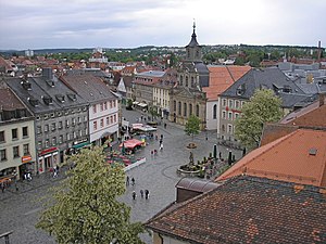
Bayreuth
Town in Bavaria, Germany
Distance: Approx. 7 meters
Latitude and longitude: 49.94805556,11.57833333
Bayreuth (German: [baɪˈʁɔʏt] , Upper Franconian: [ba(ː)ˈɾaɪ̯t]; Bareid) is a town in northern Bavaria, Germany, on the Red Main river in a valley between the Franconian Jura and the Fichtel Mountains. The town's roots date back to 1194. In the 21st century, it is the capital of Upper Franconia and has a population of 72,148 (2015).

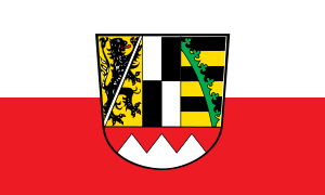
Upper Franconia
Regierungsbezirk in Bavaria, Germany
Distance: Approx. 412 meters
Latitude and longitude: 49.95,11.58333333
Upper Franconia (German: Oberfranken) is a Regierungsbezirk (administrative [Regierungs] region [bezirk]) of the state of Bavaria, southern Germany. It forms part of the historically significant region of Franconia, the others being Middle Franconia and Lower Franconia, which are all now part of the German Federal State of Bayern (Bavaria). With more than 200 independent breweries which brew approximately 1000 different types of beer, Upper Franconia has the world's highest brewery-density per capita.
Kunsteisstadion
Distance: Approx. 559 meters
Latitude and longitude: 49.94472222,11.58416667
Städtisches Kunsteisstadion is an arena in Bayreuth, Germany. It is primarily used for ice hockey. Kunsteisstadion opened in 1976 and holds 4,730 people.
Hans-Walter-Wild-Stadion
Distance: Approx. 688 meters
Latitude and longitude: 49.94527778,11.58694444
The Hans-Walter-Wild-Stadion is a multi-purpose stadium in Bayreuth, Germany. It is currently used mostly for football matches and is the home stadium of SpVgg Bayreuth. The stadium is able to hold 21,500 people.

Bayreuth Hauptbahnhof
Railway station in Bayreuth, Germany
Distance: Approx. 251 meters
Latitude and longitude: 49.95,11.58027778
Bayreuth Hauptbahnhof is the main railway station in the German town of Bayreuth, in northern Bavaria.

Margravial Opera House
Building in Bayreuth, Germany
Distance: Approx. 407 meters
Latitude and longitude: 49.94444444,11.57861111
The Margravial Opera House (German: Markgräfliches Opernhaus) is a Baroque opera house in the town of Bayreuth, Germany. Built between 1745 and 1750, it is one of Europe's few surviving theatres of the period and has been extensively restored. On 30 June 2012, the opera house was added to the UNESCO World Heritage List because of its exceptional Baroque architecture.

Wahnfried
Richard Wagner's home in Bayreuth, Germany
Distance: Approx. 825 meters
Latitude and longitude: 49.941111,11.582222
Wahnfried was the name given by Richard Wagner to his villa in Bayreuth. The name is a German compound of Wahn (delusion, madness) and Fried(e) (peace, freedom).
Mistel (Red Main)
River in Germany
Distance: Approx. 709 meters
Latitude and longitude: 49.9481,11.5685
Mistel is a river of Bavaria, Germany. It is a left tributary of the Red Main in Bayreuth.

Iwalewahaus
Distance: Approx. 399 meters
Latitude and longitude: 49.9446,11.5796
Iwalewahaus, University of Bayreuth, is a place for the production and presentation of contemporary art. By doing exhibitions, academic research and teaching, by taking care of the collection and the archive as well as providing residencies for artists, recent developments in contemporary African and Diaspora culture are presented and refined together with artists and institutions. The mission of Iwalewahaus is to research, document and teach recent African culture.

Kunstmuseum Bayreuth
Art museum, Historic site in Bayreuth, Germany
Distance: Approx. 528 meters
Latitude and longitude: 49.944,11.5747
The Kunstmuseum Bayreuth is a museum for modern art, opened in 1999 in Bayreuth, Bavaria, Germany. The historic rooms of the baroque former town hall present exhibitions with contemporary art and classical modern art. The offer includes guided tours, educational events and lectures.
Oberfrankenhalle
Multi-purpose indoor sporting arena that is located in Bayreuth, Germany
Distance: Approx. 619 meters
Latitude and longitude: 49.944591,11.585096
The Oberfrankenhalle is a multi-purpose indoor sporting arena that is located in Bayreuth, Germany. It is a part of the Bayreuth Sports Park, which also includes the Hans-Walter-Wild-Stadion football stadium, an ice rink, and an indoor pool. The arena is mainly used to host basketball, handball, and volleyball games, boxing matches, concerts and congresses.
Margrave Fountain (Bayreuth)
Distance: Approx. 675 meters
Latitude and longitude: 49.94211,11.57697
The Margrave Fountain (German: Markgrafenbrunnen) is a fountain in Bayreuth, Germany. It was built as a monument for Margrave Christian Ernest of Brandenburg-Bayreuth after he had participated in the liberation of Vienna, which had been besieged by the Turks in 1683. The Margrave's equestrian statue is placed in the centre of the fountain, surrounded by other sculpture groups representing the four known continents as well as four rivers rising in the Fichtel Mountains.
Weather in this IP's area
overcast clouds
0 Celsius
-3 Celsius
-1 Celsius
1 Celsius
1017 hPa
93 %
1017 hPa
974 hPa
10000 meters
3.13 m/s
4.47 m/s
270 degree
94 %


