Country:
Region:
City:
Latitude and Longitude:
Time Zone:
Postal Code:
IP information under different IP Channel
ip-api
Country
Region
City
ASN
Time Zone
ISP
Blacklist
Proxy
Latitude
Longitude
Postal
Route
Luminati
Country
Region
fl
City
orlando
ASN
Time Zone
America/New_York
ISP
UNIVCENTFLA
Latitude
Longitude
Postal
IPinfo
Country
Region
City
ASN
Time Zone
ISP
Blacklist
Proxy
Latitude
Longitude
Postal
Route
db-ip
Country
Region
City
ASN
Time Zone
ISP
Blacklist
Proxy
Latitude
Longitude
Postal
Route
ipdata
Country
Region
City
ASN
Time Zone
ISP
Blacklist
Proxy
Latitude
Longitude
Postal
Route
Popular places and events near this IP address

Meadow Woods, Florida
Census-designated place in Florida, United States
Distance: Approx. 2192 meters
Latitude and longitude: 28.37472222,-81.36388889
Meadow Woods is a census-designated place (CDP) and an unincorporated suburban development area located in southern Orange County, Florida, United States, between Orlando International Airport and Kissimmee. It is part of the Orlando–Kissimmee–Sanford, Florida Metropolitan Statistical Area. As of 2020, the population was 43,790.

Southchase, Florida
Census-designated place in Florida, United States
Distance: Approx. 1886 meters
Latitude and longitude: 28.39055556,-81.38027778
Southchase is a census-designated place and an unincorporated area in Orange County, Florida, United States. The population was 15,921 at the 2010 census. It is part of the Orlando–Kissimmee–Sanford, Florida Metropolitan Statistical Area.

Taft, Florida
Census-designated place in Florida, United States
Distance: Approx. 3899 meters
Latitude and longitude: 28.42888889,-81.36777778
Taft is a census-designated place and an unincorporated area in Orange County, Florida, United States. The population was 2,205 at the 2010 census. It is part of the Orlando–Kissimmee Metropolitan Statistical Area.

Orlando International Airport
Airport in Florida, United States
Distance: Approx. 6468 meters
Latitude and longitude: 28.42944444,-81.30888889
Orlando International Airport (IATA: MCO, ICAO: KMCO, FAA LID: MCO) is the primary international airport located 6 miles (9.7 km) southeast of Downtown Orlando, Florida. In 2021, it had 19,618,838 enplanements, making it the busiest airport in the state and seventh busiest airport in the United States. The airport code MCO stands for the airport's former name, McCoy Air Force Base, a Strategic Air Command (SAC) installation, that was closed in 1975 as part of a general military drawdown following the end of the Vietnam War.
McCoy Air Force Base
Former US Air Force base 10 miles SE of Orlando, FL, later became Orlando International Airport
Distance: Approx. 6468 meters
Latitude and longitude: 28.42944444,-81.30888889
McCoy AFB (1940–1947, 1951–1975) is a former U.S. Air Force installation located 10 miles (16 km) southeast of Orlando, Florida. It was a training base during World War II. From 1951 to 1975, it was a frontline Strategic Air Command (SAC) base during the Cold War and Vietnam War. It was Orlando's biggest employer and economic backbone prior to the opening of Walt Disney World in 1971.

Gatorland
Florida theme park and wildlife preserve
Distance: Approx. 5983 meters
Latitude and longitude: 28.3557,-81.404
Gatorland is a 110-acre (45 ha) theme park and wildlife preserve in Florida, located along South Orange Blossom Trail south of Orlando. It was founded in 1949 by Owen Godwin on former cattle land, and is privately owned by his family. Billed as the "Alligator Capital of the World," Gatorland features thousands of alligators (including rare leucistic alligators) and crocodiles, and many other animals.
Cypress Creek High School (Orlando, Florida)
Secondary school in Florida, US
Distance: Approx. 2214 meters
Latitude and longitude: 28.379706,-81.376865
Cypress Creek High School is located in Orlando, Florida, and serves students in grades 9 through 12. Cypress Creek is an IB World School with an International Baccalaureate Diploma Program. As an IB World School, CCHS is a local magnet school allowing students from other Orange County, Florida schools to attend.
WHOO
Radio station in Winter Park, Florida
Distance: Approx. 6208 meters
Latitude and longitude: 28.34166667,-81.34055556
WHOO (1080 AM) is a non-commercial listener-supported Catholic talk radio station licensed to Winter Park, Florida, and serving Greater Orlando. It is an owned and operated network affiliate of Relevant Radio. By day, WHOO transmits 6,000 watts.
Mallard Lake (Florida)
Lake in the state of Florida, United States
Distance: Approx. 5864 meters
Latitude and longitude: 28.3693,-81.4142
Mallard Lake is a manmade freshwater lake in the unincorporated community of Hunter's Creek, in south Orange County, Florida. Originally part the area of the lake and part of the area surrounding the lake was swamp land. The rest was dry land, according to topographical maps.

Orlando International Airport Intermodal Terminal
Intermodal transport hub in Orlando, Florida
Distance: Approx. 5686 meters
Latitude and longitude: 28.41453,-81.30818
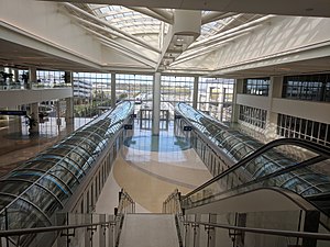
The Orlando International Airport Intermodal Terminal, also known as the Brightline Orlando Station and South Airport Intermodal Terminal, is an intermodal passenger transport hub located at Orlando International Airport in Orlando, Florida. The complex, which was partially funded by the Florida Department of Transportation, is the current terminus of Brightline, an inter-city rail service which provides service to Miami via the Florida East Coast Railway. The terminal building and the adjacent parking garage opened on November 17, 2017.

Tupperware station
Train station in Hunter's Creek, Florida, USA
Distance: Approx. 6332 meters
Latitude and longitude: 28.343265,-81.390057
Tupperware station is a train station in the community of Hunter's Creek, Florida. It is located along the southern phase of SunRail, the commuter rail service of Greater Orlando, and opened for revenue service on July 30, 2018. The station is named after the nearby Tupperware Brands Corporation headquarters campus.

Meadow Woods station
Train station on the SunRail
Distance: Approx. 1503 meters
Latitude and longitude: 28.386363,-81.373915
Meadow Woods station is a train station in the community of Meadow Woods, Florida. It is located along the southern phase of SunRail, the commuter rail service of Greater Orlando. The station is named after the community where it is located.
Weather in this IP's area
few clouds
25 Celsius
25 Celsius
24 Celsius
26 Celsius
1015 hPa
56 %
1015 hPa
1012 hPa
10000 meters
4.63 m/s
70 degree
20 %
06:49:03
17:31:51
