Country:
 Singapore
Region:
City:
Latitude and Longitude:
Time Zone:
Postal Code:
IP information under different IP Channel
ip-api
Country
Region
City
ASN
Time Zone
ISP
Blacklist
Proxy
Latitude
Longitude
Postal
Route
IPinfo
Country
Region
City
ASN
Time Zone
ISP
Blacklist
Proxy
Latitude
Longitude
Postal
Route
MaxMind
Country
Region
City
ASN
Time Zone
ISP
Blacklist
Proxy
Latitude
Longitude
Postal
Route
Luminati
Country
SGCity
singapore
ASN
Time Zone
Asia/Singapore
ISP
Viewqwest Pte Ltd
Latitude
Longitude
Postal
db-ip
Country
Region
City
ASN
Time Zone
ISP
Blacklist
Proxy
Latitude
Longitude
Postal
Route
ipdata
Country
Region
City
ASN
Time Zone
ISP
Blacklist
Proxy
Latitude
Longitude
Postal
Route
Popular places and events near this IP address
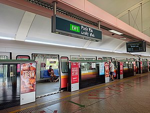
Pasir Ris MRT station
Mass Rapid Transit station in Singapore
Distance: Approx. 1227 meters
Latitude and longitude: 1.37241111,103.94936944
Pasir Ris MRT station is an elevated Mass Rapid Transit (MRT) station on the East West line (EWL) in Pasir Ris, Singapore. Situated along Pasir Ris Central adjacent to Pasir Ris Bus Interchange, Pasir Ris Mall and the White Sands Shopping Mall, it is the eastern terminus of the EWL. The station exterior has the characteristic dome-shaped segmented roof also seen on other elevated EWL stations. The station opened on 16 December 1989 as the terminus of the MRT's eastern line extension.

Hai Sing Catholic School
Government-aided school in Pasir Ris, Singapore
Distance: Approx. 1194 meters
Latitude and longitude: 1.3697324,103.9660977
Hai Sing Catholic School (HSC) is a co-educational government-aided Catholic secondary school in Pasir Ris, Singapore. Founded by the Franciscan Missionaries of Mary (FMM) sisters in 1959, it is affiliated to Catholic Junior College. The school has temporarily moved from its permanent site to its holding site at 15 Pasir Ris Street 21 until Dec 2025 (Subjected to further updates).
Escape Theme Park
Former amusement park in Singapore
Distance: Approx. 467 meters
Latitude and longitude: 1.37972222,103.95527778
Escape Theme Park was an outdoor theme park located inside NTUC Downtown East, Pasir Ris in Singapore. It was opened in May 2000 and a water park named Wild Wild Wet located adjacent to it was opened in June 2004. Its slogan is "360 degrees of fun".
Wild Wild Wet
Water theme park in Singapore
Distance: Approx. 572 meters
Latitude and longitude: 1.37722222,103.95388889
Wild Wild Wet is a water theme park in Singapore. It is located at NTUC Downtown East in Pasir Ris, Singapore.

Pasir Ris Park
Park in Singapore
Distance: Approx. 991 meters
Latitude and longitude: 1.38148333,103.9509
Pasir Ris Park (Chinese: 白沙公园; Malay: Taman Pasir Ris) is a beach park located in the eastern part of Singapore. It covers an area of 70 hectares (170 acres), and was partially built on reclaimed land. Initially planned in the late 1970s to serve people living in the vicinity, the park was designed with the help of two Japanese landscape specialists.
Loyang View Secondary School
Government secondary school in Singapore
Distance: Approx. 1222 meters
Latitude and longitude: 1.36702,103.95683
Loyang View Secondary School (LVSS / LVS) is a co-educational government secondary school located in Pasir Ris, Singapore. It was formed by the merger of Loyang Secondary School and Greenview Secondary School in 2018.
NTUC Downtown East
Entertainment hub in Singapore
Distance: Approx. 530 meters
Latitude and longitude: 1.37638889,103.95444444
NTUC Downtown East is an entertainment hub located in Pasir Ris, Singapore. It is 147,000 square metres in area and was officially opened on 5 November 2000. It is run by NTUC club.

White Sands Shopping Mall, Singapore
Shopping mall in Pasir Ris, Singapore
Distance: Approx. 1188 meters
Latitude and longitude: 1.3725,103.94972222
White Sands Shopping Mall (Chinese: 白沙购物中心), also known as White Sands, is a 5-storey shopping mall with retail outlets at the basement and two additional floors of basement carparks. It is located near Pasir Ris MRT station and Pasir Ris Bus Interchange. The mall is a gathering spot for conscripted soldiers due to the mall's close proximity to Pasir Ris Bus Interchange, the location at which they are dropped off from the army camp on Pulau Tekong.

Masjid Al-Istighfar
Mosque
Distance: Approx. 935 meters
Latitude and longitude: 1.3710541,103.9640387
The Al-Istighfar Mosque (Malay: Masjid Al-Istighfar) is a mosque in Pasir Ris, Singapore. The mosque is wheelchair accessible as there are ramps and a lift that serves all floors. The mosque is fully air conditioned in all of the prayer halls.
Pasir Ris Town Park
Park in Singapore
Distance: Approx. 888 meters
Latitude and longitude: 1.37330556,103.95238889
Pasir Ris Town Park is a 14-hectare park located in the residential area of Pasir Ris, Singapore. It features wide open spaces and a large marine pond for fishing. It is the location of Pasir Ris Central Hawker Centre, the second hawker centre in Singapore to be located within a park.
Sungei Tampines
Distance: Approx. 690 meters
Latitude and longitude: 1.3817,103.9542
Sungei Tampines (Malay for Tampines River) is a river in Pasir Ris, Singapore. It is named for a type of tree that reportedly grew in the area, Streblus elongatus, commonly known as "tempinis" in Malay.

Pasir Ris East MRT station
Future Mass Rapid Transit station in Singapore
Distance: Approx. 1330 meters
Latitude and longitude: 1.366,103.961
Pasir Ris East MRT station is a future underground Mass Rapid Transit station on the Cross Island MRT line located in Pasir Ris, Singapore. It will be located along Pasir Ris Drive 1, between Pasir Ris Street 12 and Pasir Ris Street 11.
Weather in this IP's area
light rain
31 Celsius
36 Celsius
30 Celsius
31 Celsius
1012 hPa
68 %
1012 hPa
1011 hPa
10000 meters
3.09 m/s
180 degree
40 %
06:48:47
18:54:19