132.147.6.179 - IP Lookup: Free IP Address Lookup, Postal Code Lookup, IP Location Lookup, IP ASN, Public IP
Country:
 USA
USARegion:
City:
Location:
Time Zone:
Postal Code:
ISP:
ASN:
language:
User-Agent:
Proxy IP:
Blacklist:
IP information under different IP Channel
ip-api
Country
Region
City
ASN
Time Zone
ISP
Blacklist
Proxy
Latitude
Longitude
Postal
Route
db-ip
Country
Region
City
ASN
Time Zone
ISP
Blacklist
Proxy
Latitude
Longitude
Postal
Route
IPinfo
Country
Region
City
ASN
Time Zone
ISP
Blacklist
Proxy
Latitude
Longitude
Postal
Route
IP2Location
132.147.6.179Country
usRegion
pennsylvania
City
uniontown
Time Zone
America/New_York
ISP
Language
User-Agent
Latitude
Longitude
Postal
ipdata
Country
Region
City
ASN
Time Zone
ISP
Blacklist
Proxy
Latitude
Longitude
Postal
Route
Popular places and events near this IP address

East Uniontown, Pennsylvania
Census-designated place in Pennsylvania, United States
Distance: Approx. 1061 meters
Latitude and longitude: 39.8975,-79.70444444
East Uniontown is a census-designated place (CDP) in Fayette County, Pennsylvania, United States. The population was 2,419 at the 2010 census, down from 2,760 at the 2000 census.

Oliver, Pennsylvania
Census-designated place in Pennsylvania, United States
Distance: Approx. 1598 meters
Latitude and longitude: 39.91444444,-79.71722222
Oliver is a census-designated place (CDP) in Fayette County, Pennsylvania, United States. The population was 2,535 at the 2010 census, down from 2,925 at the 2000 census. Oliver is located in North Union Township.

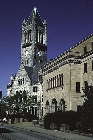
Uniontown, Pennsylvania
City in Pennsylvania, United States
Distance: Approx. 687 meters
Latitude and longitude: 39.9,-79.72444444
Uniontown is the largest city in and the county seat of Fayette County, Pennsylvania, United States, 40 miles (64 km) southeast of Pittsburgh. The population was 9,984 at the 2020 census. It is part of the Pittsburgh metropolitan area.

State Theatre Center for the Arts (Uniontown, Pennsylvania)
Distance: Approx. 701 meters
Latitude and longitude: 39.90134,-79.72445
The State Theatre Center for the Arts (formerly State Theatre) in Uniontown, Pennsylvania was designed by Thomas W. Lamb and constructed in 1922.

Sheepskin Trail
Distance: Approx. 960 meters
Latitude and longitude: 39.9008,-79.7276
The Sheepskin Trail is a non-motorized rail-trail in Fayette County, Pennsylvania. It is planned to eventually link the Great Allegheny Passage trail system near Dunbar to the Mon River Trail system at the Pennsylvania/West Virginia state line near Point Marion. Currently, due to funding restrictions, the trail is only opened for 2.1 miles (3.4 km) from the Great Allegheny Passage junction to the Dunbar town center, where there is parking and a comfort station available for public use.
Laurel Highlands High School
Public high school in Uniontown, Pennsylvania
Distance: Approx. 963 meters
Latitude and longitude: 39.90722222,-79.71
Laurel Highlands High School is a public high school serving around 1,100 students in grades 9–12 from the outlying Uniontown, Pennsylvania city limits. Due to the campus' location, some students from Uniontown do attend Laurel Highlands for convenience.
Uniontown Area High School
School in Uniontown, Pennsylvania
Distance: Approx. 529 meters
Latitude and longitude: 39.89632,-79.72016
Uniontown Area High School is a comprehensive public high school serving around 975 students in grades 9-12 who reside in the Uniontown Area School District in Fayette County, Pennsylvania.

John S. Douglas House
Historic house in Pennsylvania, United States
Distance: Approx. 767 meters
Latitude and longitude: 39.90472222,-79.72305556
John S. Douglas House, also known as Gates Funeral Home and Crematory LLC, is a historic home located at Uniontown, Pennsylvania Uniontown, Fayette County, Pennsylvania.

John P. Conn House
Historic house in Pennsylvania, United States
Distance: Approx. 1567 meters
Latitude and longitude: 39.90361111,-79.73416667
The John P. Conn House is an historic American home that is located in Uniontown, Fayette County, Pennsylvania. It was added to the National Register of Historic Places in 1988.

Gallatin School (Uniontown, Pennsylvania)
United States historic place
Distance: Approx. 560 meters
Latitude and longitude: 39.89777778,-79.72222222
Gallatin School is a historic school building located at Uniontown, Fayette County, Pennsylvania. It was built in 1908, and is a tall two-story, seven-by-eight-bay Classical Revival style building. It is built of buff-colored brick and features a terra cotta portico with Corinthian order columns and pediment.
Uniontown Downtown Historic District
Historic district in Pennsylvania, United States
Distance: Approx. 813 meters
Latitude and longitude: 39.90111111,-79.72583333
The Uniontown Downtown Historic District is a national historic district that is located in Uniontown, Fayette County, Pennsylvania, United States. It was added to the National Register of Historic Places in 1989, with a boundary increase in 2003.

St. Peter's Anglican Church (Uniontown, Pennsylvania)
Historic Anglican church in Uniontown, Pennsylvania, United States
Distance: Approx. 996 meters
Latitude and longitude: 39.89994,-79.72806
St. Peter's Anglican Church is a historic Anglican church in Uniontown, Pennsylvania. Completed in 1885, the church is a contributing property to the Uniontown Downtown Historic District.
Weather in this IP's area
overcast clouds
1 Celsius
-2 Celsius
-1 Celsius
1 Celsius
1026 hPa
44 %
1026 hPa
975 hPa
10000 meters
1.93 m/s
4.41 m/s
120 degree
100 %