Country:
 USA
USARegion:
City:
Latitude and Longitude:
Time Zone:
Postal Code:
IP information under different IP Channel
ip-api
Country
Region
City
ASN
Time Zone
ISP
Blacklist
Proxy
Latitude
Longitude
Postal
Route
IPinfo
Country
Region
City
ASN
Time Zone
ISP
Blacklist
Proxy
Latitude
Longitude
Postal
Route
MaxMind
Country
Region
City
ASN
Time Zone
ISP
Blacklist
Proxy
Latitude
Longitude
Postal
Route
Luminati
Country
USRegion
mo
City
palmyra
ASN
Time Zone
America/Chicago
ISP
MARK-TWAIN
Latitude
Longitude
Postal
db-ip
Country
Region
City
ASN
Time Zone
ISP
Blacklist
Proxy
Latitude
Longitude
Postal
Route
ipdata
Country
Region
City
ASN
Time Zone
ISP
Blacklist
Proxy
Latitude
Longitude
Postal
Route
Popular places and events near this IP address

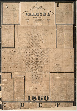
Palmyra, Missouri
City in Missouri, United States
Distance: Approx. 969 meters
Latitude and longitude: 39.79777778,-91.52638889
Palmyra is a city in and the county seat of Marion County, Missouri, United States. The population was 3,613 at the 2020 census. It is part of the Hannibal Micropolitan Statistical Area.
Palmyra massacre
Distance: Approx. 1028 meters
Latitude and longitude: 39.7975,-91.52472222
The Palmyra massacre is an incident that took place in Palmyra, Missouri on October 18, 1862, during the American Civil War, when ten Confederate prisoners of war were executed in reprisal for the abduction of a local Union supporter, Andrew Alsman. The officer who ordered the execution, Colonel John McNeil, was later known as the "Butcher of Palmyra". He left the army in 1865, after receiving the customary promotion to brevet rank of Major General of Volunteers in recognition of his faithful service to the Union.
KICK-FM
Radio station in Palmyra, Missouri
Distance: Approx. 4638 meters
Latitude and longitude: 39.757,-91.5
KICK-FM (97.9 MHz) is a radio station licensed to serve Palmyra, Missouri. The station is owned by Townsquare Media. It broadcasts a country music format to the greater Quincy, Illinois, and Hannibal, Missouri, area.
College Branch
Stream in the American state of Missouri
Distance: Approx. 4806 meters
Latitude and longitude: 39.7472671,-91.5298773
College Branch is a stream in Marion County in the U.S. state of Missouri. College Branch took its name from a now defunct college in West Ely.
Liberty Township, Marion County, Missouri
Township in Marion County, Missouri, U.S.
Distance: Approx. 4665 meters
Latitude and longitude: 39.8028,-91.4803
Liberty Township is an inactive township in Marion County, in the U.S. state of Missouri. It was established in 1827.

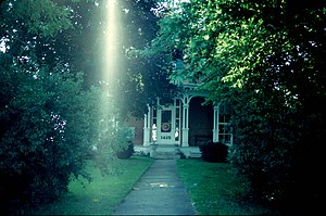
Dryden-Louthan House
Historic house in Missouri, United States
Distance: Approx. 1218 meters
Latitude and longitude: 39.79444444,-91.51916667
Dryden-Louthan House is a historic home located at Palmyra, Marion County, Missouri. It was built in 1858, and is a two-story, Italianate style burnt-sienna-colored brick dwelling. It has low hipped roofs and cornices ornamented by paired, elaborately scrolled brackets.: 3 It was added to the National Register of Historic Places in 1985.

Peter J. Sowers House
Historic house in Missouri, United States
Distance: Approx. 1341 meters
Latitude and longitude: 39.79777778,-91.52
Peter J. Sowers House is a historic home located at Palmyra, Marion County, Missouri. It was built in 1855, and is a two-story, transitional Greek Revival / Italianate style painted brick dwelling. It has a small rear wing and conservatory added in the 1870s.

Gardner House (Palmyra, Missouri)
Historic house in Missouri, United States
Distance: Approx. 1078 meters
Latitude and longitude: 39.79611111,-91.52222222
Gardner House is a historic home located at Palmyra, Marion County, Missouri. It was built about, and is a two-story, "L" plan, Federal style painted brick dwelling, with Greek Revival style detailing. It is six bays wide and has a side-gable roof.

Speigle House
Historic house in Missouri, United States
Distance: Approx. 975 meters
Latitude and longitude: 39.79666667,-91.52444444
Speigle House is a historic home located at Palmyra, Marion County, Missouri. It was built about 1850, and is a two-story, transitional vernacular Greek Revival / Italianate style brick dwelling. It has a two-story rear ell off the main block and hipped roof with bracketed cornice.: 3 It was added to the National Register of Historic Places in 1985.
Walker-Woodward-Schaffer House
Historic house in Missouri, United States
Distance: Approx. 887 meters
Latitude and longitude: 39.78694444,-91.52305556
Walker-Woodward-Schaffer House, also known as the Jane Darwell Birthplace, is a historic home located at Palmyra, Marion County, Missouri. It was built about 1868, and is a two-story, three-bay, Italianate style brick dwelling. It has a two-story rear wing with a two-story gallery porch.

Culbertson–Head Farmstead
United States historic place
Distance: Approx. 2045 meters
Latitude and longitude: 39.79472222,-91.50916667
Culbertson–Head Farmstead is a historic home, farm, and national historic district located near Palmyra, Marion County, Missouri. The house was built about 1854–1855, and is a two-story, L-shaped, Greek Revival style brick dwelling. It features a two-story front portico.

Marion County Jail and Jailor's House
United States historic place
Distance: Approx. 1140 meters
Latitude and longitude: 39.79861111,-91.52444444
Marion County Jail and Jailor's House, also known as the Palmyra Jail and Palmyra Massacre Jail, is a historic jail and sheriff's residence located at Palmyra, Marion County, Missouri. It was built in 1858, and is a two-story, three-bay, Greek Revival style brick I-house with a broad two story limestone ell. It features a full-width, one story front porch supported by smooth tampering Doric order columns.
Weather in this IP's area
clear sky
11 Celsius
10 Celsius
10 Celsius
12 Celsius
1023 hPa
67 %
1023 hPa
999 hPa
10000 meters
06:40:21
19:27:58