Country:
 Singapore
Region:
City:
Latitude and Longitude:
Time Zone:
Postal Code:
IP information under different IP Channel
ip-api
Country
Region
City
ASN
Time Zone
ISP
Blacklist
Proxy
Latitude
Longitude
Postal
Route
IPinfo
Country
Region
City
ASN
Time Zone
ISP
Blacklist
Proxy
Latitude
Longitude
Postal
Route
MaxMind
Country
Region
City
ASN
Time Zone
ISP
Blacklist
Proxy
Latitude
Longitude
Postal
Route
Luminati
Country
SGCity
singapore
ASN
Time Zone
Asia/Singapore
ISP
Viewqwest Pte Ltd
Latitude
Longitude
Postal
db-ip
Country
Region
City
ASN
Time Zone
ISP
Blacklist
Proxy
Latitude
Longitude
Postal
Route
ipdata
Country
Region
City
ASN
Time Zone
ISP
Blacklist
Proxy
Latitude
Longitude
Postal
Route
Popular places and events near this IP address

Anchorvale
Subzone of Sengkang Planning Area in Singapore
Distance: Approx. 560 meters
Latitude and longitude: 1.392625,103.88906389
Anchorvale is a neighbourhood of Sengkang New Town in Singapore between Sungei Punggol and Compassvale. House numbers of its public apartment blocks begin with the number '3' (3xx). These housing estates were fully completed by the Housing and Development Board (HDB) in 2001.
Compassvale
Place in Singapore
Distance: Approx. 411 meters
Latitude and longitude: 1.39088889,103.89761111
Compassvale is a neighbourhood of Sengkang New Town, and is located between Rivervale and Anchorvale. Compassvale encompasses the Sengkang Town Centre.

Compass One
Shopping mall in Sengkang, Singapore
Distance: Approx. 155 meters
Latitude and longitude: 1.39222222,103.89527778
Compass One (formerly known as Compass Point) is a suburban shopping mall located in the town centre of Sengkang, Singapore. The mall was built as an integrated development together with a condominium, Compass Heights which is located adjacent to the mall. Originally opened on 1 August 2002, the mall closed for extensive renovation works on 26 October 2015 and re-opened on 1 September 2016.

Sengkang Community Club
Community and Commercial in Sengkang Square, Singapore
Distance: Approx. 105 meters
Latitude and longitude: 1.3925,103.89444444
Sengkang Community Hub (Simplified Chinese: 盛港社区中心) is an amenity centre in Sengkang, within the North-East Region of Singapore. The amenity centre is located in the town centre of Sengkang New Town. It serves to provide a one-stop access to community, educational, health care, security and counselling services for the residents of Sengkang New Town.

Sengkang Bus Interchange
Bus interchange in Sengkang New Town, Singapore
Distance: Approx. 237 meters
Latitude and longitude: 1.39138889,103.89611111
Sengkang Bus Interchange is a bus interchange located in Sengkang New Town, Singapore. Located at the ground level of Compass Heights condominium, next to Sengkang MRT/LRT station and Compass One shopping mall, it is the second air-conditioned bus interchange in Singapore and the second Integrated Transport Hub (ITH) in Singapore. It was opened on 18 January 2003.

Nan Chiau High School
Government-aided, school in Sengkang New Town, Singapore
Distance: Approx. 529 meters
Latitude and longitude: 1.388713,103.890282
Nan Chiau High School (NCHS) (traditional Chinese: 南僑中學; simplified Chinese: 南侨中学; pinyin: Nánqiáo Zhōngxué; Wade–Giles: Nan2Ch'iao2 Chung1hsüeh2) is a co-educational government-aided institution in Sengkang, Singapore affiliated to the Singapore Hokkien Huay Kuan. It offers the four-year Express (Special) course for secondary education. Founded in 1947, the institution operates under the Special Assistance Plan (SAP), with the mission to nurture bilingual and bi-cultural scholars who are highly knowledgeable in the Chinese language and culture.
CHIJ Saint Joseph's Convent
Government aided school in Singapore
Distance: Approx. 690 meters
Latitude and longitude: 1.3917,103.9002
CHIJ Saint Joseph's Convent is a government-aided Catholic girls' secondary school in Sengkang, Singapore. The school is one of 11 Convent of the Holy Infant Jesus (CHIJ) schools in Singapore.

Sengkang MRT/LRT station
Mass Rapid Transit and light rail station in Singapore
Distance: Approx. 126 meters
Latitude and longitude: 1.391653,103.895133
Sengkang MRT/LRT station is a Mass Rapid Transit (MRT) and Light Rail Transit (LRT) interchange station in Sengkang, Singapore. It is an interchange between the North East line (NEL) and Sengkang LRT (SKLRT). Along with Buangkok station, it is located within the Sengkang planning area.
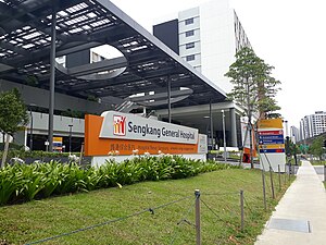
Sengkang General Hospital
Hospital in Singapore , Singapore
Distance: Approx. 432 meters
Latitude and longitude: 1.3955,103.8934
Sengkang General Hospital (abbreviation: SKH) is one of Singapore's public hospitals. It has 1000-bed, It opened its doors on 18 August 2018 and serves mainly the population of northeast Singapore, in particular Sengkang, Punggol, Hougang and Pasir Ris. The hospital is managed by Sengkang Health.

Compassvale Secondary School
Government school in Singapore
Distance: Approx. 859 meters
Latitude and longitude: 1.3964,103.9001
Compassvale Secondary School (CVSS) is a co-educational government secondary school in Sengkang, Singapore, within walking distance of Compassvale LRT station. Founded on 2 January 2000, the integrated government school offers secondary education under three academic streams, which lead up to the Singapore-Cambridge GCE Ordinary Level or the Singapore-Cambridge GCE Normal Level examinations.

Sengkang Public Library
Public library in Singapore
Distance: Approx. 155 meters
Latitude and longitude: 1.39222222,103.89527778
Sengkang Public Library is a public library owned by the National Library Board situated inside Compass One in Sengkang New Town, and it occupies levels 3 and 4. It is near Sengkang Bus Interchange and the Sengkang MRT/LRT station.
Armenian Street Char Kway Teow
Street food stall in Singapore
Distance: Approx. 595 meters
Latitude and longitude: 1.387372,103.8908145
Armenian Street Char Kway Teow is a street food stall in Anchorvale Block 303 in Anchorvale, Singapore. The food stall was originally located at the corner of Armenian Street and Loke Yew Street, and later relocated along Anchorvale Link. Two more outlets were established in 2013 and 2014.
Weather in this IP's area
broken clouds
28 Celsius
32 Celsius
26 Celsius
29 Celsius
1009 hPa
78 %
1009 hPa
1007 hPa
10000 meters
2.57 m/s
180 degree
75 %
06:58:24
19:06:11