Country:
Region:
City:
Latitude and Longitude:
Time Zone:
Postal Code:
IP information under different IP Channel
ip-api
Country
Region
City
ASN
Time Zone
ISP
Blacklist
Proxy
Latitude
Longitude
Postal
Route
Luminati
Country
Region
nw
City
ratingen
ASN
Time Zone
Europe/Berlin
ISP
ORCL-CHICAGO-PP
Latitude
Longitude
Postal
IPinfo
Country
Region
City
ASN
Time Zone
ISP
Blacklist
Proxy
Latitude
Longitude
Postal
Route
db-ip
Country
Region
City
ASN
Time Zone
ISP
Blacklist
Proxy
Latitude
Longitude
Postal
Route
ipdata
Country
Region
City
ASN
Time Zone
ISP
Blacklist
Proxy
Latitude
Longitude
Postal
Route
Popular places and events near this IP address

Ratingen
Town in North Rhine-Westphalia, Germany
Distance: Approx. 4366 meters
Latitude and longitude: 51.3,6.85
Ratingen (Limburgish: Rotinge) is a town in the district of Mettmann in North Rhine-Westphalia, Germany. It lies in the northwestern part of Berg about 12 km northeast of Düsseldorf.

Ratingen-Lintorf
Quarter of Ratingen in North Rhine-Westphalia, Germany
Distance: Approx. 1816 meters
Latitude and longitude: 51.33277778,6.83083333
Lintorf is a village at the transition of the Berg region into the lower Rhine plain in North Rhine-Westphalia, Germany. Since 1975 it has been a quarter of the city of Ratingen.

Duisburg-Entenfang station
Railway station in Duisburg, Germany
Distance: Approx. 5090 meters
Latitude and longitude: 51.3769,6.8137
Duisburg-Entenfang is a railway station in southern Duisburg, Germany. The station was opened in 1982 and closed on December 15, 2019. The station lies on the eastern side of the freight sidings on the freight-only line to Düsseldorf.
Hösel station
Railway station in Ratingen, Germany
Distance: Approx. 2696 meters
Latitude and longitude: 51.341481,6.893484
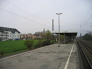
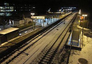
Hösel is a railway station in Ratingen in western Germany. It serves the outlying town part of Hösel.
Angermund
City district of Düsseldorf, Germany
Distance: Approx. 5307 meters
Latitude and longitude: 51.33,6.78
Angermund is an urban quarter of Düsseldorf, part of Borough 5. Angermund is the northernmost part of Düsseldorf, neighbouring to Kalkum, Kaiserswerth, Ratingen and Duisburg. Having the second largest income in Düsseldorf, it provides a home to many corporate managers and foreign, mainly American, British and Dutch employees.

Düsseldorf-Angermund station
Railway station in Düsseldorf, Germany
Distance: Approx. 5193 meters
Latitude and longitude: 51.33,6.78166667
Düsseldorf-Angermund station is a station on the Cologne–Duisburg railway in the Düsseldorf district of Angermund in the German state of North Rhine Westphalia. It is served by line S 1 of the Rhine-Ruhr S-Bahn.

Ratingen Ost station
Railway station in Ratingen, Germany
Distance: Approx. 4921 meters
Latitude and longitude: 51.295217,6.863434
Ratingen Ost is a station situated in Ratingen in the German state of North Rhine Westphalia and is a station of the Rhine-Ruhr S-Bahn. It was opened in 1872 as the Ratingen station of the Bergisch-Märkische Railway Company (German: Bergisch-Märkische Eisenbahn-Gesellschaft, BME) along with the Ruhr Valley Railway. After the nationalisation of the BME, it received its current name in the 19th century.

Duisburg-Rahm station
Railway station in Duisburg, Germany
Distance: Approx. 5274 meters
Latitude and longitude: 51.346757,6.780054
Duisburg-Rahm station is a station in the suburb of Rahm of the city of Duisburg in the German state of North Rhine-Westphalia. It is on the Cologne–Duisburg railway and it is classified by Deutsche Bahn as a category 5 station. The station was opened on 30 September 1973.

Rinderbach (Ruhr)
River in Germany
Distance: Approx. 6087 meters
Latitude and longitude: 51.36194444,6.93444444
The Rinderbach is a river of North Rhine-Westphalia, Germany, flowing into the Ruhr at Kettwig.

Textilfabrik Cromford
Distance: Approx. 3705 meters
Latitude and longitude: 51.305833,6.853056
The Textilfabrik Cromford in Ratingen, North Rhine-Westphalia, Germany was built in 1783 by Johann Gottfried Brügelmann. It was the first cotton spinning mill on the European mainland. Today it is an industrial museum specialising in textile history.

Nürnberger Flugdienst Flight 108
1988 aviation accident
Distance: Approx. 5718 meters
Latitude and longitude: 51.3743,6.9148
Nürnberger Flugdienst Flight 108 was a scheduled regional flight which crashed near Essen, Germany, on 8 February 1988 with the loss of all 21 occupants. The flight was operated by Swearingen SA.227BC Metroliner III D-CABB for Nürnberger Flugdienst, from Hannover Airport to Düsseldorf Airport. It is the deadliest aviation accident involving the Swearingen Fairchild Metroliner.

Ratingen-Breitscheid
Distance: Approx. 1614 meters
Latitude and longitude: 51.3519,6.8658
Breitscheid is a quarter of the city Ratingen in Germany.
Weather in this IP's area
few clouds
5 Celsius
3 Celsius
5 Celsius
7 Celsius
1011 hPa
89 %
1011 hPa
1003 hPa
10000 meters
3.6 m/s
210 degree
20 %
07:55:42
16:40:14

