131.111.179.82 - IP Lookup: Free IP Address Lookup, Postal Code Lookup, IP Location Lookup, IP ASN, Public IP
Country:
Region:
City:
Location:
Time Zone:
Postal Code:
IP information under different IP Channel
ip-api
Country
Region
City
ASN
Time Zone
ISP
Blacklist
Proxy
Latitude
Longitude
Postal
Route
Luminati
Country
Region
eng
City
cambridge
ASN
Time Zone
Europe/London
ISP
Jisc Services Limited
Latitude
Longitude
Postal
IPinfo
Country
Region
City
ASN
Time Zone
ISP
Blacklist
Proxy
Latitude
Longitude
Postal
Route
IP2Location
131.111.179.82Country
Region
england
City
coton
Time Zone
Europe/London
ISP
Language
User-Agent
Latitude
Longitude
Postal
db-ip
Country
Region
City
ASN
Time Zone
ISP
Blacklist
Proxy
Latitude
Longitude
Postal
Route
ipdata
Country
Region
City
ASN
Time Zone
ISP
Blacklist
Proxy
Latitude
Longitude
Postal
Route
Popular places and events near this IP address

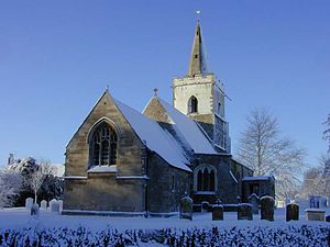
Coton, Cambridgeshire
Human settlement in England
Distance: Approx. 210 meters
Latitude and longitude: 52.21056,0.06398
Coton is a small village and civil parish about three miles (about 5 km) west of Cambridge in Cambridgeshire, England and about the same distance east of the Prime Meridian. It is in the district of South Cambridgeshire. The parish covers an area of 392 hectares (970 acres).

Department of Computer Science and Technology, University of Cambridge
Computer science division at the University of Cambridge
Distance: Approx. 2122 meters
Latitude and longitude: 52.211,0.092
The Department of Computer Science and Technology, formerly the Computer Laboratory, is the computer science department of the University of Cambridge. As of 2023 it employed 56 faculty members, 45 support staff, 105 research staff, and about 205 research students. The current Head of Department is Professor Alastair Beresford.

West Cambridge
Place in Cambridge, England
Distance: Approx. 2023 meters
Latitude and longitude: 52.21027778,0.09055556
West Cambridge is a university site to the west of Cambridge city centre in England. As part of the West Cambridge Master Plan, several of the University of Cambridge's departments have relocated to the West Cambridge site from the centre of town due to overcrowding. A number of other research institutions also have buildings on the site.
Madingley
Village in Cambridgeshire, England
Distance: Approx. 2105 meters
Latitude and longitude: 52.225,0.0409
Madingley is a small village near Cambridge, England. It is located close to the nearby villages of Coton and Dry Drayton on the western outskirts of Cambridge. The population of the civil parish at the 2011 Census was 210.

Cambridge American Cemetery and Memorial
ABMC war grave cemetery in England
Distance: Approx. 781 meters
Latitude and longitude: 52.2161,0.0538
Cambridge American Cemetery and Memorial is a World War II American military war grave cemetery, lying between the villages of Coton and Madingley, 7 km (4.3 mi) north-west of Cambridge, England. The cemetery, dedicated in 1956, contains 3,811 American war dead and covers 30.5 acres (12.3 ha). It is one of 26 overseas military cemeteries administered by the American Battle Monuments Commission (ABMC).

Department of Chemical Engineering and Biotechnology, University of Cambridge
Distance: Approx. 1707 meters
Latitude and longitude: 52.209208,0.085819
The Department of Chemical Engineering and Biotechnology (CEB) is one of the teaching and research departments at the University of Cambridge. The department trains undergraduate students and conducts original research at the interfaces between engineering, chemistry, biology and physics. It conducts research in collaboration with industrial partners.

William Gates Building, Cambridge
Building in Cambridge, England
Distance: Approx. 2123 meters
Latitude and longitude: 52.210925,0.092022
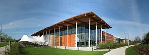
The William Gates Building, or WGB, is a square building that houses the Computer Laboratory at the University of Cambridge, on the University's West Cambridge site in JJ Thomson Avenue south of the Madingley Road in Cambridge, England. Construction on the building began in 1999 and was completed in 2001 at a cost of £20 million. Opened by Maurice Wilkes, it was named after William H. Gates Sr., the father of Microsoft founder Bill Gates.
Conduit Head
House in Cambridge, England
Distance: Approx. 2125 meters
Latitude and longitude: 52.21565,0.09095
Conduit Head is a 1910 house located off the Madingley Road (A1303) on the western outskirts of Cambridge, England. Built in 1910, it was designed by Harry Redfern for Francis Darwin, and was built for Darwin's daughter Frances on the occasion of her marriage to F. M. Cornford. The architectural historians Simon Bradley and Nikolaus Pevsner describe the house as "gabled, rural and relaxed".

University of Cambridge Sports Centre
Distance: Approx. 1718 meters
Latitude and longitude: 52.2083,0.0858
The University of Cambridge Sports Centre is the Cambridge's main sporting facility. It is managed by Nick Brooking.

Madingley Wood
Biological Site of Special Scientific Interest
Distance: Approx. 1132 meters
Latitude and longitude: 52.217,0.048
Madingley Wood is a 15.4-hectare (38-acre) biological Site of Special Scientific Interest near Madingley, on the western outskirts of Cambridge. The western part of this wood is ancient pedunculate oak, with other trees including ash and field maple, with hazel and hawthorn in the shrub layer. The newer eastern woodland is elm and ash.

North West Cambridge development
University area in Cambridge, England
Distance: Approx. 1995 meters
Latitude and longitude: 52.21805556,0.0875
The North West Cambridge Development is a University of Cambridge site to the north west of Cambridge city centre in England. The development is meant to alleviate overcrowding and rising land prices in Cambridge. The first phase resulted from a £350 million investment by the university.
Plant Breeding Institute
Research institute in Cambridge, UK
Distance: Approx. 1995 meters
Latitude and longitude: 52.21805556,0.0875
The Plant Breeding Institute was an agricultural research organisation in Cambridge in the United Kingdom between 1912 and 1987.
Weather in this IP's area
broken clouds
10 Celsius
8 Celsius
9 Celsius
11 Celsius
1028 hPa
93 %
1028 hPa
1023 hPa
10000 meters
3.01 m/s
4.92 m/s
243 degree
74 %
