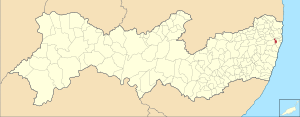
Country:
 Brazil
Region:
City:
Latitude and Longitude:
Time Zone:
Postal Code:
IP information under different IP Channel
ip-api
Country
Region
City
ASN
Time Zone
ISP
Blacklist
Proxy
Latitude
Longitude
Postal
Route
IPinfo
Country
Region
City
ASN
Time Zone
ISP
Blacklist
Proxy
Latitude
Longitude
Postal
Route
MaxMind
Country
Region
City
ASN
Time Zone
ISP
Blacklist
Proxy
Latitude
Longitude
Postal
Route
Luminati
Country
BRRegion
pe
City
recife
ASN
Time Zone
America/Recife
ISP
pgf telecomunicacoes ltda
Latitude
Longitude
Postal
db-ip
Country
Region
City
ASN
Time Zone
ISP
Blacklist
Proxy
Latitude
Longitude
Postal
Route
ipdata
Country
Region
City
ASN
Time Zone
ISP
Blacklist
Proxy
Latitude
Longitude
Postal
Route
Popular places and events near this IP address
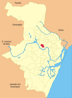
Camaragibe
City in Pernambuco, Brazil
Distance: Approx. 3708 meters
Latitude and longitude: -8.02194444,-34.98083333
Camaragibe is a city in the Northeastern region of Brazil, in the state of Pernambuco. It lies within the Greater Recife — Brazil's 5th-largest metropolitan area. Currently, Camaragibe is run by Nadegi Queiroz (from the political party Republicanos) and Délio Junior (The Vice-mayor).

Estádio do Arruda
Distance: Approx. 6753 meters
Latitude and longitude: -8.02671111,-34.891175
Estádio José do Rego Maciel, also known as Estádio do Arruda, is a multi-purpose stadium in Recife, Brazil. It is currently used mostly for football matches. The stadium was built in 1972 and is able to hold 60,044 spectators.

Federal University of Pernambuco
Public university in Recife, Brazil
Distance: Approx. 4740 meters
Latitude and longitude: -8.05166667,-34.95083333
Federal University of Pernambuco (Portuguese: Universidade Federal de Pernambuco, UFPE) is a public university in Recife, Brazil, established in 1946. UFPE has 70 undergraduate courses and 175 postgraduate courses. As of 2007, UFPE had 35,000 students and 2,000 professors.

Recife Brazil Temple
Distance: Approx. 5235 meters
Latitude and longitude: -8.03639,-34.911123
The Recife Brazil Temple is the 101st operating temple of the Church of Jesus Christ of Latter-day Saints (LDS Church). The Recife Brazil Temple sits on 5.59 acres (2.26 ha) in the city of Recife, capital of the Brazilian state of Pernambuco, the grounds feature mango and palm trees and an ornamental garden. The temple exterior is finished with Asa branca granite from Brazil and features a single spire topped with a gold statue of the angel Moroni.
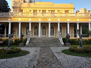
Museu do Estado de Pernambuco
Museum in Recife, Brazil
Distance: Approx. 6616 meters
Latitude and longitude: -8.04473194,-34.90176111
The Museu do Estado de Pernambuco (MEPE) (Museum of the State of Pernambuco) is housed in a 19th-century mansion on the Av. Rui Barbosa in Recife, capital of Pernambuco state, Brazil. It was opened in 1929.

Zoo Botanical Park Dois Irmãos
Zoo in Pernambuco, Brazil
Distance: Approx. 325 meters
Latitude and longitude: -8.01,-34.947
The Zoo Botanical Park Dois Irmãos, is located in the city of Recife, state of Pernambuco - Brazil. The park has an area of 384.4 hectares (950 acres), 14 of which is dedicated for the Zoo Botanical and a Natural Science Museum, and the remaining area for an Atlantic Forest reserve (considered one of the largest atlantic forest area in the state). This park offers to the visitors the possibility to know about the local ecosystems, plants and wildlife.

Academia Pernambucana de Letras
Distance: Approx. 6061 meters
Latitude and longitude: -8.03960161,-34.90424981
The Academia Pernambucana de Letras (Pernambuco Academy of Letters) is a Brazilian literary society established in the manner of the Académie des Inscriptions et Belles-Lettres, on January 26, 1901, in Recife by Carneiro Vilela and other writers from the state of Pernambuco, with a total of 20 seats. One of the first letters academies of Brazil, being surpassed only by Academia Cearense de Letras, by Academia Brasileira de Letras and Academia Paraense de Letras.
Poço da Panela
Neighborhood in Recife, Brazil
Distance: Approx. 3251 meters
Latitude and longitude: -8.03333333,-34.93333333
Poço da Panela is a neighborhood of Recife, Brazil located in the north of the city. It has a land area of 87 hectares, a resident population of 4,006 people and an annual geometric growth rate of 0.45. Adjoining neighborhoods are 'Casa Forte', 'Santana' and 'Monteiro', and it runs along the Capibaribe River.

Federal Institute of Pernambuco
Distance: Approx. 4740 meters
Latitude and longitude: -8.05166667,-34.95083333
The Pernambuco Federal Institute of Education, Science, and Technology (Portuguese: Instituto Federal de Educação, Ciência e Tecnologia de Pernambuco, IFPE) is a Brazilian institution of higher education located in Pernambuco State, Brazil. Its rectory is headquartered in Recife, Pernambuco. The IFPE is one of the oldest and most traditional among the Federal Institutes, it has 9 campuses and offers Technical, undergraduate and postgraduate courses, as well as researches and scientific production.

Caxangá (Recife)
Neighborhood in Recife, Brazil
Distance: Approx. 2416 meters
Latitude and longitude: -8.0308,-34.9497
Caxangá is a neighborhood in Recife, Brazil, located on the banks of the Capibaribe River, eleven kilometers from the center of Recife. The neighborhood was first populated by the canon Francisco Pereira Lopes, in the late eighteenth century, when he built a house and a chapel dedicated to St. Francis of Paula there.
Alberto Maia
Neighborhood
Distance: Approx. 6265 meters
Latitude and longitude: -8.02228449,-35.00504987
Alberto Maia is a neighborhood of the city of Camaragibe, state of Pernambuco. The neighborhood is located between the allotments of John Paul II, Santa Terezinha, Santa Maria, Santa Mônica and Santana.
Casa Forte
Brazilian neighborhood
Distance: Approx. 4346 meters
Latitude and longitude: -8.03333333,-34.91888889
Casa Forte is a neighborhood in the North Zone of Recife, Pernambuco, Brazil.
Weather in this IP's area
broken clouds
26 Celsius
26 Celsius
26 Celsius
26 Celsius
1013 hPa
73 %
1013 hPa
1009 hPa
10000 meters
2.57 m/s
100 degree
75 %
05:02:53
17:14:18