131.0.28.180 - IP Lookup: Free IP Address Lookup, Postal Code Lookup, IP Location Lookup, IP ASN, Public IP
Country:
Region:
City:
Location:
Time Zone:
Postal Code:
IP information under different IP Channel
ip-api
Country
Region
City
ASN
Time Zone
ISP
Blacklist
Proxy
Latitude
Longitude
Postal
Route
Luminati
Country
Region
rj
City
riodejaneiro
ASN
Time Zone
America/Sao_Paulo
ISP
GIGA MAIS FIBRA TELECOMUNICACOES S.A.
Latitude
Longitude
Postal
IPinfo
Country
Region
City
ASN
Time Zone
ISP
Blacklist
Proxy
Latitude
Longitude
Postal
Route
IP2Location
131.0.28.180Country
Region
rio de janeiro
City
tres rios
Time Zone
America/Sao_Paulo
ISP
Language
User-Agent
Latitude
Longitude
Postal
db-ip
Country
Region
City
ASN
Time Zone
ISP
Blacklist
Proxy
Latitude
Longitude
Postal
Route
ipdata
Country
Region
City
ASN
Time Zone
ISP
Blacklist
Proxy
Latitude
Longitude
Postal
Route
Popular places and events near this IP address

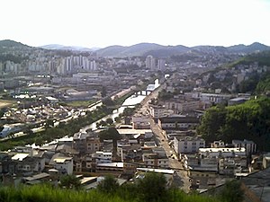
Três Rios
Municipality in Southeast, Brazil
Distance: Approx. 42 meters
Latitude and longitude: -22.11694444,-43.20888889
Três Rios (Portuguese pronunciation: [ˈtɾe(j)z ˈʁi.us]) is a municipality located in the Brazilian state of Rio de Janeiro. As of 2020 its population was an estimated 82,142 inhabitants, and its area is around 322 square kilometres (124 sq mi). The current mayor of Três Rios is Joacir Barbaglio Pereira (known as Joa) of the Liberal Party, elected in 2020 to a four-year term.

Comendador Levy Gasparian
Municipality in Southeast, Brazil
Distance: Approx. 9785 meters
Latitude and longitude: -22.02888889,-43.205
Comendador Levy Gasparian (Portuguese pronunciation: [komẽdɐˈdoʁ leˈvi ɡɐspaɾiˈɐ̃]) is a municipality located in the Brazilian state of Rio de Janeiro. Its population was 8,576 (2020) and its area is 107 km².
Paraíba do Sul, Rio de Janeiro
Place in Southeast, Brazil
Distance: Approx. 9982 meters
Latitude and longitude: -22.16194444,-43.29277778
Paraíba do Sul (Brazilian Portuguese pronunciation: [paɾaˈibɐ du ˈsuw]) is a municipality located in the Brazilian state of Rio de Janeiro. Its population was 44,518 (2020) and its area is 581 km².
Fagundes River
River in Brazil
Distance: Approx. 9649 meters
Latitude and longitude: -22.2,-43.18333333
The Fagundes River is a river of Rio de Janeiro state in southeastern Brazil.

Piabanha River
River in Brazil
Distance: Approx. 7403 meters
Latitude and longitude: -22.111863,-43.137605
The Piabanha River (Portuguese: Rio Piabanha) is a river of Rio de Janeiro state in southeastern Brazil. It is a tributary of the Paraíba do Sul.

Paraibuna River (Minas Gerais)
River in Minas Gerais, Brazil
Distance: Approx. 7410 meters
Latitude and longitude: -22.10944444,-43.13777778
The Paraibuna is a river in Minas Gerais state, Brazil, and a major tributary of the Paraíba do Sul. It flows through the important commercial and industrial city of Juiz de Fora. The name of the river probably comes from the Tupi "pará y b'una" signifying "great dark river".
Weather in this IP's area
overcast clouds
20 Celsius
21 Celsius
20 Celsius
20 Celsius
1013 hPa
94 %
1013 hPa
955 hPa
10000 meters
1.06 m/s
1.76 m/s
219 degree
100 %
