130.51.234.77 - IP Lookup: Free IP Address Lookup, Postal Code Lookup, IP Location Lookup, IP ASN, Public IP
Country:
Region:
City:
Location:
Time Zone:
Postal Code:
IP information under different IP Channel
ip-api
Country
Region
City
ASN
Time Zone
ISP
Blacklist
Proxy
Latitude
Longitude
Postal
Route
Luminati
Country
Region
wi
City
rhinelander
ASN
Time Zone
America/Chicago
ISP
NORTHWOODS-COMMUNICATION-TECHNOLOGIES
Latitude
Longitude
Postal
IPinfo
Country
Region
City
ASN
Time Zone
ISP
Blacklist
Proxy
Latitude
Longitude
Postal
Route
IP2Location
130.51.234.77Country
Region
wisconsin
City
rhinelander
Time Zone
America/Chicago
ISP
Language
User-Agent
Latitude
Longitude
Postal
db-ip
Country
Region
City
ASN
Time Zone
ISP
Blacklist
Proxy
Latitude
Longitude
Postal
Route
ipdata
Country
Region
City
ASN
Time Zone
ISP
Blacklist
Proxy
Latitude
Longitude
Postal
Route
Popular places and events near this IP address

Pine Lake, Wisconsin
Town in Wisconsin, United States
Distance: Approx. 2762 meters
Latitude and longitude: 45.69333333,-89.385
Pine Lake is a town in Oneida County, Wisconsin. The population was 2,720 at the time of the 2000 census. The unincorporated community of Roosevelt is located in the town.

Rhinelander, Wisconsin
City in Wisconsin, United States
Distance: Approx. 7554 meters
Latitude and longitude: 45.63944444,-89.41222222
Rhinelander is a city in and the county seat of Oneida County, Wisconsin, United States. The population was 8,285 at the 2020 census.

Stella, Wisconsin
Town in Wisconsin, United States
Distance: Approx. 7522 meters
Latitude and longitude: 45.67916667,-89.25444444
Stella is a town in Oneida County, Wisconsin, United States. The population was 633 at the 2000 census. The unincorporated community of Starks is located within the town.
Camp Horseshoe for Boys
Summer camp in Rhinelander, Wisconsin, US
Distance: Approx. 6359 meters
Latitude and longitude: 45.662797,-89.278743
Camp Horseshoe is a summer camp for boys located in Rhinelander, Wisconsin. The camp was started in 1932 by Maurice Arthur Hirshberg ("Doc H")and Al Engelhardt. They were co-directors until Al left the camp leadership to Doc H. In 1990, the camp closed and was reopened in 2004, or Quenota, by former camper, Jordan Shiner and his wife, Fran.
Rhinelander High School
High school in Rhinelander, Oneida, Wisconsin, United States
Distance: Approx. 6185 meters
Latitude and longitude: 45.64833333,-89.4
Rhinelander High School (RHS) is a high school in Rhinelander, Oneida County, Wisconsin, United States.

Hodag Country Festival
Distance: Approx. 5996 meters
Latitude and longitude: 45.67916667,-89.42472222
The Hodag Country Festival, named after the folkloric Hodag, is an outdoor country music festival usually held the second weekend of July in Rhinelander, Wisconsin. Celebrating its 45th Anniversary in 2023, the festival has grown from 500 attendees at the first event to over 25,000 per day, with a total attendance of 30,000 - 50,000 people annually. There was no festival in 2020 due to the COVID-19 pandemic.

Northwoods Community Secondary School
School in Rhinelander, Oneida, Wisconsin, United States
Distance: Approx. 6185 meters
Latitude and longitude: 45.64833333,-89.4
Northwoods Community Secondary School (NCSS) was an American charter school in Rhinelander, Wisconsin. Founded in 2003, the school offered a project-based curriculum. In 2011 the Rhinelander Environmental Stewardship Academy was moved to NCSS due to a significant decrease in enrollment and the resignation of the head teacher.

Rhinelander Brewing Company
Brewery in Rhinelander, Wisconsin
Distance: Approx. 7775 meters
Latitude and longitude: 45.63694444,-89.41236111
Rhinelander Brewery is a regional American brewery located in Rhinelander, Wisconsin.

Solon and Mathilda Sutliff House
Historic house in Wisconsin, United States
Distance: Approx. 7394 meters
Latitude and longitude: 45.63812,-89.40655
The Solon and Mathilda Sutliff House is a historic house located at 306 Dahl Street in Rhinelander, Wisconsin. It was added to the National Register of Historic Places on October 7, 2009.

First National Bank (Rhinelander, Wisconsin)
United States historic place
Distance: Approx. 7631 meters
Latitude and longitude: 45.63805556,-89.41138889
The First National Bank in Rhinelander, Wisconsin was built in 1911. It is a Sullivanesque building designed by architects Purcell & Elmslie. It was listed on the National Register of Historic Places in 1973.

Pioneer Park Historical Complex
Distance: Approx. 3020 meters
Latitude and longitude: 45.66666667,-89.33333333
Pioneer Park Historical Complex, also called Rhinelander Logging Museum, Rhinelander Schoolhouse Museum is a combination open-air museum of historical structures in Rhinelander, Wisconsin, United States. It is listed as a city park, managed by a non-profit organizations. The structures include log cabins from the fur trade era, buildings from and stores and public buildings from the late nineteenth century.

Oneida County Courthouse (Wisconsin)
United States historic place
Distance: Approx. 7481 meters
Latitude and longitude: 45.6375,-89.40722222
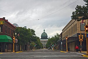
The Oneida County Courthouse is a three-story, copper-domed county courthouse located in Rhinelander, Wisconsin. It houses the circuit court and government offices of Oneida County, Wisconsin. The building was listed on the National Register of Historic Places in 1981 and on the State Register of Historic Places in 1989 for its significance as a local example of Neoclassical architecture.
Weather in this IP's area
light rain
2 Celsius
-3 Celsius
1 Celsius
2 Celsius
1005 hPa
93 %
1005 hPa
946 hPa
10000 meters
5.14 m/s
260 degree
100 %