130.51.232.186 - IP Lookup: Free IP Address Lookup, Postal Code Lookup, IP Location Lookup, IP ASN, Public IP
Country:
Region:
City:
Location:
Time Zone:
Postal Code:
IP information under different IP Channel
ip-api
Country
Region
City
ASN
Time Zone
ISP
Blacklist
Proxy
Latitude
Longitude
Postal
Route
Luminati
Country
Region
wi
City
rhinelander
ASN
Time Zone
America/Chicago
ISP
NORTHWOODS-COMMUNICATION-TECHNOLOGIES
Latitude
Longitude
Postal
IPinfo
Country
Region
City
ASN
Time Zone
ISP
Blacklist
Proxy
Latitude
Longitude
Postal
Route
IP2Location
130.51.232.186Country
Region
wisconsin
City
argonne
Time Zone
America/Chicago
ISP
Language
User-Agent
Latitude
Longitude
Postal
db-ip
Country
Region
City
ASN
Time Zone
ISP
Blacklist
Proxy
Latitude
Longitude
Postal
Route
ipdata
Country
Region
City
ASN
Time Zone
ISP
Blacklist
Proxy
Latitude
Longitude
Postal
Route
Popular places and events near this IP address

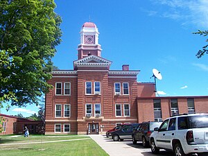
Forest County, Wisconsin
County in Wisconsin, United States
Distance: Approx. 8570 meters
Latitude and longitude: 45.67,-88.78
Forest County is a county in the U.S. state of Wisconsin. As of the 2020 census, the population was 9,179. Its county seat is Crandon.

Argonne, Wisconsin
Town in Wisconsin, United States
Distance: Approx. 7319 meters
Latitude and longitude: 45.65972222,-88.87916667
Argonne is a town in Forest County, Wisconsin, United States. The population was 512 at the 2010 census. The census-designated place of Argonne is located in the town.

Hiles, Forest County, Wisconsin
Town in Wisconsin, United States
Distance: Approx. 9478 meters
Latitude and longitude: 45.70388889,-88.97722222
Hiles is a town in Forest County, Wisconsin, United States. The population was 311 at the 2010 census. The unincorporated communities of Atkins and Hiles are located in the town.

Argonne (CDP), Wisconsin
Census-designated place in Wisconsin, United States
Distance: Approx. 7319 meters
Latitude and longitude: 45.65972222,-88.87916667
Argonne is an unincorporated census-designated place in the town of Argonne, Forest County, Wisconsin, United States. Argonne is located at the junction of Wisconsin Highway 32 and Wisconsin Highway 55 6 miles (9.7 km) north of Crandon. Argonne has a post office with ZIP code 54511.

Hiles (community), Wisconsin
Unincorporated community in Wisconsin, United States
Distance: Approx. 9478 meters
Latitude and longitude: 45.70388889,-88.97722222
Hiles is an unincorporated community in the town of Hiles, Forest County, Wisconsin, United States. Hiles is located on Wisconsin Highway 32 10 miles (16 km) north-northwest of Crandon.
Weather in this IP's area
overcast clouds
3 Celsius
-0 Celsius
2 Celsius
4 Celsius
1010 hPa
98 %
1010 hPa
950 hPa
68 meters
3.35 m/s
11.47 m/s
96 degree
100 %