130.51.230.197 - IP Lookup: Free IP Address Lookup, Postal Code Lookup, IP Location Lookup, IP ASN, Public IP
Country:
Region:
City:
Location:
Time Zone:
Postal Code:
IP information under different IP Channel
ip-api
Country
Region
City
ASN
Time Zone
ISP
Blacklist
Proxy
Latitude
Longitude
Postal
Route
Luminati
Country
Region
mo
City
clinton
ASN
Time Zone
America/Chicago
ISP
ROCKETCONNECT
Latitude
Longitude
Postal
IPinfo
Country
Region
City
ASN
Time Zone
ISP
Blacklist
Proxy
Latitude
Longitude
Postal
Route
IP2Location
130.51.230.197Country
Region
missouri
City
clinton
Time Zone
America/Chicago
ISP
Language
User-Agent
Latitude
Longitude
Postal
db-ip
Country
Region
City
ASN
Time Zone
ISP
Blacklist
Proxy
Latitude
Longitude
Postal
Route
ipdata
Country
Region
City
ASN
Time Zone
ISP
Blacklist
Proxy
Latitude
Longitude
Postal
Route
Popular places and events near this IP address

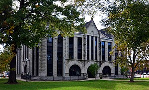
Henry County, Missouri
County in Missouri, United States
Distance: Approx. 2886 meters
Latitude and longitude: 38.39,-93.79
Henry County is a county located in the western portion of the U.S. state of Missouri. As of the 2020 census, the population was 21,946. Its county seat is Clinton.

Clinton, Missouri
City in Missouri, United States
Distance: Approx. 315 meters
Latitude and longitude: 38.37166667,-93.77166667
Clinton is a city in and the county seat of Henry County, Missouri, United States. The population was 9,174 at the 2020 census.
KDKD (AM)
Radio station in Clinton, Missouri
Distance: Approx. 2763 meters
Latitude and longitude: 38.395,-93.77166667
KDKD (1280 AM) was a radio station broadcasting a farm and conservative talk format. Licensed to Clinton, Missouri, United States, the station was owned by Clayton and Brittany Radford, through licensee Radford Media Group, LLC. KDKD featured programming from Fox News Radio and Westwood One.
Coal Creek (Henry County, Missouri)
Stream in the American state of Missouri
Distance: Approx. 5147 meters
Latitude and longitude: 38.3261338,-93.7510455
Coal Creek is a stream in Henry County in the U.S. state of Missouri. Coal Creek was so named on account of coal deposits near its course.
Deer Creek (South Grand River tributary)
Stream in Henry County, Missouri, United States
Distance: Approx. 4394 meters
Latitude and longitude: 38.3333558,-93.7507679
Deer Creek is a stream in Henry County in the U.S. state of Missouri. It is a tributary of the South Grand River. Deer Creek was named for the fact deer were hunted there.
Clinton Township, Henry County, Missouri
Township in Henry County, Missouri, U.S.
Distance: Approx. 4061 meters
Latitude and longitude: 38.3369,-93.7872
Clinton Township is a township in Henry County, in the U.S. state of Missouri. Clinton Township takes its name from the community of Clinton, Missouri.
William F. and Julia Crome House
Historic house in Missouri, United States
Distance: Approx. 585 meters
Latitude and longitude: 38.3675,-93.77416667
The William F. and Julia Crome House is a historic house located at 305 South Second Street in Clinton, Henry County, Missouri.

Judge Jerubial Gideon Dorman House
Historic house in Missouri, United States
Distance: Approx. 980 meters
Latitude and longitude: 38.37055556,-93.77972222
Judge Jerubial Gideon Dorman House, also known as the Dorman House, is a historic home located at Clinton, Henry County, Missouri. It was built in 1852, and is two-story, central passage plan, brick I-house with Greek Revival and Gothic Revival style design elements. It has a side gable roof and a small Greek Revival porch.: 2 It was listed on the National Register of Historic Places in 1983.
Gustave C. Haysler House
Historic house in Missouri, United States
Distance: Approx. 569 meters
Latitude and longitude: 38.36777778,-93.77416667
Gustave C. Haysler House is a historic home located at Clinton, Henry County, Missouri. It was built about 1896, and is two-story, Queen Anne style frame dwelling. It features steep hipped roofs, front porch with classical columns, and a cylindrical tower.: 5 It was listed on the National Register of Historic Places in 1995.
C.C. Williams House
Historic house in Missouri, United States
Distance: Approx. 959 meters
Latitude and longitude: 38.37111111,-93.77944444
C. C. Williams House, also known as the Biddlecomb House and Cummings Apartment House, is a historic home located at Clinton, Henry County, Missouri. It was built about 1867, and is two-story, T-shaped, Italianate style frame dwelling. It sits on a sandstone foundation with southern mansion front and hipped cross-gable roof.: 5 It was listed on the National Register of Historic Places in 1995.
Anheuser-Busch Brewing Association Building
United States historic place
Distance: Approx. 836 meters
Latitude and longitude: 38.37083333,-93.77805556
Anheuser-Busch Brewing Association Building, also known as the Lobaugh Building and Henry County Museum and Cultural Arts Center, is a historic Anheuser-Busch distribution building located at Clinton, Henry County, Missouri. It was built in 1886, and is one- to two-story, Romanesque Revival style timber frame building with brick load bearing walls. It sits on a limestone foundation.

Clinton Square Historic District
Historic district in Missouri, United States
Distance: Approx. 713 meters
Latitude and longitude: 38.37027778,-93.77666667
Clinton Square Historic District is a national historic district located at Clinton, Henry County, Missouri. The district encompasses 62 contributing buildings, 1 contributing structure, and 1 contributing object in the central business district of Clinton. It developed between about 1885 and 1957 and includes representative examples of Italianate and Romanesque Revival style architecture.
Weather in this IP's area
clear sky
-6 Celsius
-11 Celsius
-6 Celsius
-6 Celsius
1027 hPa
73 %
1027 hPa
995 hPa
10000 meters
3.09 m/s
340 degree