Country:
 USA
USARegion:
City:
Latitude and Longitude:
Time Zone:
Postal Code:
IP information under different IP Channel
ip-api
Country
Region
City
ASN
Time Zone
ISP
Blacklist
Proxy
Latitude
Longitude
Postal
Route
IPinfo
Country
Region
City
ASN
Time Zone
ISP
Blacklist
Proxy
Latitude
Longitude
Postal
Route
MaxMind
Country
Region
City
ASN
Time Zone
ISP
Blacklist
Proxy
Latitude
Longitude
Postal
Route
Luminati
Country
USRegion
mi
City
harborbeach
ASN
Time Zone
America/Detroit
ISP
AGRI-VALLEY
Latitude
Longitude
Postal
db-ip
Country
Region
City
ASN
Time Zone
ISP
Blacklist
Proxy
Latitude
Longitude
Postal
Route
ipdata
Country
Region
City
ASN
Time Zone
ISP
Blacklist
Proxy
Latitude
Longitude
Postal
Route
Popular places and events near this IP address
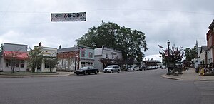
Port Hope, Michigan
Village in Michigan, United States
Distance: Approx. 3960 meters
Latitude and longitude: 43.94083333,-82.71277778
Port Hope is a village in Huron County of the U.S. state of Michigan. The population was 267 at the 2010 census. The village is within Rubicon Township.

Rubicon Township, Michigan
Civil township in Michigan, United States
Distance: Approx. 3737 meters
Latitude and longitude: 43.91388889,-82.71444444
Rubicon Township is a civil township of Huron County in the U.S. state of Michigan. The population was 705 at the 2020 census.
Masonic Temple (Port Hope, Michigan)
United States historic place
Distance: Approx. 3932 meters
Latitude and longitude: 43.94111111,-82.71333333
The Masonic Temple in Port Hope, Michigan is a fraternal lodge constructed in 1867. It was listed on the National Register of Historic Places in 1987. it is now used as the Rubicon Township Hall.

St. John's Lutheran Church (Port Hope, Michigan)
Historic church in Michigan, United States
Distance: Approx. 3525 meters
Latitude and longitude: 43.94055556,-82.71861111
St. John's Lutheran Church is a historic Lutheran church in Huron County, Michigan. It is located at 4527 Second St.

First Methodist Episcopal Church (Port Hope, Michigan)
Historic church in Michigan, United States
Distance: Approx. 3632 meters
Latitude and longitude: 43.93944444,-82.71638889
The First Methodist Episcopal Church, also known as the Red Church, is a historic church located at 4451 Second Street in Port Hope, Michigan. It was listed on the National Register of Historic Places in 1987.

William R. Stafford House
United States historic place
Distance: Approx. 3832 meters
Latitude and longitude: 43.94111111,-82.71472222
The Stafford House is a private home located at 4467 Main Street in Port Hope, Michigan. It was listed on the National Register of Historic Places in 1973.

W. R. Stafford Worker's House
United States historic place
Distance: Approx. 4023 meters
Latitude and longitude: 43.93944444,-82.71111111
The W. R. Stafford Worker's House, also known as the Blue Town House, is a private house located at 8022 Cedar Street in Port Hope, Michigan. It was listed on the National Register of Historic Places in 1987.

Herman House
United States historic place
Distance: Approx. 3960 meters
Latitude and longitude: 43.94083333,-82.71277778
The Herman House, also known as the Lake View Hotel, was built as a hotel, located at 4405 Main Street in Port Hope, Michigan. It was listed on the National Register of Historic Places in 1987. The building now houses a restaurant, the Port Hope Hotel.

Isaac Leuty House
United States historic place
Distance: Approx. 3785 meters
Latitude and longitude: 43.94055556,-82.715
The Isaac Leuty House is a private home located at 7955 School Street in Port Hope, Michigan. It was listed on the National Register of Historic Places in 1987.

Melligan Store-Agriculture Hall
United States historic place
Distance: Approx. 3999 meters
Latitude and longitude: 43.94166667,-82.71277778
The Melligan Store, also known as Agriculture Hall, is a commercial building located at 4432 Main Street in Port Hope, Michigan. It was listed on the National Register of Historic Places in 1988.

Ogilvie Building
United States historic place
Distance: Approx. 3925 meters
Latitude and longitude: 43.94138889,-82.71361111
The Ogilvie Building is a commercial building located at 4443 Main Street in Port Hope, Michigan. It was listed on the National Register of Historic Places in 1987.

Frederick H. and Elizabeth Stafford House
United States historic place
Distance: Approx. 3859 meters
Latitude and longitude: 43.94166667,-82.71472222
The Frederick H. and Elizabeth Stafford House was constructed as a private house, located at 4489 Main Street in Port Hope, Michigan. It was listed on the National Register of Historic Places in 1987.
Weather in this IP's area
scattered clouds
17 Celsius
16 Celsius
16 Celsius
18 Celsius
1013 hPa
82 %
1013 hPa
988 hPa
10000 meters
1.54 m/s
140 degree
26 %
07:15:21
19:34:02