Country:
Region:
City:
Latitude and Longitude:
Time Zone:
Postal Code:
IP information under different IP Channel
ip-api
Country
Region
City
ASN
Time Zone
ISP
Blacklist
Proxy
Latitude
Longitude
Postal
Route
Luminati
Country
Region
mi
City
croswell
ASN
Time Zone
America/Detroit
ISP
AGRI-VALLEY
Latitude
Longitude
Postal
IPinfo
Country
Region
City
ASN
Time Zone
ISP
Blacklist
Proxy
Latitude
Longitude
Postal
Route
db-ip
Country
Region
City
ASN
Time Zone
ISP
Blacklist
Proxy
Latitude
Longitude
Postal
Route
ipdata
Country
Region
City
ASN
Time Zone
ISP
Blacklist
Proxy
Latitude
Longitude
Postal
Route
Popular places and events near this IP address

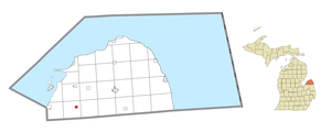
Brookfield Township, Huron County, Michigan
Civil township in Michigan, United States
Distance: Approx. 9232 meters
Latitude and longitude: 43.7325,-83.28694444
Brookfield Township is a civil township of Huron County in the U.S. state of Michigan. As of the 2020 census, the township population was 739.

Owendale, Michigan
Village in Michigan, United States
Distance: Approx. 8611 meters
Latitude and longitude: 43.72916667,-83.26805556
Owendale is a village in Huron County of the U.S. state of Michigan. The population was 241 at the 2010 census. The village is within Brookfield Township.

Cass City, Michigan
Village in Michigan, United States
Distance: Approx. 8858 meters
Latitude and longitude: 43.59944444,-83.17638889
Cass City is a village in Elkland Township, Tuscola County in the Flint/Tri-Cities area of the U.S. state of Michigan. The population was 2,428 at the 2010 U.S. Census and 2,643 at the 2000 U.S. Census (a decrease of about 8%). It is located along M-81 approximately four miles (6.4 km) west of that highway's intersection with M-53.
Elkland Township, Michigan
Township in Michigan, United States
Distance: Approx. 7838 meters
Latitude and longitude: 43.61194444,-83.17888889
Elkland Township is a civil township of Tuscola County in the U.S. state of Michigan. The population was 3,532 at the 2020 census. The village of Cass City is located within the southern part of the township.
Elmwood Township, Tuscola County, Michigan
Township in Michigan, United States
Distance: Approx. 2819 meters
Latitude and longitude: 43.63444444,-83.28388889
Elmwood Township is a civil township of Tuscola County in the U.S. state of Michigan. The population was 1,060 at the 2020 census. Elijah White was the first permanent white settler in the township in 1855.

Gagetown, Michigan
Village in Michigan, United States
Distance: Approx. 1249 meters
Latitude and longitude: 43.65722222,-83.245
Gagetown is a village in Tuscola County in the U.S. state of Michigan. The population was 388 at the 2010 census. It is located in the northeastern corner of Elmwood Township.

Cass City Jr./Sr. High School
Middle/high school in Cass City, Michigan, United States
Distance: Approx. 8104 meters
Latitude and longitude: 43.61203056,-83.17482778
Cass City Jr./Sr. High School is a public middle school and high school located in Cass City, Michigan, United States.

Cass City Public Schools
School district in Michigan, United States
Distance: Approx. 8143 meters
Latitude and longitude: 43.61137,-83.17485
Cass City Public Schools is a public school district headquartered in Cass City, Michigan that serves approximately 1,060 students. The district is a part of Tuscola Intermediate School District and covers approximately 200 square miles (520 km2), including Cass City and parts of Huron, Sanilac, and Tuscola counties. The district's schools include Cass City Elementary School and Cass City Jr./Sr.

First Presbyterian Church (Cass City, Michigan)
Historic church in Michigan, United States
Distance: Approx. 8777 meters
Latitude and longitude: 43.60222222,-83.17444444
The First Presbyterian Church is a historic church at 6505 Church Street in Cass City, Michigan. It was built in 1907 and added to the National Register in 2006.
Weather in this IP's area
overcast clouds
8 Celsius
5 Celsius
6 Celsius
8 Celsius
1021 hPa
65 %
1021 hPa
995 hPa
10000 meters
3.62 m/s
10.83 m/s
160 degree
91 %
07:21:18
17:12:50