Country:
Region:
City:
Latitude and Longitude:
Time Zone:
Postal Code:
IP information under different IP Channel
ip-api
Country
Region
City
ASN
Time Zone
ISP
Blacklist
Proxy
Latitude
Longitude
Postal
Route
Luminati
Country
ASN
Time Zone
America/Toronto
ISP
FIBRENOIRE-INTERNET
Latitude
Longitude
Postal
IPinfo
Country
Region
City
ASN
Time Zone
ISP
Blacklist
Proxy
Latitude
Longitude
Postal
Route
db-ip
Country
Region
City
ASN
Time Zone
ISP
Blacklist
Proxy
Latitude
Longitude
Postal
Route
ipdata
Country
Region
City
ASN
Time Zone
ISP
Blacklist
Proxy
Latitude
Longitude
Postal
Route
Popular places and events near this IP address

Boucherville
City in Quebec, Canada
Distance: Approx. 4101 meters
Latitude and longitude: 45.6,-73.45
Boucherville is a city in the Montérégie region in Quebec, Canada. It is a suburb of Montreal on the South shore of the Saint Lawrence River. Boucherville is part of both the urban agglomeration of Longueuil and Montreal Metropolitan Community regional government.

Longueuil—Saint-Hubert
Federal electoral district in Quebec, Canada
Distance: Approx. 3055 meters
Latitude and longitude: 45.54166667,-73.44166667
Longueuil—Saint-Hubert (formerly Longueuil—Pierre-Boucher and Longueuil) is a federal electoral district in Quebec, Canada, represented in the House of Commons of Canada from since 2015
Louis-Hippolyte Lafontaine Bridge–Tunnel
Bridge–tunnel in Quebec
Distance: Approx. 4345 meters
Latitude and longitude: 45.57944444,-73.47944444
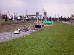
The Louis-Hippolyte Lafontaine Bridge–Tunnel (French: Pont-Tunnel Louis-Hippolyte-La Fontaine) is a highway bridge–tunnel running over and beneath the Saint Lawrence River. It connects the Montreal borough of Mercier–Hochelaga-Maisonneuve with the south shore of the river at Longueuil, Quebec. Named after Lower Canada political reformer Louis-Hippolyte Lafontaine, the Lafontaine Tunnel is an immersed tube structure, measuring 1,391 m (4,563.6 ft) long.

Colisée Jean Béliveau
Arena in Longueuil, Quebec, Canada
Distance: Approx. 3487 meters
Latitude and longitude: 45.54416667,-73.45722222
The Colisée Jean-Béliveau (originally known as Aréna Jacques-Cartier) is a multi-purpose arena built in 1966 in Longueuil, Quebec, and home to the ice hockey team of Le Collège Français de Longueuil, that play in the Quebec Junior AAA Hockey League. The arena was originally named Aréna Jacques-Cartier, but renamed in 1971 in honour of former hockey great, Jean Béliveau to mark his 500th career goal. It has 2,400 seats, and a total capacity of 2,600 with standing room.

Taillon
Provincial electoral district in Quebec, Canada
Distance: Approx. 2720 meters
Latitude and longitude: 45.555,-73.457
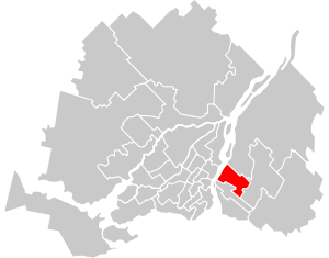
Taillon is a provincial electoral district in the Montérégie region of Quebec, Canada that elects members to the National Assembly of Quebec. It comprises part of the borough of Le Vieux-Longueuil of the city of Longueuil. It was created for the 1966 election from Verchères and Chambly electoral districts.
Marguerite-D'Youville
Provincial electoral district in Quebec, Canada
Distance: Approx. 2635 meters
Latitude and longitude: 45.588,-73.411
Marguerite-D'Youville is a former provincial electoral district in the Montérégie region of Quebec, Canada that elected members to the National Assembly of Quebec. As of its final election, it consisted of the cities of Boucherville and Sainte-Julie. It was created for the 1994 election from Bertrand and named after Saint Marie-Marguerite d'Youville, founder of the Order of Sisters of Charity of the Hôpital Général of Montreal.

Terminus De Montarville
Distance: Approx. 4194 meters
Latitude and longitude: 45.60083333,-73.45027778
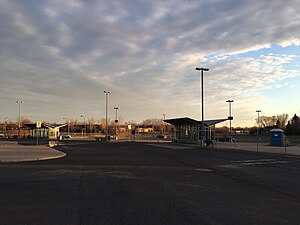
The Terminus De Montarville was inaugurated November 20, 2007 by the former Agence métropolitaine de transport (AMT) & the city of Boucherville. The bus terminus was built on the corner of Quebec route 132 and Boulevard De Montarville. It includes a 308 car and 35 bicycle capacity parking and seven waiting areas for buses on two bus platforms.

Hôpital Pierre Boucher
Hospital in Longueuil, Quebec, Canada
Distance: Approx. 4053 meters
Latitude and longitude: 45.5382,-73.4584
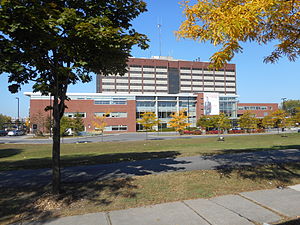
Pierre Boucher Hospital (French: Hôpital Pierre-Boucher) is a Canadian hospital located on Jacques Cartier Boulevard in Longueuil, Quebec. Inaugurated in 1982, the hospital is the regional health centre for 245,000 people located in the borough of Le Vieux-Longueuil, as well as the cities and towns of Boucherville, Varennes, Verchères, Sainte-Julie, Saint-Amable, Calixa-Lavallée and Contrecœur. The hospital provides general, specialized and ultraspecialized health care, and is also the location of 3,400 births per year.

Parc Michel-Chartrand
Park in Quebec, Canada
Distance: Approx. 3985 meters
Latitude and longitude: 45.547,-73.469
Parc Michel-Chartrand, formerly known as the Parc régional de Longueuil, is a large park located in Longueuil, Quebec, Canada. It is located at 1895 Rue Adoncour in the borough of Le Vieux-Longueuil. It is 1,850,000 square metres (19,900,000 sq ft) in area.

Longueuil—Charles-LeMoyne
Federal electoral district in Quebec, Canada
Distance: Approx. 3055 meters
Latitude and longitude: 45.54166667,-73.44166667
Longueuil—Charles-LeMoyne is a federal electoral district in Quebec, Canada, that has been represented in the House of Commons of Canada since 2015. It encompasses a portion of Quebec formerly included in the electoral districts of Saint-Bruno—Saint-Hubert and Saint-Lambert. Longueuil—Charles-LeMoyne was created by the 2012 federal electoral boundaries redistribution and was legally defined in the 2013 representation order.

Boisé du Tremblay
Woodland in Longueuil, Quebec, Canada
Distance: Approx. 3017 meters
Latitude and longitude: 45.54,-73.43
The Boisé du Tremblay is a wooded area in Longueuil, Quebec, Canada. The wooded area is located partially in the borough of Le Vieux-Longueuil and partially within the city of Boucherville. The territory of the woods is 267 hectares (660 acres), of which 174 hectares (430 acres) belongs to the City of Longueuil.
Sabrevois River
River in Quebec, Canada
Distance: Approx. 4401 meters
Latitude and longitude: 45.59917,-73.45944
The Sabrevois River is a tributary of the south shore of the St. Lawrence River, flowing in the city of Boucherville, in the administrative region of Montérégie, southwest of province of Quebec, in Canada. The upper part of this watercourse crosses the agricultural zone between autoroute 30 and route 132.
Weather in this IP's area
overcast clouds
11 Celsius
11 Celsius
11 Celsius
12 Celsius
1017 hPa
90 %
1017 hPa
1013 hPa
10000 meters
1.79 m/s
3.13 m/s
208 degree
100 %
06:39:35
16:35:02
