130.41.133.172 - IP Lookup: Free IP Address Lookup, Postal Code Lookup, IP Location Lookup, IP ASN, Public IP
Country:
Region:
City:
Location:
Time Zone:
Postal Code:
IP information under different IP Channel
ip-api
Country
Region
City
ASN
Time Zone
ISP
Blacklist
Proxy
Latitude
Longitude
Postal
Route
Luminati
Country
ASN
Time Zone
Europe/Paris
ISP
GCP-ENTERPRISE-USER-TRAFFIC
Latitude
Longitude
Postal
IPinfo
Country
Region
City
ASN
Time Zone
ISP
Blacklist
Proxy
Latitude
Longitude
Postal
Route
IP2Location
130.41.133.172Country
Region
dakar
City
dakar
Time Zone
Africa/Dakar
ISP
Language
User-Agent
Latitude
Longitude
Postal
db-ip
Country
Region
City
ASN
Time Zone
ISP
Blacklist
Proxy
Latitude
Longitude
Postal
Route
ipdata
Country
Region
City
ASN
Time Zone
ISP
Blacklist
Proxy
Latitude
Longitude
Postal
Route
Popular places and events near this IP address

Dakar
Capital and the largest city of Senegal
Distance: Approx. 279 meters
Latitude and longitude: 14.69277778,-17.44666667
Dakar ( UK also: ; French: [dakaʁ]; Wolof: Ndakaaru) is the capital and largest city of Senegal. The department of Dakar has a population of 1,278,469, and the population of the Dakar metropolitan area was at 4.0 million in 2023. Dakar is situated on the Cap-Vert peninsula, the westernmost point of mainland Africa.

Dakar department
Department in Dakar Region, Senegal
Distance: Approx. 924 meters
Latitude and longitude: 14.7,-17.45
Dakar department is one of the departments of Senegal, located in the Dakar region. The department of Dakar is one of the four departments of the Dakar region, which is one of the 14 regions of Senegal. The Dakar region encompasses the city of Dakar and all its suburbs along the Cape Verde Peninsula.

Roman Catholic Archdiocese of Dakar
Roman Catholic archdiocese in Senegal
Distance: Approx. 281 meters
Latitude and longitude: 14.6928,-17.4467
The Roman Catholic Archdiocese of Dakar (Latin: Dakaren(sis), French: Archidiocèse catholique romain de Dakar) is the Metropolitan See for the ecclesiastical province of Dakar in Senegal.

Grand Mosque of Dakar
Mosque in Dakar, Senegal
Distance: Approx. 1798 meters
Latitude and longitude: 14.67777778,-17.44222222
The Dakar Grand Mosque (Arabic: المسجد الكبير في داكار, French: Grande Mosquée de Dakar) is one of the most important religious buildings in Dakar, Senegal. It is situated on Allée Pape Gueye Fall.

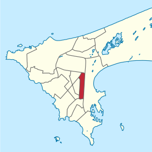
Gueule Tapée-Fass-Colobane
Commune d'arrondissement in Dakar Region, Senegal
Distance: Approx. 1316 meters
Latitude and longitude: 14.68555556,-17.45305556
Gueule Tapée-Fass-Colobane is a commune d'arrondissement of the city of Dakar, Senegal. As of 2013 it had a population of 52,270.

Grand Dakar
Commune d'arrondissement in Dakar Region, Senegal
Distance: Approx. 1509 meters
Latitude and longitude: 14.70416667,-17.45333333
Grand Dakar is a commune d'arrondissement of the city of Dakar, Senegal.

HLM (Dakar)
Commune d'arrondissement in Dakar Region, Senegal
Distance: Approx. 703 meters
Latitude and longitude: 14.7,-17.44555556
HLM is a commune d'arrondissement of the city of Dakar, Senegal. As of 2013 it had a population of 39,126. HLM stands for Habitations à Loyer Modéré (Homes for moderate rents).

Médina, Dakar
Commune d'arrondissement in Dakar Region, Senegal
Distance: Approx. 1125 meters
Latitude and longitude: 14.685,-17.44944444
Médina is a commune d'arrondissement of the city of Dakar, Senegal, part of the Dakar-Plateau arrondissement, located in the southern part of Dakar.

Sicap-Liberté
Commune d'arrondissement in Dakar Region, Senegal
Distance: Approx. 924 meters
Latitude and longitude: 14.7,-17.45
Sicap-Liberté is a commune d'arrondissement of the city of Dakar, Senegal. As of 2013 it had a population of 47,164.
Association des Jeunes pour la Sensibilisation et la Solidarité
Distance: Approx. 279 meters
Latitude and longitude: 14.69277778,-17.44666667
The Association des Jeunes pour la Sensibilisation et la Solidarité (AJSS) is a Senegalese organization whose stated aims are to help young Senegalese away from poverty, criminality and emigration. The AJSS was officially established 23 September 2005 after a meeting held by young people from Sicap-Liberté The AJSS has approximately 400 members.

Place de l'Obélisque
Central plaza in Dakar, Senegal
Distance: Approx. 399 meters
Latitude and longitude: 14.694,-17.448
The Place de l'Obélisque (Obelisk Square) is a central plaza in Dakar, Senegal.

Massalikoul Djinane Mosque
Mosque in Dakar, Senegal
Distance: Approx. 935 meters
Latitude and longitude: 14.70111111,-17.44858333
The Massalikoul Djinane Mosque (French: Mosquée Massalikoul Djinane) is a mosque in Dakar, Senegal.
Weather in this IP's area
clear sky
20 Celsius
20 Celsius
20 Celsius
20 Celsius
1013 hPa
88 %
1013 hPa
1012 hPa
10000 meters
5.14 m/s
350 degree