Country:
Region:
City:
Latitude and Longitude:
Time Zone:
Postal Code:
IP information under different IP Channel
ip-api
Country
Region
City
ASN
Time Zone
ISP
Blacklist
Proxy
Latitude
Longitude
Postal
Route
Luminati
Country
ASN
Time Zone
America/Chicago
ISP
CL-1379-14537
Latitude
Longitude
Postal
IPinfo
Country
Region
City
ASN
Time Zone
ISP
Blacklist
Proxy
Latitude
Longitude
Postal
Route
db-ip
Country
Region
City
ASN
Time Zone
ISP
Blacklist
Proxy
Latitude
Longitude
Postal
Route
ipdata
Country
Region
City
ASN
Time Zone
ISP
Blacklist
Proxy
Latitude
Longitude
Postal
Route
Popular places and events near this IP address

Truckee Meadows
Valley in Nevada, US
Distance: Approx. 826 meters
Latitude and longitude: 39.45,-119.75
The Truckee Meadows is a valley in Northern Nevada, named for the Truckee River, which collects and drains all water in the valley. Truckee Meadows is also colloquially used as a name for the Reno–Sparks metropolitan area, even though the metro area includes areas outside this valley. The name for the valley in the Washo language is Welganuk.

Galaxy Airlines Flight 203
1985 aviation accident
Distance: Approx. 2445 meters
Latitude and longitude: 39.465281,-119.782223
Galaxy Airlines Flight 203 was a Lockheed L-188 Electra 4-engine turboprop, registration N5532, operating as a non-scheduled charter flight from Reno, Nevada to Minneapolis/St Paul, which crashed on January 21, 1985, shortly after takeoff. All but one of the 71 on board died.

Reno-Sparks Convention Center
Convention center in Nevada
Distance: Approx. 4625 meters
Latitude and longitude: 39.486,-119.791
The Reno-Sparks Convention Center is a convention center in the western United States, located in Reno, Nevada. Opened 59 years ago in 1965 as Centennial Coliseum, it hosted the Big Sky Conference basketball tournament in 1983, and also hosts boxing matches. In 2021 the convention center will host the Legion Sports Fest, the largest fitness and bodybuilding event in the West.
2006 Pine Middle School shooting
School shooting in Reno, Nevada
Distance: Approx. 3580 meters
Latitude and longitude: 39.48,-119.7808
The Pine Middle School shooting was a school shooting that occurred in Reno, Nevada, United States, on March 14, 2006. The shooting was perpetrated by then fourteen-year-old student James Scott Newman who shot and injured two 14-year-old eighth grade classmates with a .38-caliber revolver that had belonged to his parents. Newman was arrested and charged as an adult on charges of attempted murder, use of a deadly weapon and use of a firearm by a minor but later pleaded guilty to different charges of two counts of battery with a deadly weapon, in which he had received sentencing as a juvenile.

Atlantis Casino Resort Spa
Hotel and casino in Nevada, United States
Distance: Approx. 5023 meters
Latitude and longitude: 39.488865,-119.793785
The Atlantis Casino Resort Spa (formerly Golden Road Motor Inn, Travelodge, Quality Inn and Clarion) is a hotel and casino located in Reno, Nevada. It is owned and operated by Monarch Casino & Resort, Inc. Its three hotel towers have a combined 824 guest rooms and suites.

Meadowood Mall
Shopping mall in Reno, Nevada United States
Distance: Approx. 3137 meters
Latitude and longitude: 39.474183,-119.782476
Meadowood Mall is a one-level, 901,357-square-foot (83,738.8 m2) super-regional mall in Reno, Nevada, managed by Simon Property Group, which owns 50% of it. Meadowood Mall contains 125 retailers and restaurants and it is anchored by Macy's Women, Macy's Men/Home, JCPenney, and Dick's Sporting Goods.
Damonte Ranch High School
Public school
Distance: Approx. 5069 meters
Latitude and longitude: 39.424036,-119.713082
The Damonte Ranch High School (DRHS) opened in the Fall of 2003. Located in the Truckee Meadows, the school is the newest public high school in the Washoe County School District. Located in southeast Reno, the High School is named for the Damonte Ranch development during the rapid expansion of Reno NV. The Damonte Ranch High School DRHS opened as a combined middle school and high school, to help alleviate the overcrowding at Pine Middle School until Depoali Middle School was built.
Bishop Manogue High School
Private, coeducational school in Reno, Nevada, United States
Distance: Approx. 3261 meters
Latitude and longitude: 39.42361111,-119.76444444
Bishop Manogue Catholic High School is a Catholic high school in Reno, Nevada. It is the only Catholic high school in the Roman Catholic Diocese of Reno and one of only two Catholic high schools in the state of Nevada.

Peleg Brown Ranch
United States historic place
Distance: Approx. 4604 meters
Latitude and longitude: 39.41194444,-119.74916667
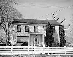
The Peleg Brown Ranch, at 12945 Old Virginia Rd. in Reno, Nevada, dates from 1864. Also known as the Louis Damonte Ranch, it includes Bungalow/craftsman and Greek Revival architecture.
Station Casino Reno
Proposed building
Distance: Approx. 4442 meters
Latitude and longitude: 39.482993,-119.792496
Station Casino Reno is a proposed hotel and casino located at the intersection of Kietzke Lane and South Virginia Street next to the Reno-Sparks Convention Center in Reno, Nevada. The land is owned by Station Casinos and is located on 8 acres (3.2 ha) of land. The building design is similar to Aliante (formerly known as Aliante Station), Green Valley Ranch and Red Rock Resort.

Damonte Ranch
Distance: Approx. 4535 meters
Latitude and longitude: 39.41244,-119.75016
The Damonte Ranch started in 1939 when Louis Damonte, an Italian immigrant farmed alfalfa and raised cattle. The original Damonte Ranch included about 620 acres (250 ha) known as the Peleg Brown Ranch, at 12945 Old Virginia Road in Reno, Nevada, back in 1864. Author Holly Walton-Buchanan, whose latest book, "Land of the Buckaroo: Historic Ranches of Western Nevada" includes a chapter in his book on the Brown-Damonte Ranch.
SNAFU Con
Anime convention in Reno, Nevada, U.S.
Distance: Approx. 4625 meters
Latitude and longitude: 39.486,-119.791
SNAFU Con is an annual three day anime convention held during November at the Reno-Sparks Convention Center in Reno, Nevada. SNAFU is an abbreviation for Sierra Nevada Anime Fans Unite. The event was created by the Anime and Manga Society of UNR, under the name Shadows.
Weather in this IP's area
broken clouds
8 Celsius
8 Celsius
4 Celsius
9 Celsius
1015 hPa
47 %
1015 hPa
862 hPa
10000 meters
1.03 m/s
1.64 m/s
137 degree
82 %
06:46:01
16:42:32