Country:
 USA
USARegion:
City:
Latitude and Longitude:
Time Zone:
Postal Code:
IP information under different IP Channel
ip-api
Country
Region
City
ASN
Time Zone
ISP
Blacklist
Proxy
Latitude
Longitude
Postal
Route
IPinfo
Country
Region
City
ASN
Time Zone
ISP
Blacklist
Proxy
Latitude
Longitude
Postal
Route
MaxMind
Country
Region
City
ASN
Time Zone
ISP
Blacklist
Proxy
Latitude
Longitude
Postal
Route
Luminati
Country
USASN
Time Zone
America/Chicago
ISP
BWINPARTY-US-01
Latitude
Longitude
Postal
db-ip
Country
Region
City
ASN
Time Zone
ISP
Blacklist
Proxy
Latitude
Longitude
Postal
Route
ipdata
Country
Region
City
ASN
Time Zone
ISP
Blacklist
Proxy
Latitude
Longitude
Postal
Route
Popular places and events near this IP address
Exchange Place, Jersey City
Commercial district in Hudson County, New Jersey, US
Distance: Approx. 344 meters
Latitude and longitude: 40.71611111,-74.03305556
Exchange Place is a district of Downtown Jersey City, New Jersey that is sometimes referred to as Wall Street West due to the concentration of financial companies that have offices there. The namesake is a square, about 200 feet long, at the foot of Montgomery Street at the waterfront of the Hudson River. This square was created by landfilling the shore at Paulus Hook, and has been a major transportation hub since the colonial era.

Exchange Place station (Pennsylvania Railroad)
Former intermodal terminal in Jersey City (closed 1961)
Distance: Approx. 309 meters
Latitude and longitude: 40.71648,-74.03238
The Pennsylvania Railroad Station was the intermodal passenger terminal for the Pennsylvania Railroad's (PRR) vast holdings on the Hudson River and Upper New York Bay in Jersey City, New Jersey. By the 1920s the station was called Exchange Place. The rail terminal and its ferry slips were the main New York City station for the railroad until the opening in 1910 of New York Pennsylvania Station, made possible by the construction of the North River Tunnels.

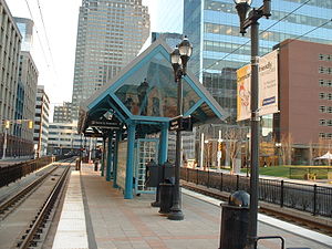
Exchange Place station (PATH)
Port Authority Trans-Hudson rail station
Distance: Approx. 334 meters
Latitude and longitude: 40.7162,-74.032981
Exchange Place station is a station on the Port Authority Trans–Hudson (PATH) rail system in the Paulus Hook neighborhood of Jersey City, Hudson County, New Jersey. The station is on the Newark–World Trade Center line between Newark Penn Station and World Trade Center all week and the Hoboken–World Trade Center line during the day on weekdays to service Hoboken Terminal. Exchange Place provides access to the Jersey City waterfront and a station on the Hudson–Bergen Light Rail, where connections are available to Bayonne and North Bergen.
Harborside station
Distance: Approx. 79 meters
Latitude and longitude: 40.7194,-74.034
Harborside station (formerly named Harborside Financial Center station) is a station on the Hudson–Bergen Light Rail (HBLR) located east of Greene Street, between Morgan and Steuben Streets, in Exchange Place section of Jersey City, New Jersey and named for the adjacent Harborside office complex. There are two tracks and an island platform. The station opened on November 18, 2000, and is served by the West Side–Tonnelle and 8th Street–Hoboken lines at all times and the Bayonne Flyer during the weekday rush.

Exchange Place station (Hudson–Bergen Light Rail)
Distance: Approx. 368 meters
Latitude and longitude: 40.716,-74.0342
Exchange Place station is a light rail station in Jersey City, New Jersey. Located on Hudson Street between York and Montgomery Streets, the station services trains of New Jersey Transit's Hudson–Bergen Light Rail between Bayonne and North Bergen. Exchange Place station is located near the PATH station of the same name.
Harborside (Jersey City)
Mixed-use complex in Jersey City, New Jersey
Distance: Approx. 157 meters
Latitude and longitude: 40.7178,-74.0333
Harborside is a mixed-use residential, retail, and office complex in the Exchange Place district of Jersey City, New Jersey located on the Hudson Waterfront. The majority of the buildings were originally owned and managed by Veris Residential, however many of the buildings were sold to other companies, including Harborside Plaza 1, 2, 3, 4, 5, 6, and 10. The complex contains some of the tallest buildings in Jersey City.

Trump Plaza (Jersey City)
Skyscraper in Jersey City, New Jersey
Distance: Approx. 289 meters
Latitude and longitude: 40.7195,-74.0365
88 Morgan Street, formerly known as "Trump Plaza", is the first of two apartment complex buildings to be built in Jersey City, New Jersey. Trump Plaza Residences is 532 ft tall (162 m) and has 55 floors, and is the 7th tallest residential building in New Jersey. In 2020, the Trump name was removed from the properties and has been renamed the 88 Morgan Street Condominiums.

Hudson and Manhattan Railroad Powerhouse
United States historic place
Distance: Approx. 295 meters
Latitude and longitude: 40.72055556,-74.03611111
The Hudson and Manhattan Railroad Powerhouse, also known as the Jersey City Powerhouse in Jersey City, Hudson County, New Jersey, United States, was built in 1908. The powerhouse made possible the subway system between New Jersey and New York for the Hudson and Manhattan Railroad (which became PATH in 1962). It was built under the leadership of William Gibbs McAdoo, president of the railroad.
Katyń Memorial (Jersey City)
Memorial to Poles massacred by Soviets
Distance: Approx. 344 meters
Latitude and longitude: 40.71611111,-74.03305556
The Katyń Memorial is a bronze statue created by Polish-American sculptor Andrzej Pitynski in dedication to the victims of Stalin's March 5 1940 Katyn massacre in which thousands of Polish Army officers and intellectual leaders who had been interned at Kozielsk or imprisoned at Ostashkov and Starobielsk had been killed by the occupying Soviet People's Commissariat for Internal Affairs, or NKVD. The memorial stands at Exchange Place in Jersey City, New Jersey, United States, near the mouth of the Hudson River. Unveiled in June 1991, the statue depicts a bound and gagged Polish soldier with a bayoneted rifle impaled through his back. The statue stands 34-foot-tall (10-meter) and is atop a granite base containing Katyn soil.
Trump Bay Street
Skyscraper in Jersey City, New Jersey
Distance: Approx. 220 meters
Latitude and longitude: 40.719687,-74.035624
65 Bay Street is a 50-story apartment tower, originally named Trump Bay Street after Donald Trump and located at 65 Bay Street in Jersey City, New Jersey. It is located adjacent to the Trump Plaza apartment tower, which was completed in 2008. A second Trump Plaza tower had initially been planned but was delayed, and the property for the proposed building was sold several times during the Great Recession.

Jersey City Urby
Residential buildings in Jersey City, New Jersey
Distance: Approx. 316 meters
Latitude and longitude: 40.7202,-74.0366
Jersey City Urby is a residential tower complex in downtown Jersey City, New Jersey, United States, known for its Jenga-like appearance. The first tower was proposed in 2012 as URL Harborside, and later renamed to Jersey City Urby. The construction of the first tower began in 2014, and completed in 2017.

Isaac Edge's Windmill
Historic landmark in Jersey City, New Jersey, US
Distance: Approx. 363 meters
Latitude and longitude: 40.7166,-74.0357
Isaac Edge's windmill is a historic landmark that played an important role in the early industrial development of Jersey City, New Jersey. Isaac Edge, a British immigrant, built the windmill in 1806 on the shore of the Hudson River, the Great Western Mill stones imported from England found their first home in Brooklyn Heights. Later the smock mill relocated to Paulus Hook just north of the present-day corner of Montgomery and Greene streets in Jersey City, New Jersey.
Weather in this IP's area
clear sky
14 Celsius
14 Celsius
12 Celsius
16 Celsius
1013 hPa
87 %
1013 hPa
1013 hPa
10000 meters
1.79 m/s
4.92 m/s
322 degree
06:30:33
19:17:06