Country:
Region:
City:
Latitude and Longitude:
Time Zone:
Postal Code:
IP information under different IP Channel
ip-api
Country
Region
City
ASN
Time Zone
ISP
Blacklist
Proxy
Latitude
Longitude
Postal
Route
Luminati
Country
ASN
Time Zone
America/Chicago
ISP
CL-1379-14537
Latitude
Longitude
Postal
IPinfo
Country
Region
City
ASN
Time Zone
ISP
Blacklist
Proxy
Latitude
Longitude
Postal
Route
db-ip
Country
Region
City
ASN
Time Zone
ISP
Blacklist
Proxy
Latitude
Longitude
Postal
Route
ipdata
Country
Region
City
ASN
Time Zone
ISP
Blacklist
Proxy
Latitude
Longitude
Postal
Route
Popular places and events near this IP address

Philadelphia
Largest city in Pennsylvania, United States
Distance: Approx. 138 meters
Latitude and longitude: 39.9528,-75.1636
Philadelphia, colloquially referred to as Philly, is the most populous city in the U.S. state of Pennsylvania and the sixth-most populous city in the United States, with a population of 1,603,797 in the 2020 census. The city is the urban core of the larger Delaware Valley, also known as the Philadelphia metropolitan area, the nation's eighth-largest metropolitan area and seventh-largest combined statistical area with 6.245 million residents and 7.366 million residents, respectively. Philadelphia has played an extensive role in United States history.

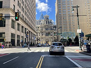
Philadelphia City Hall
City hall of Philadelphia
Distance: Approx. 139 meters
Latitude and longitude: 39.95239444,-75.16359722
Philadelphia City Hall is the seat of the municipal government of the City of Philadelphia in the U.S. state of Pennsylvania. Built in the ornate Second Empire style, City Hall houses the chambers of the Philadelphia City Council and the offices of the Mayor of Philadelphia. This building is also a courthouse, serving as the seat of the First Judicial District of Pennsylvania.

Center City, Philadelphia
Neighborhood and central business district in Philadelphia, Pennsylvania
Distance: Approx. 122 meters
Latitude and longitude: 39.952,-75.164
Center City includes the central business district and central neighborhoods of Philadelphia, Pennsylvania, United States. It comprises the area that made up the City of Philadelphia prior to the Act of Consolidation, 1854, which extended the city borders to be coterminous with Philadelphia County. The area has grown to the second-most densely populated downtown area in the United States (after Midtown Manhattan in New York City), with an estimated 202,000 residents in 2020 and a population density of 26,234 per square mile.

Broad Street Station (Philadelphia)
Former railway station in Philadelphia (closed 1952)
Distance: Approx. 68 meters
Latitude and longitude: 39.953,-75.1658
Broad Street Station at Broad & Market streets was the primary passenger terminal for the Pennsylvania Railroad (PRR) in Philadelphia from early December 1881 to the 1950s. Located directly west of Philadelphia City Hall, the site is now occupied by the northwest section of Dilworth Park and the office towers of Penn Center.

15th Street station (SEPTA)
Rapid transit station in Philadelphia
Distance: Approx. 34 meters
Latitude and longitude: 39.952804,-75.165489
15th Street station is a subway station in Philadelphia. It is served by SEPTA's Market–Frankford Line and all routes of the subway–surface trolley lines. A free interchange also provides access to the Broad Street Line at City Hall station, which is connected to 15th Street by the Downtown Link underground concourse.

City Hall station (SEPTA)
Rapid transit station in Philadelphia
Distance: Approx. 118 meters
Latitude and longitude: 39.95224722,-75.16389444
City Hall station is a SEPTA subway station in Philadelphia. Located in Center City underneath City Hall, it serves the Broad Street Line. It is the busiest station on the line, serving 57,000 passengers daily.

Market Street (Philadelphia)
Major thoroughfare in Philadelphia
Distance: Approx. 47 meters
Latitude and longitude: 39.95266,-75.16575
Market Street, originally known as High Street, is a major east–west highway and street in Philadelphia, Pennsylvania, United States. The street is signed as Pennsylvania Route 3 between 38th Street (U.S. Route 13) and 15th Street (PA 611). A short portion of the road continues west from Cobbs Creek Parkway (63rd Street) to Delaware County, adjacent to Philadelphia.

Centre Square (building)
Office complex in Center City, Philadelphia, Pennsylvania
Distance: Approx. 107 meters
Latitude and longitude: 39.95194444,-75.16611111
Centre Square is an office complex in Center City Philadelphia, Pennsylvania. The complex consists of two concrete high-rise towers: the 417 feet (127 m) Centre Square I, also known as Centre Square East, and the 490 feet (150 m) Centre Square II (Centre Square West) represent the 24th and 15th-tallest buildings in Philadelphia, respectively. Designed by Vincent Kling & Associates in the 1960s, Centre Square opened in 1973.

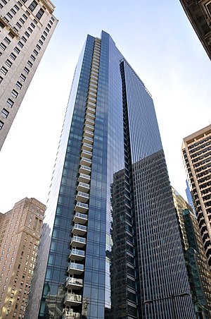
The Residences at The Ritz-Carlton (Philadelphia)
Luxury residential skyscraper in Center City in Philadelphia, Pennsylvania
Distance: Approx. 141 meters
Latitude and longitude: 39.95138889,-75.16472222
The Residences at The Ritz-Carlton is a luxury residential skyscraper in Center City in Philadelphia, Pennsylvania. At 518 feet (158 m), the 48-story skyscraper is the 12th-tallest building in Philadelphia, and the tallest residential tower in the city. The building was erected on the former site of One Meridian Plaza which was seriously damaged by a deadly fire in 1991.

Dilworth Park
Public space in Philadelphia
Distance: Approx. 48 meters
Latitude and longitude: 39.953,-75.165
Dilworth Park is a public park and open space along the western side of City Hall in Center City, Philadelphia. The one-half-acre (0.20 ha) park opened to the public on September 4, 2014.
Octavius V. Catto Memorial
Statue in Philadelphia, Pennsylvania
Distance: Approx. 123 meters
Latitude and longitude: 39.95180556,-75.16419444
A Quest for Parity: The Octavius V. Catto Memorial is a group of sculptures designed by Branly Cadet memorializing Octavius Catto in Philadelphia, Pennsylvania, United States. It was unveiled in 2017 and is the first monument on Philadelphia public property to commemorate a specific African American.

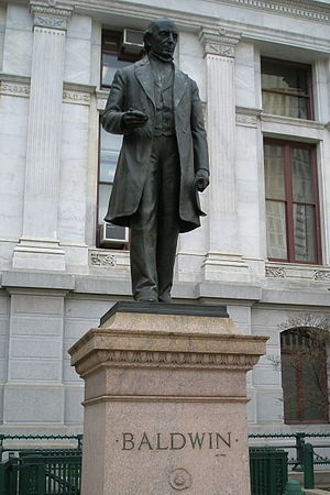
Statue of Matthias W. Baldwin
Statue in Philadelphia, Pennsylvania
Distance: Approx. 123 meters
Latitude and longitude: 39.95305556,-75.16388889
Matthias William Baldwin is a monumental statue located outside Philadelphia City Hall in Philadelphia, Pennsylvania, United States. The statue honors industrialist and philanthropist Matthias W. Baldwin and was designed by sculptor Herbert Adams. It was dedicated in 1906 and moved to its present location in 1921.
Weather in this IP's area
overcast clouds
7 Celsius
6 Celsius
6 Celsius
8 Celsius
1019 hPa
69 %
1019 hPa
1017 hPa
10000 meters
1.79 m/s
4.47 m/s
80 degree
100 %
06:45:13
16:45:21