Country:
Region:
City:
Latitude and Longitude:
Time Zone:
Postal Code:
IP information under different IP Channel
ip-api
Country
Region
City
ASN
Time Zone
ISP
Blacklist
Proxy
Latitude
Longitude
Postal
Route
IPinfo
Country
Region
City
ASN
Time Zone
ISP
Blacklist
Proxy
Latitude
Longitude
Postal
Route
MaxMind
Country
Region
City
ASN
Time Zone
ISP
Blacklist
Proxy
Latitude
Longitude
Postal
Route
Luminati
Country
Region
85
City
borup
ASN
Time Zone
Europe/Copenhagen
ISP
Telenor A/S
Latitude
Longitude
Postal
db-ip
Country
Region
City
ASN
Time Zone
ISP
Blacklist
Proxy
Latitude
Longitude
Postal
Route
ipdata
Country
Region
City
ASN
Time Zone
ISP
Blacklist
Proxy
Latitude
Longitude
Postal
Route
Popular places and events near this IP address
Ramsø
Distance: Approx. 6753 meters
Latitude and longitude: 55.5488,12.02617
Ramsø was a municipality (Danish kommune) in the former Roskilde County on the island of Zealand (Sjælland) in east Denmark until 1 January 2007. The municipality covered an area of 76 km2 (29 sq mi) and had a total population in 2005 of 9,320. Its last mayor was Poul Lindor Nielsen, a member of the Social Democrats (Socialdemokraterne) political party.

Ortved
Distance: Approx. 7728 meters
Latitude and longitude: 55.48333333,11.85
Ortved is a small village with a population of only 245 (1 January 2024) in Ringsted Municipality in the central part of the island of Zealand, Denmark, and is a part of region Sjælland. It lies on Roskildevejen main road close to the city of Ringsted. Ortved is also the village with Denmark's 5th most popular camping.
OZ7IGY
Amateur radio beacon
Distance: Approx. 5985 meters
Latitude and longitude: 55.51666667,11.88166667
OZ7IGY is a Danish amateur radio beacon, and the world's oldest VHF and UHF amateur radio beacon and active since the International Geophysical Year in 1957. It is located near Jystrup, in Maidenhead locator JO55WM54, and transmits on the frequencies detailed in Table 1. Since 30 October 2012, when the Next Generation Beacons platform came into use, the 2 m and 6 m beacons have been frequency and time locked to GPS. Since 30 March 2013 all the beacons using the Next Generation Beacons platform transmit PI4 (a specialized digital modulation system), CW and unmodulated carrier in a one-minute cycle.

Copenhagen–Fredericia/Taulov Line
Railway line in Denmark
Distance: Approx. 5240 meters
Latitude and longitude: 55.4593,11.9206
The Copenhagen–Fredericia/Taulov Line is the Danish railway line between the capital, Copenhagen, and the Jutland peninsula by way of the islands of Zealand and Funen. It is administered by Banedanmark and has a length of about 220 kilometres (140 mi). Being one of the main arteries of the Danish railway network, it has double track and is fully electrified.

Ejby, Køge Municipality
Town in Denmark
Distance: Approx. 6962 meters
Latitude and longitude: 55.4887,12.0795
Ejby is a town in Køge Municipality, with a population of 3,130 (1 January 2024), on the Danish island of Zealand. The town is located about 8 kilometres/5 miles west of the town of Køge.

Osted
Town in Denmark
Distance: Approx. 7747 meters
Latitude and longitude: 55.56666667,11.96666667
Osted is a town with a population of 2,266 (1 January 2024) in Lejre Municipality, Region Zealand, Denmark. The town is located at the road between the cities of Roskilde and Ringsted.

Borup, Køge Municipality
Town in Denmark
Distance: Approx. 508 meters
Latitude and longitude: 55.49592,11.97789
Borup is a railway town in Zealand, Denmark. It lies about 40 km southwest of Copenhagen on the railroad between Roskilde and Ringsted. It is located in Køge Municipality in Region Zealand.
Skjoldenæsholm Tram Museum
Transport museum in Ringsted, Denmark
Distance: Approx. 8871 meters
Latitude and longitude: 55.5334,11.8448
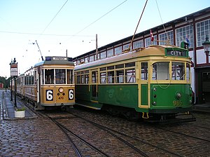
Skjoldenæsholm Tram Museum (Danish: Sporvejsmuseet Skjoldenæsholm), also referred to as the Danish Tramway Museum, is an open-air museum dedicated to vintage trams and buses. It is located 65 km (40 mi) south-west of Copenhagen, Denmark, between Ringsted and Roskilde. The museum opened on land which belongs to Skjoldenæsholm Castle on 26 May 1978.

Bjæverskov
Town in Denmark
Distance: Approx. 5368 meters
Latitude and longitude: 55.4598783,12.0241841
Bjæverskov is a town in Køge Municipality, with a population of 3,211 (1 January 2024) at the road between Køge and Ringsted about 10 kilometres west of Køge and 16 kilometres/10 miles east of Ringsted.
Viby, Roskilde Municipality
Town in Zealand, Denmark
Distance: Approx. 6868 meters
Latitude and longitude: 55.55111111,12.02277778
Viby, often referred to as Viby Sjælland (usually styled Viby Sj) to distinguish it from Viby J in Jutland, is a satellite and commuter town to Roskilde and Copenhagen, located 8 km south of Roskilde, in Roskilde Municipality, some 30 km west of Copenhagen, Denmark. The original village, now Gammel Viby ("Old Viby"), is located in the northern part of town while the modern district has formed around Viby railway station which opened on the Danish Main Line between Copenhagen and western Denmark in 1854. The village of Dåstrup is now also an integrated part of Viby.
Vibygård
Distance: Approx. 7976 meters
Latitude and longitude: 55.5626,12.0214
Vibygård is a manor house located in the northeastern outskirts of Viby, Roskilde Municipality, some 30 km west of Copenhagen, Denmark. The estate covers 833 hectares of land and comprises the farms Slåenkær, Ørstedgård, Arnakke and Drags-Møllegård.
Rosengaard
Danish manor house
Distance: Approx. 6994 meters
Latitude and longitude: 55.46138889,11.87888889
Rosengaard is a manor house and estate in Ringsted Municipality, Denmark.
Weather in this IP's area
broken clouds
12 Celsius
11 Celsius
10 Celsius
12 Celsius
1011 hPa
58 %
1011 hPa
1006 hPa
10000 meters
8.23 m/s
270 degree
75 %
07:34:48
18:22:26

