Country:
Region:
City:
Latitude and Longitude:
Time Zone:
Postal Code:
IP information under different IP Channel
ip-api
Country
Region
City
ASN
Time Zone
ISP
Blacklist
Proxy
Latitude
Longitude
Postal
Route
Luminati
Country
Region
er
City
yerevan
ASN
Time Zone
Asia/Yerevan
ISP
GNC-Alfa CJSC
Latitude
Longitude
Postal
IPinfo
Country
Region
City
ASN
Time Zone
ISP
Blacklist
Proxy
Latitude
Longitude
Postal
Route
db-ip
Country
Region
City
ASN
Time Zone
ISP
Blacklist
Proxy
Latitude
Longitude
Postal
Route
ipdata
Country
Region
City
ASN
Time Zone
ISP
Blacklist
Proxy
Latitude
Longitude
Postal
Route
Popular places and events near this IP address

National Gallery of Armenia
Art gallery in Yerevan, Armenia
Distance: Approx. 489 meters
Latitude and longitude: 40.17875,44.51416667
The National Gallery of Armenia (Armenian: Հայաստանի ազգային պատկերասրահ, Hayastani azgayin patkerasrah) is the largest art museum in Armenia. Located on Yerevan's Republic Square, the museum has one of the most prominent locations in the Armenian capital. The NGA houses significant collections of Russian and Western European art, and the world's largest collection of Armenian art.

Kentron District
Place in Yerevan, Armenia
Distance: Approx. 486 meters
Latitude and longitude: 40.17805556,44.51305556
Kentron (Armenian: Կենտրոն վարչական շրջան, romanized: Kentron varch’akan shrjan), is one of the 12 districts of Yerevan, the capital of Armenia. It comprises the downtown, the commercial centre of the city. As of the 2022 census, the district has a population of 119,841.

Zoravor Surp Astvatsatsin Church
Distance: Approx. 488 meters
Latitude and longitude: 40.186079,44.509606
Zoravor Surp Astvatsatsin Church (Armenian: Զորավոր Սուրբ Աստվածածին եկեղեցի (Zoravor Surp Astvatsatsin yekeghets'i)) is the second oldest surviving church in Yerevan. It was previously known as Surp Astvatsatsin (Holy Mother of God). However, the name Zoravor (meaning Powerful) was added because the church was home to the 13th century bible of Zoravor.

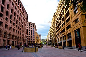
Northern Avenue, Yerevan
Street in Yerevan, Armenia
Distance: Approx. 414 meters
Latitude and longitude: 40.18222222,44.51472222
Northern Avenue (Armenian: Հյուսիսային պողոտա, romanized: Hyusisayin poghota) is a pedestrian avenue in Yerevan, Armenia, opened in 2007. It is in the central Kentron district and links Abovyan Street with Freedom Square on Tumanyan street. It is 450 metres (1,480 ft) long and 27 metres (89 ft) wide.

Saint Gregory the Illuminator Church, Yerevan
Distance: Approx. 251 meters
Latitude and longitude: 40.179528,44.509111
Saint Gregory the Illuminator Church (Armenian: Սուրբ Գրիգոր Լուսավորիչ եկեղեցի, Surb Grigor Lusavorich yekeghets'i) was an Armenian Apostolic church in Yerevan, Armenia, that was destroyed in 1939. It was where Yeghishe Charents School is now on Amiryan Street, Yerevan.
Armenian Center for Contemporary Experimental Art
Distance: Approx. 447 meters
Latitude and longitude: 40.17944444,44.50555556
Armenian Center for Contemporary Experimental Art (or ACCEA; Armenian: Նորարար Փորձառական Արվեստի Կենտրոն, romanized: Norar Pordzarakan Arvesti Kentovon, or NPAK) is a contemporary art institution founded in 1992, and located in Yerevan, capital of Armenia.

Erivan uezd
County of the Russian Empire
Distance: Approx. 388 meters
Latitude and longitude: 40.18138889,44.51444444
The Erivan uezd was a county (uezd) of the Erivan Governorate of the Caucasus Viceroyalty of the Russian Empire. The uezd bordered the Etchmiadzin and Surmalu uezds to the west, the Nor Bayazet uezd to the east, the Sharur-Daralayaz uezd to the south, and Iran to the southwest. It included most of the Ararat Province and southern parts of the Kotayk Province of central Armenia, the Sadarak District of the Nakhchivan exclave of Azerbaijan, and the Aras corridor of the Aralık District of the Iğdır Province of Turkey.

Mashtots Avenue
Street in Yerevan, Armenia
Distance: Approx. 90 meters
Latitude and longitude: 40.1825,44.50972222
Mashtots Avenue (Armenian: Մաշտոցի Պողոտա Mashtots'i Poghota), known as Lenin Avenue until 1990, is an avenue in the central Kentron district of Yerevan, Armenia. The avenue starts with the Victory Bridge at the south and ends up with the Matenadaran museum to the north.

Baghramyan Avenue
Street in Yerevan, Armenia
Distance: Approx. 90 meters
Latitude and longitude: 40.1825,44.50972222
Marshal Baghramyan Avenue (Armenian: Մարշալ Բաղրամյան Պողոտա) is an avenue in the central Kentron and the northwestern Arabkir districts of Yerevan, Armenia. The avenue is named after the Soviet Armenian commander and Marshal of the Soviet Union Hovhannes Baghramyan whose statue stands at the central part of the avenue. It was known as the Friendship Avenue (Comradeship Avenue) between 1970 and 1995, as a tribute to the friendship of all Soviet Union member nations.

Modern Art Museum of Yerevan
Contemporary art museum in Yerevan, Armenia
Distance: Approx. 410 meters
Latitude and longitude: 40.17972222,44.50583333
The Modern Art Museum of Yerevan (MAMY, Armenian: Երևանի Ժամանակակից Արվեստի Թանգարան) is an art museum in Yerevan, Armenia. It is located on Mashtots Avenue at the central Kentron District of the capital city of Armenia. The museum was founded in 1972 by the efforts of the painter Henrik Igityan, who was the director of the museum for 37 years and a supporter of then-mayor of Yerevan Grigor Hasratyan.
Hripsime School for Girls (Yerevan)
Distance: Approx. 220 meters
Latitude and longitude: 40.17972222,44.51
Hripsime School for Girls (Armenian: Հռիփսիմյան օրիորդաց դպրոց) or Hripsimian Women's Gymnasium, was an all-female gymnasium founded in 1850 in Yerevan, then part of the Erivan Governorate of the Russian Empire. Located on Amiryan Street, the building of the gymnasium is intact and included in the list of immovable historical and cultural monuments of the Kentron District of Yerevan, the capital of Armenia.
Ara Sargsyan and Hakob Kojoyan Museum
Biographical museum, art museum in Yerevan, Armenia
Distance: Approx. 491 meters
Latitude and longitude: 40.186,44.5086
Ara Sargsyan and Hakob Kojoyan Museum (Armenian: Արա Սարգսյանի և Հակոբ Կոջոյանի տուն-թանգարան) house museum of Ara Sargsian and Hakob Kojoyan where they lived since 1934 until the foundation of the museum. The museum building is a cultural heritage monument in Armenia.
Weather in this IP's area
clear sky
-1 Celsius
-1 Celsius
-1 Celsius
-1 Celsius
1027 hPa
74 %
1027 hPa
911 hPa
6000 meters
1 %
07:41:58
17:49:56

