129.96.88.39 - IP Lookup: Free IP Address Lookup, Postal Code Lookup, IP Location Lookup, IP ASN, Public IP
Country:
Region:
City:
Location:
Time Zone:
Postal Code:
IP information under different IP Channel
ip-api
Country
Region
City
ASN
Time Zone
ISP
Blacklist
Proxy
Latitude
Longitude
Postal
Route
Luminati
Country
Region
sa
City
adelaide
ASN
Time Zone
Australia/Adelaide
ISP
Australian Academic and Research Network AARNet
Latitude
Longitude
Postal
IPinfo
Country
Region
City
ASN
Time Zone
ISP
Blacklist
Proxy
Latitude
Longitude
Postal
Route
IP2Location
129.96.88.39Country
Region
victoria
City
flinders
Time Zone
Australia/Melbourne
ISP
Language
User-Agent
Latitude
Longitude
Postal
db-ip
Country
Region
City
ASN
Time Zone
ISP
Blacklist
Proxy
Latitude
Longitude
Postal
Route
ipdata
Country
Region
City
ASN
Time Zone
ISP
Blacklist
Proxy
Latitude
Longitude
Postal
Route
Popular places and events near this IP address

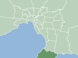
Shire of Mornington Peninsula
Local government area in Victoria, Australia
Distance: Approx. 4810 meters
Latitude and longitude: -38.43333333,145
The Mornington Peninsula Shire is a local government area in southeastern Metropolitan Melbourne, Victoria, Australia. It is located to the south of the Melbourne City Centre. It has an area of 724 square kilometres and in June 2018 it had a population of 165,822.

Flinders, Victoria
Town in Victoria, Australia
Distance: Approx. 262 meters
Latitude and longitude: -38.474,145.022
Flinders is a seaside town on the Mornington Peninsula in Melbourne, Victoria, Australia, 73 km (45 mi) south of Melbourne's Central Business District, located within the Shire of Mornington Peninsula local government area. Flinders recorded a population of 1,130 at the 2021 census. Flinders is located at the point where Western Port meets Bass Strait.

Main Ridge, Victoria
Town in Victoria, Australia
Distance: Approx. 8992 meters
Latitude and longitude: -38.402,144.972
Main Ridge is a locality on the Mornington Peninsula in Melbourne, Victoria, Australia, approximately 65 km (40 mi) south of Melbourne's Central Business District, located within the Shire of Mornington Peninsula local government area. Main Ridge recorded a population of 453 at the 2021 census. South of and inland from Rosebud and originally known as Main Creek, the district consists of the western spine of Arthurs Seat and the southern hinterlands.
Point Leo, Victoria
Town in Victoria, Australia
Distance: Approx. 7649 meters
Latitude and longitude: -38.421,145.075
Point Leo is a small coastal village on the shore of Western Port bay on the eastern side of the Mornington Peninsula in Melbourne, Victoria, Australia, 67 km (42 mi) south-east of Melbourne's Central Business District, located within the Shire of Mornington Peninsula local government area. Point Leo recorded a population of 178 at the 2021 census. Point Leo Foreshore Reserve provides excellent waves for surfing and is one of the closest surf beaches to Melbourne.
Shoreham, Victoria
Town in Victoria, Australia
Distance: Approx. 5879 meters
Latitude and longitude: -38.427,145.05
Shoreham is a seaside surfing town located on the shore of Western Port bay on the Mornington Peninsula in the Australian state of Victoria. It lies within the Shire of Mornington Peninsula local government area, about 68 km (42 mi) south-east of the central business district of Melbourne. Shoreham recorded a population of 679 at the 2021 census.

Nobbies Centre
Ecotourism destination in Victoria, Australia
Distance: Approx. 9905 meters
Latitude and longitude: -38.517476,145.118115
The Nobbies Centre is an ecotourism destination located at Point Grant, on the western tip of Phillip Island, Victoria, Australia. Once known as the Seal Rocks Sea Life Centre, the centre is managed by the Phillip Island Nature Park, and features educational displays, a cafe, a children's play area, and a gift shop. Overlooking Seal Rocks, Australia's largest colony of fur seals, with an estimated 16,000 inhabiting the area, around half a million people visit the centre yearly, with 53% being international visitors.

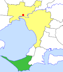
Shire of Flinders (Victoria)
Local government area in Victoria, Australia
Distance: Approx. 4810 meters
Latitude and longitude: -38.43333333,145
The Shire of Flinders was a local government area encompassing the extremity of the Mornington Peninsula, about 65 kilometres (40 mi) south of Melbourne, the state capital of Victoria, Australia. The shire covered an area of 324 square kilometres (125.1 sq mi), and existed from 1874 until 1994.
Seal Rocks (Victoria)
Islands in Victoria, Australia
Distance: Approx. 9107 meters
Latitude and longitude: -38.525996,145.099601
Seal Rocks comprises two small islets – Seal Rock and Black Rock – 1.5 kilometres (0.9 mi) south-west of Phillip Island in Victoria, Australia at the western entrance to Western Port. They were named Seal Islands by James Grant in HMS Lady Nelson in January 1801.
Weather in this IP's area
overcast clouds
16 Celsius
15 Celsius
16 Celsius
16 Celsius
1016 hPa
78 %
1016 hPa
1013 hPa
10000 meters
7.78 m/s
8.66 m/s
235 degree
100 %
